Curated OER
Environment: Erosion Boxes
Fourth graders discover how the processes of erosion and weathering alter the physical characteristics of the environment. In a student log,they record the various types of erosion and list ways to prevent it. Using clear, plastic...
Curated OER
Geography of South America
Young explorers study South American geography. They study maps and create a physical map of the Andes themselves! They also research the geography, environment, and the culture of the Andes and present a report to the class.
Curated OER
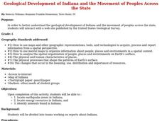
Geological Development of Indiana and the Movement of Peoples Across the State
Fourth graders examine the geological development of the state of Indiana. Using the internet, they interact with the United States Geological Survey. They identify earthquake zones and energy resources in the state. They work...
Curated OER
Geological Development of Indiana and the Movement of Peoples Across the State
Students are introduced to the geological development of the state of Indiana. Using the internet, they visit the U.S. Geological Survey and locate the earthquake zones in the state. In groups, they locate and identify the energy...
Curated OER
My Own Private Idaho; Using Social Studies to Explore Idaho
Students engage in several activities to explore Idaho and Social Studies themes. Using an variety of media, students become familiar with Idaho's geography and geology.
Channel Islands Film
Island Rotation: Lesson Plan 2
Why are Torrey pines only found in La Jolla, California and on Santa Rosa Island? Class members examine images of Torrey pines from these two locations, noting the similarities and differences, and then develop a demonstration model that...
Curated OER
Urban Rivers
Students discuss how urban rivers have shaped the region in which they live. They research river geology and ecology. They examine a case study of life and living along the Delaware River.
Curated OER
Carving Mountains
Students explore geography by participating in an illustration activity. In this land-form lesson, students define vocabulary terms associated with glaciers and forests. Students utilize pens, cardboard and pottery clay to draw and...
Curated OER
Exploration and Settlement of the American Southwest
Students scrutinize the Zuni Pueblo Revolt in this seven lessons unit on early Spanish explorers in the American southwest. The discovery of the Spanish missions, the search for the seven cities of gold, and particular geological...
Curated OER
Cartographer on Assignment: Creating a Physical Map of Africa
Learners use geographic information to make an outline map of Africa, then demonstrate their understanding of the physical landscape of Africa by using a variety of materials to create a physical map of Africa
Curated OER
Geography: examining the Glacial Features of Cape Cod
Students examine satellite images of the glacial features of Cape Cod. They analyze where human activity is located in terms of those features. Students make models of the features, including kettle holes. They also use contour maps...


