US Geological Survey
U.s. Geological Survey: Earthquake Lists, Maps, and Statistics
All kinds of earthquake data compiled here. Find the deadliest earthquakes, most damaging earthquakes, world and US statistics, historical earthquake lists, and more.
Math Science Nucleus
Math/science Nucleus: Famous Earthquakes Animation
This animation reviews three famous historical earthquakes in a storybook format with pictures and animations, told from the perspective of three girls.
US Geological Survey
Usgs: 2004 Deadliest in Nearly 500 Years for Earthquakes
The USGS provides the facts and figures on 2004's earthquakes, which is the second most fatal in recorded history.
Texas State Historical Association
Texas State Historical Association: Notable Earthquakes Shake Texas [Pdf]
An activity guide where students refer to the Texas Almanac, which is free to download, for information needed to complete assigned tasks. In this lesson, they research earthquakes that have taken place in Texas, and the risk of...
US Geological Survey
Usgs: Earthquakes Frequently Asked Questions
Use this resource to find answers to frequently asked questions about earthquakes.
Exploratorium
Exploratorium: Loma Prieta, Bay Area, Earthquake 1989
This outstanding multimedia site documents the earthquake and related events that took place on October 17, 1989 in the San Francisco Bay Area.
TeachEngineering
Teach Engineering: Earthquakes Living Lab: The 1906 San Francisco Earthquake
Students examine the effects of geology on earthquake magnitudes and how engineers anticipate and prepare for these effects. They look in-depth at the historical 1906 San Francisco earthquake and compare it to the Kobe, Japan earthquake,...
US Geological Survey
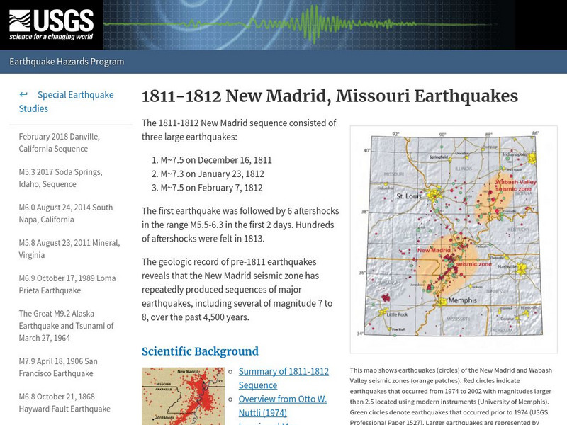
U.s. Geological Survey:1811 1812 New Madrid, Missouri Earthquakes
A detailed description of events that took place during the 1811 and 1812 earthquakes in New Madrid, and information concerning a similar event in the future.
NASA
Nasa: A Century of Quake Research April 2006
This site that presents an in depth look at the catastrophic San Francisco earthquake of 1906. Plate boundaries are identified, effects of this natural disaster are outlined, and a wealth of information is discussed that provides a...
Columbia University
Scientific Background on the Indian Ocean Earthquake and Tsunami
This site features information and related links that can be used by students and scientists to understand the events that led to the December 2004 Indian Ocean tsunami.
US Geological Survey
U.s. Geological Survey: Did You Feel It?
Locate all the most recent earthquakes on this interactive map. Data includes location, magnitude and time of the quake.
Texas State Historical Association
Texas State Historical Association: Texas' Natural Environment
Presents information and data on all aspects of the geography, natural resources, and climate of Texas, including natural disasters and extreme weather events.
Woods Hole Oceanographic Institution
Woods Hole Oceanographic Institution: Tsunami: An Interactive Guide
A complete, interactive learning activity covering the science of tsunamis, preparedness, research, and historical tsunamis. Excellent animations and real, historical recordings of survivors allow the learner to experience what happens...
University of Washington
University of Washington: A Survey of Great Tsunamis
This resource opens up with a clickable map that will provide information on eight different tsunamis, such as the 1929 Grand Banks tsunami, the 1975 Hawaiian tsunami, and several others. Basic information and the damage caused by each...
Curated OER
Etc: Earthquake Activity in the United States, 1872 1882
A map from 1888 of the United States showing the regions shaken by earthquakes since 1872 and the extent of the area in which the earthquake was felt. The month and year of each earthquake is indicated in its boundary line.
Curated OER
Wikipedia: National Historic Landmarks in California: James C. Flood Mansion
Mansion of James C. Flood, 19th century silver-baron; first brownstone building built west of the Mississippi River; one of the only buildings on Nob Hill to survive the 1906 San Francisco earthquake and fire; purchased by the...
Curated OER
Wikipedia: National Historic Landmarks in Ca: Mission San Miguel Arcangel
The 16th California Mission church remains well preserved and still in use today though under earthquake remediation construction. Inside are murals by Esteban Munras.
Curated OER
Wikipedia: National Historic Landmarks in California: Old United States Mint
Built for the San Francisco Mint in 1874 to handle the overflow from the California Gold Rush, this building is affectionately as The Granite Lady. It is one of the few that survivors of the great 1906 San Francisco earthquake and served...
Library of Congress
Loc: America's Memory: Montana
Who were the first white explorers to "set foot in Montana?" Find out more about the Native American population living in Montana. Draw on the experience of the Native American population.
Library of Congress
Loc: America's Story: California
What is happening in the "Golden State." Look for new and exciting things going on in California at this site. How big was the crack in the earth after the 1906 earthquake?
Curated OER
Etc: Maps Etc: Mexico, Central America, and the West Indies, 1898
A map from 1898 of Mexico, Central America and the West Indies. The map includes an inset map of Cuba and the Isthmus of Nicaragua. "The surface of the Rocky Mountain highland in Mexico is quite similar to that of the great plateau...
Curated OER
Etc: Maps Etc: Physical Map of South America, 1898
A map from 1898 of South America showing the general physical features including mountain systems, prominent peaks and volcanoes, river and lake systems, plateaus, and coastal features. The map includes an insert of the Isthmus of...


![Texas State Historical Association: Notable Earthquakes Shake Texas [Pdf] Lesson Plan Texas State Historical Association: Notable Earthquakes Shake Texas [Pdf] Lesson Plan](https://d15y2dacu3jp90.cloudfront.net/images/attachment_defaults/resource/large/FPO-knovation.png)


