Curated OER
Visiting the Arctic Circle
Students familiarize themselves with the Arctic Circle by locating it on a globe and wall map. They discuss they climate in the North Pole and the reasons for its low temperatures. They compare and contrast the climates of the Arctic...
Curated OER
Great North
Students view a video about the Arctic Circle, North Pole and Northern Europe. They locate areas using a map. They create a drawing of the countries where the Inuit live.
Curated OER
Human Impact on the Geosphere
Ninth graders answer the bulleted points from the project guideline sheet using the Internet for help. They then use Inspiration to create a concept map to link all of their ideas.
Curated OER
Food Webs in the Barnegat Bay
Students investigate the food webs in the Barnegat Bay. In this organisms instructional activity, students use a graphic organizer to illustrate the types of consumers in the bay. Students use reference books to continue to research the...
Curated OER
Migration of the Neo-Tropical Songbirds
Fifth graders plot the migration of birds using Google Earth. In this lesson on bird migration, 5th graders work in groups to plot the migration of a group of birds using Google Earth. Students present and discuss their findings and look...
Curated OER
Barnegat Bay Watershed
Students design a model watershed. In this watershed lesson plan, students learn the needed parts of a watershed and how they work. Students evaluate how watersheds effect communities.
Curated OER
Aquifers and Groundwater
Students understand the purpose of an aquifer. In this aquifer and groundwater lesson, students build a model aquifer find its relationship to water usage. Students record observations as they build the layers of the aquifer.
Curated OER
Infrared-Hot
Students describe how the sun heats the Earth, explain the nature of infrared light, explain how thunderstorms are formed and use infrared maps to predict severe weather.
Curated OER
Barrier Islands
Third graders explore how barrier islands work. For this erosion lesson, 3rd graders create barrier islands in stream tables and simulate wave action to see how it affects their island.
Curated OER
Water Cycle
Students explore the water cycle. In this water cycle lesson, students examine water as a resource as they create a water cycle poster and create a water cycle model. Water cycle game instructions are included as well.
Curated OER
Observing Lava Flows
Learners examine the difference between fast and slow spreading lava flows. They identify various types of lava flow and determine the factors that cause them to form. Viewing photographs of lava flows, students working in groups,...
Curated OER
The Frozen Desert: Graphing and Comparing Climates
Students explore the concept of climate. They use temperature and precipitation data from their area and other regions to construct climate graphs. These graphs are used to help identify factors that influence climate.
Curated OER
Microclimates of Our School
Students read the story "Weslandia" by Paul Fleischman, define the term microclimate, gather and record data in various places on school grounds to establish the presence of difference microclimates, analyze and compare microclimates,...
Curated OER
Cherishing the Water of Life
Students work in small groups to brainstorm a list of all creatures, plants, natural, and artificial processes that use or depend on fresh water. The class views an aquarium filled with water representing all the water in the world. The...
Curated OER
Geologic cross section of Manhattan, NYC
Learners draw an accurate geologic cross section by using a given data table. They relate the features of the cross section to geologic processes. Students then relate the characteristics of the bedrock to the architecture.
Curated OER
Geography And The Gulf War
High schoolers develop maps, tables, graphs, charts, and diagrams to depict the geographic implications of current world events, and analyze major human conflicts to determine the role of physical and cultural geographic features in the...
Curated OER
The American Trail System
Students research a trail system. They create a display board of the trail system, generate a map of the trail system, and develop a commercial advertising of the trail system. They design a display board featuring facts about the...
Curated OER
Early Explorers
Fifth graders study early explorers. In this World history lesson, 5th graders draw an outline of a map labeling each part, build geographical features out of dough, and paint each of the land and water features.
Curated OER
Yellowstone Fires
Students assume the role of environmental biologists and help several government agencies resolve the debate surrounding "let it burn" policies in national parks.
Curated OER
What Do We Learn From the Repartiation of Alaska Native Artifacts?
Students observe and evaluate evidence of Alaska Native cultural symbols and artifacts. They research historical data from a variety of primary resources, including the Harriman expedition journals, related web sites, oral accounts,...
Curated OER
THE INCREDIBLE JOURNEY
Students describe the movement of water within the water cycle and identify the states of water as it moves through the water cycle.
Curated OER
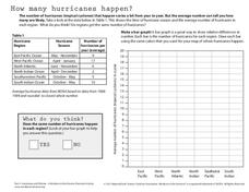
How Many Hurricanes Happen?
In this hurricanes worksheet, students use a data table showing the hurricane region and the average number of hurricanes per year to determine if the same number of hurricanes happen in each region by creating a graph. Then students...
Curated OER
Here Today, Gone Tomorrow
Students explore erosion. Through multi-media and hands-on activities, students identify the effects of wave erosion and hurricanes on a barrier island. Students watch a video and create a cause and effect chart of their observations. ...
Curated OER
Conditions at Sea Data Activity
Students study how to forecast sea conditions. In this oceanography lesson students complete a class activity on wave making.


