Curated OER
Sea Floor Spreading
Students discuss convection currents in the Earth's mantle, how they form, and how they move as well as the causes of earthquakes. Working in a group, they analyze a color coded World Earthquake Map and try to determine which direction...
Science Matters
Seismic Activity and California Landforms
By the 19th lesson plan in the 20-part series, scholars realize volcanoes and earthquakes are related to plate boundaries. The lesson plan extends and applies the knowledge by having individuals create a bumper sticker for one specific...
Channel Islands Film
Island Rotation: Lesson Plan 1
How do scientists provide evidence to support the theories they put forth? What clues do they put together to create these theories? After watching West of the West's documentary Island Rotation class members engage in a series of...
Curated OER
Watercolor Ways
Students investigate the concept of being part of a global community. In this global community lesson, students learning the definition of stewardship as it relates to taking care of the Earth. They listen to the lyrics of the song,...
Curated OER
What's in the Air?
In this air worksheet, students will choose the correct definition for atmosphere, troposphere, stratosphere, and pollutant. Then students will complete a concept map showing what components make up air. This worksheet has 4 multiple...
Curated OER
Painting the Hallway with Pixels
Students create science design to be painted on the wall in the hallway of the science area of the school building. They measure space available, make a scale model of the design, and paint different pixels.
Science Matters
Spaghetti Fault Model
Does increasing the pressure between two moving plates provide a stabilizing force or create more destruction? The hands-on lesson plan encourages exploration of strike-split fault models. The sixth lesson plan in a 20-part series...
Curated OER
Meteorologist for the Day
Fourth graders examine the symbols used on weather maps. They analyze a newspaper weather forecast and identify and discuss the various symbols used on the map. Next, they prepare a weather map for their own city using the symbols...
Curated OER
Ocean Water and Life
In this ocean water and life worksheet, students match the vocabulary term with the correct definition. Also, students answer questions by deciding if the statements are true or false. Finally, students complete concepts maps while using...
Curated OER
Applications of GIS
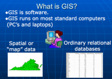
Don't be concerned that the title slide of this presentation mentions Virginia's Geospatial Extension Program; this slide show is very informative for any technology-focused curriculum when considering global information systems. It...
Curated OER
Student Tracking
Here is an interesting lesson plan on satellite tracking. Learners use various tracking techniques to find out where they go on a daily basis, what the environmental conditions are, and what they are doing during their "migrations." A...
Curated OER
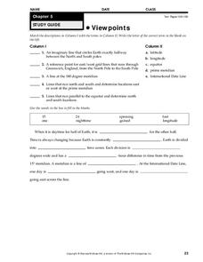
Viewpoints
In this map worksheet, students review latitude, longitude, equator, and prime meridian. This worksheet has 5 matching and 8 fill in the blank questions.
Curated OER
Earthquake Unit
Eighth graders watch the "Earth, the Environment & Beyond" video on earthquakes. Take notes and give an oral summary. They build a working, two dimensional model of a strike-slip, thrust, or normal fault.
Curated OER
Tracking Satellites Using Latitude and Longitude
Students, viewing an Internet site, plot the path of several satellites using latitude and longitude over the course of an hour. They learn the four basic types of satellites and their purpose.
Curated OER
Moon Crash
In this moon crash worksheet, students research information about the moon. In a given scenario, students decide which emergency supplies to take in order to survive on the moon.
Curated OER
This Land Is Your Land, This Land Is My Land
Students review and evaluate the ways land is covered and used in their local community. They consider the environmental effects of the different types of land use. Students act as community planning engineers to determine where to place...
Curated OER
The Effects Of Earthquakes
Students investigate the concept of how earthquakes occur and the after effects of how they effect landforms. They conduct research it using a variety of resources and measure the varying intensities of how earthquakes effect the...
Curated OER
Longitude-Dava Sobel
In this longitude worksheet, students read about how to determine the longitude of location while at sea and they answer 5 questions about calculating longitude.
Curated OER
Building A Topographic Model
Students visualize, in three dimensions, features represented by contour lines on a topographic map. They see that the different elevations shown on a two dimensional topographic map can be used to build a 3-D model.
Curated OER
Igneous Rock Formation
Fifth graders use the computer lab to search for answers to questions on their workshet. They discuss the creation of igneouss rocks and listen as the teacher lectures about lava. Students follow directions to mix a batch of salt dough...
Curated OER
Watersheds, Watersheds Everywhere
Students identify the watershed in which their school is located. They use maps to locate their homes and school. They define and use the correct vocabulary.
Curated OER
I Know Where You Are!
Students study what a GPS is and use it to challenge themselves and find positions on a map. In this investigative lesson students find various points on a map using a GPS system and answer questions on a worksheet.
Curated OER
Lahar Travel Time
Ninth graders analyze published geologic hazard maps of California and comprehend how to use the map's information to identify evidence of geologic events of the past and present and predict geologic changes in the future. They select...
Curated OER
Gilligan's Island
Students investigate topographical maps and match actual landforms to them. In this topographical maps lesson students create "Gilligan's Island" to scale then answer questions about it such as what the highest elevations is and...


