Curated OER
Globe Skills Lesson 10 Apollo 11
Students develop their globe skills. For this geography skills lesson, students use a globe and a softball to replicate distance between the earth and its moon.
Curated OER
Anza and Font in Search of Latitude
This is an integrated lesson plan that incorporates Social Studies, Science, and Mathematics. In Social Studies, 7th graders complete an online interview and complete an online worksheet about latitude of sites on the Anza trail. In...
Curated OER
Continents and Oceans
Students identify oceans and continents and their locations on a map. They color-code and label their own map of the world's continents and oceans. They play the game Continents and Oceans to identify specific areas.
Curated OER
Natural Features as a Resource
Learners investigate how land and water can meet basic needs. In this natural resources lesson plan, students locate water features on a Landscape Picture Map and describe how water is used to meet their needs.
Curated OER
Expanding the Mission: Historical Parks
Students explore U.S. geography by viewing a documentary in class. In this national parks lesson, students view video clips of individual national parks and locate them using Google Earth software. Students create a persuasive...
Curated OER
Planets
In this planets activity, students read about Mercury, Venus, and Earth and then complete 21 multiple choice, 2 true or false, and 1 short answer question.
Curated OER
Exploring the USA and the World with Cartograms
Students investigate cartograms in order to explore the different countries on Earth. In this world geography lesson, students use the Internet to analyze data on different cartograms. Students compare data, such as population density,...
Curated OER
Drifting Continents
In this plate tectonics worksheet, students study the continents map and complete 8 short answer questions related to them. They predict what the Earth will look like millions from now.
Curated OER
Estuary and Watershed
Young scholars investigate the San Francisco Bay Estuarine Research Reserve and watershed. In this estuary and watershed lesson plan, students complete 4 activities to better understand estuarine systems. They include studying the San...
Curated OER
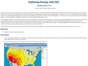
Exploring Energy with GIS
Students examine GIS technology as it is used to locate energy sources. In this GIS lesson, student access an assigned website to locate a series of lessons using the GIS software. They use the maps that are located on the primary lesson...
Curated OER
At the Edge of the Continent
Students study how to interpret a bathymetric map. They study the main features of the continental margin. They plot and graph bathymetric data. They think about and discuss the bathymetry of the edge of the cont
Curated OER
Plate Tectonics: Movin' and Shakin'
Students are introduced to the causes of plate movements and the hazards they present. They plot the location of 50 earthquakes and 50 volcanic eruptions on a map and explore the relationships between plate tectonics, earthquakes, and...
Curated OER
You Can Die Here – Death Valley California
Students use Google Maps to explore the rain shadow desert. For this climate lesson, students use the Internet, Google Maps, and directed inquiry worksheets to understand how rain shadow deserts form. Students apply climate concepts to...
Curated OER
Ping!
Seventh graders study side-scan sonar and discover how it can be used to locate objects underwater. They complete a sonar simulation activity in which they create and map mystery landscapes inside shoeboxes.
Curated OER
Exploring National Marine Sanctuaries
Young scholars research marine ecosystems by creating class presentations. For this oceanography lesson, students research the different locations of marine sanctuaries by identifying them on a transparency map in class....
Curated OER
Causes and Effects of ENSO
High schoolers analyze monthly sea surface temperature data from the Pacific Ocean to determine if the period is an El Nino or a normal year. They recognize signs to see if there are any patterns that signal either occurrence. Satellite...
Curated OER
Mapping of the Earth's Past
Young scholars create a scale model time linen of the Earth's 4.6 billion year history. They calculate a scale that can fit on a very long register tape then label each geologic era. They use text books to annotate each era with major...
Curated OER
Coal: More Than Meets the Eye!
Students participate in a hands-on simulation to help them explain that coal resources are deposited unevenly between the earth's surface and under the ground.
Curated OER
Powering a Green Earth
Students compare and contrast renewable and nonrenewable energy. In this environmental science lesson, students discuss the importance of going green. They identify the different components in a power grid system.
Curated OER
What are Igneous Rocks and How are They Formed?
Crystals form before your very eyes! What sixth grader wouldn't enjoy this lesson on igneous rock formation? Using hot Salol, junior geologists observe the crystal formation process as the material cools. This comprehensive lesson plan...
Curated OER
Sandscapes to Landscapes
Students explore landscapes and create their own in a creative project.
Michigan Sea Grant
Exploring Watersheds
Collaboratively, students partake in a hands-on activity in which they build models of a watershed. Each group member draws an elevation map—a bird's eye view—of their model and predicts how water will flow from the high to low points....
Curated OER
Social Studies: Public Goods and Services Map
Students discuss physical and human characteristics and list examples. After identifying government goods and services provided to the community, they locate examples of each located near their school. Based on their discoveries,...
Curated OER
Give Me Some Latitude
For this latitude worksheet, students use an atlas or other reference to respond to 4 multiple choice questions about the equator and the poles.


