Curated OER
You Got The Whole World In Your Hands: Geology, Earth's Layers, Science
Students make a model of the Earth's crust out of foam in order to better explain the make-up of the Earth's layers. They add continents and oceans.
Curated OER
We are the World - Writing about our Earth
First graders write facts about the Earth. In this Earth lesson, 1st graders discuss natural resources, recycling, and how to keep the Earth clean. They work in groups to create a small book with 3-5 facts about the Earth's environment.
Curated OER
Earth Matters
Young scholars identify Earth's equator, prime meridian, lines of latitude, lines of longitude, parallels, and meridians.
Curated OER
Mapping Potato Island
Students create their own topographical map using a potato. For this hands on lesson students construct a topographical map and explain what contour lines are using a potato.
Curated OER
Converging Earthquake!
Young scholars identify the fault lines and tectonic plates on the map. In this earth science lesson, students simulate landscape formation using robots. They take a quiz at the end of the lesson to demonstrate mastery.
Curated OER
Landscape Picture Map
Students explore pollution of water sources. In this ecology lesson, students define and identify natural resources. Students use map skills to locate local rivers and lakes used for recreation. Students brainstorm ways in which to keep...
Curated OER
Climate Change Challenge: Earth Day
Students explore the concept of philanthropy. For this environmental stewardship lesson, students watch a video about state policies pertaining to greenhouse gas emissions. Students plan and carry out an Earth Day service project...
Curated OER
Where in the World is Hawaii?
Learners compare a globe and a two-dimensional world map and explore how they both represent the planet Earth. They locate the Hawaiian Islands on the globe or the world map and describe how the geographical position is unique.
Curated OER
Plotting a Hurricane Using Latitude and Longitude
Learners define and use "absolute location," latitude, and longitude. They locate on a map or globe the Earth's poles, circles, tropics, and beginning points of measurements for latitude and longitude.
Curated OER
Exploring Hawaiian Mountain Zones
Fourth graders watch a video that describes the climate and vegetation zones of Hawaii. They describe the different physical conditions that create vegetation zones from the sea to the mountains. In groups, they create an illustrated...
Curated OER
Explosive Ideas: Oregon quarter reverse
Explore Earth and her amazing layers with this lesson on planetary change. Students will research the ways in which Earth's layers cause change. They will complete a "Tectonic Puzzle" and use a worksheet to answer questions about Earth's...
Curated OER
A Comparison of Cloud Coverage Over Africa
Students use a NASA satellite data to contrast amounts of cloud coverage over different climate regions in Africa. They explore how Earth's major air circulations affect global weather patterns, and relate to local weather patterns.
Curated OER
Comparison of Snow Cover on Different Continents
Students use the Live Access Server (LAS) to form maps and a numerical text file of snow cover for each continent on a particular date and analyze the data for each map, corresponding text file to determine an estimate of snow cover for...
Curated OER
An Introduction to the Night Sky and Movement Astronomy
Basically, this is an interactive exploration of educational astronomy software and an app. Young astronomers discover how the apparent motion of the sky relates to Earth's movements and the position of the observer. It is out of this...
Curated OER
once and future MOON
Beyond the phases of the moon, this comprehensive lesson plan covers geologic history and geology. Amateur astronauts examine photos of the lunar landscape, experiment with the creation of craters, and delve into information about the...
Curated OER
Settlement Exploration: Then and Now
NASA has crafted an imaginative and memorable series of lessons, "NASA and Jamestown Education Module." This lesson is one of the five components. In it, middle schoolers connect history and science by comparing the settlement of...
Midnight Martian
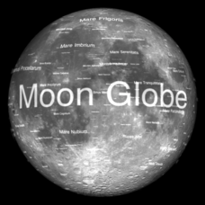
Moon Globe
Not just a simple globe of the moon, this interactive version allows you to choose lighting according to the location of the sun, views from different positions on Earth, and more! Satellite images and topographic data have been combined...
Cornell University
Constructing and Visualizing Topographic Profiles
Militaries throughout history have used topography information to plan strategies, yet many pupils today don't understand it. Scholars use Legos and a contour gauge to understand how to construct and visualize topographic profiles. This...
It's About Time
Effects of Plate Tectonics
Explore our world from within as you lead young scientists on a thrilling adventure. Pupils examine the location of plate boundaries to determine earthquake and volcano distribution around the globe and explore the cause of hot spots in...
Curated OER
Good Vibrations Remote Sensing data Collection: Thermal Emission Spectrometer
The Mars Global Surveyor spent two years creating a mineral map of the planet Mars using thermal emission spectrometry. To help young astronomers understand this remote sensing instrument, have them simulate how data is collected and...
Science Matters
Slip Sliding Along
The San Andreas Fault is the largest earthquake-producing fault in California. In the seventh lesson in the 20 part series, pupils create maps of California, focusing on the San Andreas Fault system. The comparison of where...
NOAA
To Explore Strange New Worlds
It's time to boldly go where your class has not gone before! The introductory lesson in a five-part series takes young oceanographers aboard the NOAA Ship Okeanos to begin a study of ocean exploration. The lesson includes a comparison of...
Curated OER
Effects of Ozone Depletion
Explore the causes of ozone depletion and the effect on plankton, algae, plants, amphibians, and humans. Learn how the Montreal Protocol has possibly helped reverse the decline of the ozone layer. Warning: photos of skin and eye...
Columbus City Schools
Experiencing Eclipses
Don't be caught in the dark! Young scientists investigate the causes of both solar and lunar eclipses using an interactive to help them understand the development of an eclipse over time. They then research facts and characteristics...


