Curated OER
Barrels and Buckets: Access to Water - What Would It Be Like to Live in Africa?
Students compare water access in the United States with that of Africa. In this water access lesson plan, students located Ghana and Kenya on a globe before reading Peace Corps Volunteer accounts of the difficulty of accessing clean...
Science 4 Inquiry
Edible Plate Tectonics
Many people think they can't observe plate tectonics, but thanks to GPS, we know that Australia moves at a rate of 2.7 inches per year, North America at 1 inches per year, and the Pacific plate at more than 3 inches per year! Scholars...
Science 4 Inquiry
An Investigative Look at Florida's Sinkholes
In May of 1981, the Winter Park Sinkhole in Florida first appeared and is now referred to as Lake Rose. Scholars learn about the causes of sinkholes through an inquiry project. Then, they analyze recent data and draw conclusions to...
Curated OER
Reading Satellite Images
Learners analyze satellite images. In this astronomy lesson, students examine 3 satellite images in order to understand how satellite images are taken and what they can teach scientists.
Curated OER
Principles of Flight: Where are We?
Students explore the concept of topographical maps. In this topographical map lesson, students discuss how airplanes know where to fly. Students use topographical maps to simulate a field trip on the computer.
Curated OER
Where in the Latitude Are You? A Longitude Here.
Students distinguish between latitude and longitude on the map. In this mapping lesson, students participate in mapping skills to recognize spatial relationships, and where to find natural resources on the map. Students create...
Curated OER
Pollution is Not a Solution
Students explore the environment by completing science worksheets in class. In this water conservation lesson, students identify ways water is used in our society and how we abuse the privilege. Students discuss methods to reduce water...
Curated OER
Longitude-Dava Sobel
In this longitude instructional activity, students read about how to determine the longitude of location while at sea and they answer 5 questions about calculating longitude.
NASA
NASA
Everything you have ever wanted to know about our solar system, space exploration, and more can be found here. Be prepared to clear your schedule; you will be sucked into the app like a star into a black hole.
Curated OER
Weather in Your City
Students observe weather conditions of a particular city. Multiple intelligences are explored within this lesson. They locate their particular city on a United States map. Each student writes about their discoveries in his/her journal...
Teach Engineering
Incoming Asteroid! What's the Problem?
Oh, no! An asteroid is on a collision course with Earth!. Class members must rise to the challenge of designing a shelter that will protect people from the impact and permit them to live in this shelter for one year. In this first lesson...
Forest Foundation
Forest Watersheds
Where does the water we use come from? To understand the concept of a watershed, class members study the water cycle and then engage in an activity that simulates a watershed.
Curated OER
Different Minerals
In this minerals worksheet, students read about the relationship between elements, rocks and minerals. They experiment using 6 different colored gumdrops to represent 6 common elements. Students construct gumdrop and toothpick models of...
Science Matters
Energy and Winds
In the study of wind energy, scholars build a small windmill and observe how it transfers wind into mechanical energy. Learners will make connections to the previous lesson with concepts such as the creation of wind...
Polar Trec
What Can We Learn from Sediments?
Varve: a deposit of cyclical sediments that help scientists determine historical climates. Individuals analyze the topography of a region and then study varve datasets from the same area. Using this information, they determine the...
Curated OER
Microclimates of Our School
Students read the story "Weslandia" by Paul Fleischman, define the term microclimate, gather and record data in various places on school grounds to establish the presence of difference microclimates, analyze and compare microclimates,...
Curated OER
THE GULF STREAM
Students explore how to describe the Gulf Stream, how Benjamin Franklin charted it, and correctly plot it on a map.
Curated OER
Studying Snow and Ice Changes
Students compare the change in snow and ice over a 10 year period. In this environmental science lesson, students use the live data on the NASA site to study and compare the monthly snow and ice amounts on a map of the entire...
Curated OER
Biodiversity in an Estuary
High schoolers investigate the biodiversity in estuaries. In this estuary lesson plan, students use Google Earth to explore the Rookery Bay National Estuarine Research Reserve. They produce a biodiversity concept map and portray the life...
Curated OER
You Can Die Here
Students examine Death Valley including the amount of precipitation and winds that it gets. For this climate based lesson students explain the reasons for the amount of precipitation and windward patterns in Death Valley.
Curated OER
Quad Squad
Students pretend they have visited a forest research station on an overnight field trip. They study forest fires, use compass directions, read maps, interpret imagery, and think about the impact of fire on ecosystems.
Curated OER
Recent Volcanoes And Earthquakes:
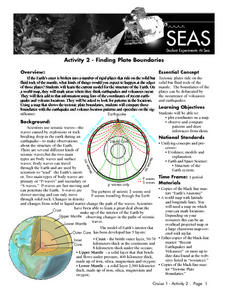
Students investigate the current model for the structure of the Earth. On a world map, they mark areas where they think earthquakes and volcanoes occur and compare those areas with earthquake and volcano location patterns.
Curated OER
Identifying Materials by their Reflectivity
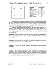
In this reflectivity learning exercise, students read about the absorption and reflectivity of light by different materials. Students solve 4 problems and determine the composition of given materials based on the amount of light...
Curated OER
Analysis of Atmospheric Conditions for a High Mountain Retreat
Students examine the relationship between altitude, atmospheric pressure, temperature and humidity at a particular location. They practice science and math in real world applications. They write reports detailing their scientific...


