Curated OER
Understanding Weather and Climate Patterns
Learners research the climate patterns of various locations and make predictions based on their findings. They determine the importance of latitude and longitude in weather and climate. Students create graphs displaying their collected...
Houghton Mifflin Harcourt
Journeys: Challenge Activities (Theme 1)
This nine-page packet, the first in the series of support materials for the Houghton Mifflin Harcourt thematic units on journeys, contains enrichment activities for learners who have mastered the basic concepts of the lessons....
Curated OER
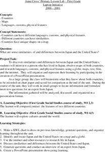
Japan
First graders investigate the similarities and differences between Japan and the United States. They develop a KWL chart, locate Japan and the U.S. on a globe, conduct Internet research on life in Japan, conduct an interview, and create...
Curated OER
Canada, O Canada
Students study the similarities and differences between Canada and the United State in this unit. They examine geography, government and culture as they "travel" through Canada.
Curated OER
ESRI Live Earthquake Site
High schoolers examine a World map and find earthquakes near plate boundaries. They locate and describe earthquakes in the United States and California.
Curated OER
Migrating to Texas
Fourth graders explore the migration to Texas from other parts of the United States. Through journal entries they write about the trip as if they were the settlers coming to a new and foreign country. Working in small groups, 4th graders...
Curated OER
Oh, the Regions
Focus on the geography of Oklahoma. In this activity, learners compare different geographic regions in Oklahoma, create a collage to share their results, and identify important landforms throughout the United States, such as the...
Curated OER
Geography of China (Tibet)
Sixth graders study the geography of Tibet. They create maps of Tibet. Students predict population, land area, water area and coastline length of the United States and Tibet. Students compare and contrast the day-to-day lives of people...
Curated OER
Splish Splash
Students study drinking water. In this environment lesson, students draw the path of drinking water from the place of precipitation to the tap after researching a map and information from the United States Geological Survey water...
Curated OER
Maps: U.S, Time Zones
Students perform various activities to demonstrate knowledge of time zones. They connect with an interactive map to discover what time zone they are in. They create clocks out of paper plates and simulate different time zones.
Curated OER
This Land is Your Land
Young scholars consider the concept of borders and their development by looking at maps and documents. They create a presentation highlighting a current border dispute and propose solutions.
Curated OER
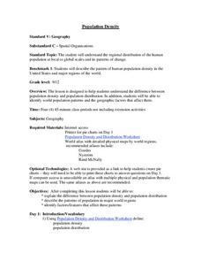
Population Density
Students examine world population density and population distribution. They create pie charts showing population distribution and analyze population patterns in the United States and major regions of the world. They identify...
Curated OER
U.S. Commonwealths and Territories
In this Puerto Rico worksheet, students follow directions to create icons and label cities on a map of Puerto Rico. Students follow 5 sets of directions.
Curated OER
Florida: U.S. Geography for Kids
In this Florida geography worksheet, students locate and label the important features of Florida and create icons for the economy and culture of Florida.
Curated OER
Maps In Our Everyday Lives
Young scholars break into groups and complete a chart about information on maps of their hometown.
Curated OER
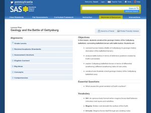
Geology and the Battle of Gettysburg
Students create geologic maps of the Gettysburg battlefield. In this geologic skills lesson, students consider the variations of Earth's surfaces and explore strategies employed by the North and South in the Battle of Gettysburg to...
Curated OER
Representing Our Nation
Students use pennies to illustrate how our states are represented in Congress. This lesson is to be implemented during a unit covering the branches of United States government.
Curated OER
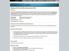
Mapping the Human Movement
Students research data on African-American emigration, place the data in a chart and create a human movement map. They also create another map using research on current immigration information.
Curated OER
If I Had Been at Ellis Island
Students examine what it was like to enter the U.S. as an immigrant. They conduct Internet research, develop a concept map, list the ways children occupied their time while at Ellis Island, and create a diorama.
Curated OER
Physical Features
Students draw physical land features using ClarisWorks or Kid Pix, write their definitions, create slideshow, and create class geography book.
Curated OER
Creating Stories Using Pictographs
Fourth graders research pictograph stories written by Native Americans. They investigate the history behind pictographs, and look through a reference book identifying the different pictures. The teacher then create their own individual...
Curated OER
The American Mosaic
Eighth graders role play as a poor immigrant family moving from the Old World to the New World in search of the American Dream. They create a portfolio and journal of their travels.
Curated OER
Follow the Leader
Students examine the roles of national leaders and the three branches of government and their duties. They view and discuss the images on the South Dakota Quarter Reverse transparency, complete a worksheet, and create a mobile of the...
Curated OER
Road Trip
Students explore a state, create a travel plan for visiting that state, write postcards from an imaginary trip there, and research selected points of interest in that state.


