Curated OER
Walking the Line
Students get an introduction to basic line drawing, including a definition, examples from art history, and three drawing exercises. They focus on drawing what they see rather than on drawing from memory.
Curated OER
Composition and Line
Young scholars examine the use of composition and line as they create original drawings. In this composition and line lesson, students recognize the art vocabulary associated with line and composition. Young scholars illustrate the...
Curated OER
Introducing Topographic Maps: Guiding Students from Concrete Models to Graphic Representations
Students interpret topographic maps and infer human activity as it is influenced by the landscape.
Curated OER
Topographic Maps
Your choice of hands-on topographic mapping tasks is provided in this resource. From actual map-making to viewing and interpreting stereographic photos, the activities are sure to succeed. To make the most of this lesson plan, you will...
Curated OER
Contour Map Worksheet #2
Following a contour map of a hill, a stream, and the ocean, are five multiple choice questions. Earth science enthusiasts determine elevation, direction of water flow, distance, and steepness. They also match the map to a selection of...
Curated OER
Doodle Animals
Fifth graders explore the abstract form of drawing of Paul Klee. They create a drawing of an animal using contour line in the same style.
Curated OER
Topographic Map Unit Plan
Students examine topographic maps and discover how to decipher contour intervals, use contour lines and apply information to complete a topographic map lab. Working in groups, they identify the scale of the map, latitude and longitude,...
Curated OER
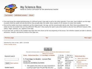
From Maps to Models
Fourth graders study topography maps and learn the importance of their contour lines. In this map lesson students create their own topography map.
Curated OER
WPA Art and Visual Elements of Art
Young scholars recognize the following formal elements om art: visual and tactile texture; shape or contour; value. They create a 2-D or 3-D work of art that embodies this element strongly.
Curated OER
Gilligan's Island
Students investigate topographical maps and match actual landforms to them. In this topographical maps lesson students create "Gilligan's Island" to scale then answer questions about it such as what the highest elevations is and what...
Curated OER
Contour Map
In this contour map worksheet, students create 3 different contour maps by highlighting all the data points with the same value and connecting the dots.
Curated OER
Line With Printmaking
Third graders investigate the use of lines in different pieces of art by creating their own ink print. In this art analysis activity, 3rd graders identify the contours and lines of natural objects such as twigs and leaves. Students...
Curated OER
Contour Hand Gestures with Text
Students examine different types of hand drawings. They create their own 3-D contour drawings. They also discuss the use of symbolism in art.
Curated OER
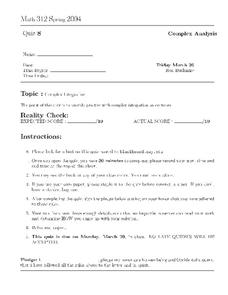
Math 312 Spring 2004: Complex Integration
In this complex integration worksheet, students use contour integration to find the area of odd shapes in a plane. This two-page worksheet contains four multi-step problems.
Curated OER
Understanding Topographic Maps
Underclassmen create a cone-shaped landform and then draw a contour map for it. Then they examine a quadrangle (which was easily located with an online search), and relate it to what they experienced. The accompanying worksheet is...
Curated OER
Sailing Vessel Contour Creations
Students explore different types of sailing vessels and the rigging, sails, masts. They discuss contour lines and how they can be used to create a portrait of a sailing vessel then they choose a sailing vessel image as a reference to...
Curated OER
Modern Mona
Students use contour drawings of the Mona Lisa. Students turn the drawings upside down and cover 3/4 of the drawing with a sheet of construction paper. They "erase from their minds" what the drawing is, and complete the quarter section...
Curated OER
Melody II
In this music worksheet, students determine which string of notes are a harmony and which ones are a melody. Students also form a map of the musical contour of the songs "Twinkle, Twinkle Little Star" and "Sweet Georgia Brown."
Curated OER
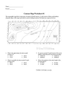
Contour Map Worksheet #1
Being able to read a topographic map is a standard in middle school earth science units and imperative for outdoor enthusiasts. As you introduce learners to this skill, you can assign this as an assessment or reinforcement. Pupils view a...
Curated OER
"Draw the Line"
Understanding the power of line in art is a step toward becoming a good artist. Provide a systematic way for learners to either show what they know about line, or explore how line affects the visual experience of the viewer. They create...
Curated OER
Topographic Mapping Skills
For this geography worksheet, students read an excerpt about topographic maps and why they are useful for various jobs. They also respond to eleven questions that follow related to the excerpt and locating specific map points on the map...
Curated OER
MAPS AND TOPOGRAPHY
Learners analyze the details of a topographic map and create one of their own by utilyzing a map of elevations.
Curated OER
Maps Reinforcement
For this map worksheet, middle schoolers complete 6 multiple choice questions and 5 short answer questions about 3 different map figures.
Curated OER
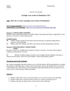
Geologic cross section of Manhattan, NYC
Students draw an accurate geologic cross section by using a given data table. They relate the features of the cross section to geologic processes. Students then relate the characteristics of the bedrock to the architecture.
Other popular searches
- Contour Maps
- Blind Contour
- Geography Contour Lines
- Contour Maps and Elevation
- Contour Drawings
- Blind Contour Drawing
- Contour Planting
- Contour Line Drawing
- Geography Contour Lines
- Contour Intervals
- Teaching Contour Lines
- Contour Maps Topography


