Curated OER
SEASHELLS - PENCIL DRAWINGS
Students explore realism through drawing techniques to create 3D drawing on a 2D surface. They review steps of drawing and vocabulary and develop eye hand coordination while creating their own sketch. Upon completion of sketch students...
Curated OER
"3-D" Painting
Students experiment with color using tints and shades of at least 2 hues and create a 3-D painting/mobile.
Curated OER
Mapping the Sea Floor
Students review their prior knowledge on topographical maps. Using a map, they examine the sea floor off the coast of San Diego, California. With a partner, they chart the sea floor of an area and use cutouts to create a visual...
Curated OER
Building a Topographic Model
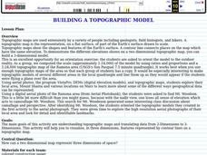
Pupils explore Mount Shasta and various locations on Mars to examine ways geographical data can be represented. They study topographic maps and translating data from 2-Dimensions to 3-Dimensions.
Curated OER
Multimedia Stained Glass Window Design
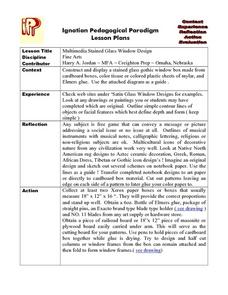
Students construct and display a stained glass gothic window box made from cardboard boxes, color tissue or colored plastic sheets of mylar, and glue.
Curated OER
Definition and Applications of Computational Science
Students participate in a variety of instructional experiences about Computer Science. They define Computational Science and describe computational simulation. They also compare and contrast Computational Science and Computer Science.
Curated OER
Mapping Seamounts in the Gulf of Alaska
Learners describe major topographic features on the Patton Seamount, and interpret two-dimensional topographic data. They create three-dimensional models of landforms from two-dimensional topographic data.
Curated OER
Enlarged Pastel Portraits
Students select a person whom they admired and get a picture of that person. Then they go through a lesson on creating and using grids. They learned how to properly use a grid to increase the scale when they create a drawing.
Curated OER
Gesture Drawing
Third graders, after the introduction to the artwork of Keith Haring, explore the art term "gesture."
Curated OER
VH1 Fan Club Dave Matthews Band
Learners study how the music of Dave Matthews Band is based on jazz, blues, bluegrass, rock and roll, and rap.
Curated OER
Mud in the Water
Students build a soil erosion model to study the importance of soil conservation. They investigate how land forms from both constructive and destructive forces.
Curated OER
Groundwater Pollution Site Assessment
Students study how a geologist examines a hazardous waste spill using an actual site. They use site data to map the spill, find its source and determine how fast the spill is spreading.
Curated OER
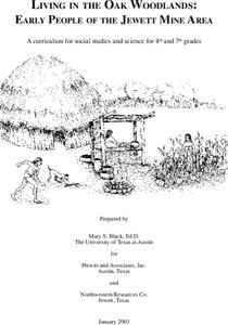
Living in the Oak Woodlands: Early People of the Jewett Mine Area
Students examine the archeology and native peoples of the Jewett Mine area of Texas. Using a map, they explain the economic patterns of the native groups and how the geography of the area affected activities. They compare and contrast...
Curated OER
Living in the Oak Woodlands: Early People of the Jewett Mine Area
Students are introduced to the early peoples living in the Jewett Mine area. After viewing transparencies, they view pictures of the mine today and its main area of production. For each picture, they develop symbols and captions about...
Curated OER
What do Bison Eat?
Middle schoolers identify the three major categories of food eaten by bison. In groups, they collect examples of grass and forbs and press them. They complete a chart of the percentages of each type of food the bison eat in a day. ...
Curated OER
Coffee Plantations
Learners explore coffee and coffee plantations. They view a Power Point presentation of what coffee looks like, where it grows, and how it is harvested. They discuss the environmental impacts on growing cofee and how it compares to...
Curated OER
Erosion Exploration
Ninth graders investigate the factors that increase soil erosion. They identify how the environment is affected by erosion. In small groups, 9th graders research erosion problems in various locations. Groups brainstorm ideas to help...
Curated OER
A Thoreau Look at Our Environment
Sixth graders write journal entries o school site at least once during each season, including sketched and written observations of present environment. They can use sample topographical maps and student's own maps. Students can use...
Curated OER
Birds of Wisconsin
First graders explore the job done by ornithologists. They role play identifying the characteristics that make a bird a bird. They discuss what makes each bird species unique. Students are introduced to Wisconsin's most common and rare...
Curated OER
Tooling Around Arizona: Reading Arizona Maps
Students study geography. In this Arizona maps lesson, students develop their map reading skills. They have class discussions and work independently with various copies of Arizona maps to practice those skills. This lesson mentions...
Curated OER
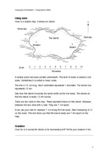
Geographical Skills-- Map Scale
In this maps learning exercise, students study a simple map and the scale in kilometres. Students read the directions and answer one question. Students then look at a sketch map of a town and answer 2 questions. Students also read how to...
Curated OER
Using GIS to Construct Water Table Maps and Flow Nets
Students examine how to use GIS software to analyze patterns of groundwater flow. Seepage lake elevation data from the Sand Hills of Nebraska is used to construct a water table map and flow net using Esri's Arc Map software.
Curated OER
Sea Secrets
Students study the following: For centuries, people have been challenged by the mysteries that lie beneath the blue depths of our ocean planet. Very little was known about the ocean until late in the nineteenth century, although nearly...
Other popular searches
- Contour Maps
- Blind Contour
- Geography Contour Lines
- Contour Maps and Elevation
- Contour Drawings
- Blind Contour Drawing
- Contour Planting
- Contour Line Drawing
- Geography Contour Lines
- Contour Intervals
- Teaching Contour Lines
- Contour Maps Topography


