Science Struck
Science Struck: The Meaning of a Vernacular Region Explained
Gives the definition of a vernacular region, one of the three main types of geographical regions, along with examples.
Houghton Mifflin Harcourt
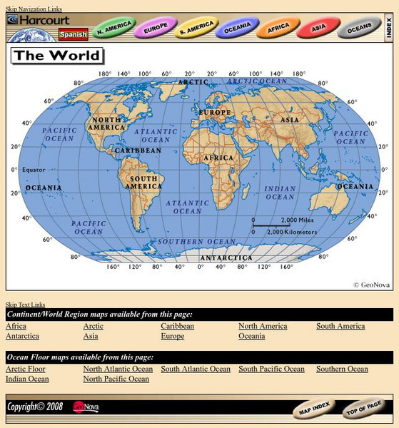
Harcourt: School Publishers: World Atlas: The World
Provides continent, country, and ocean floor maps from all over the world. Click on a continent's name to access the detailed maps which also include statistical facts on each available country.
Other
Reach the World: Geogames Build Planet Earth
Practice your mapping skills with Build Planet Earth! This animated 3D globe challenges players to locate the Poles, continents, countries, and cities. Colorful graphics and sound effects as well as a teacher's lesson plan are included.
Enchanted Learning
Enchanted Learning: Explorers
Do you know who Afonso de Albuquerque was? Do you know where Robert de LaSalle was from or where Jacques Cartier sailed? Enchanted Learning's A-to-Z list of explorers lets you browse through a large collection of biographical notes on...
Natural History Museum
Natural History Museum: Dino Directory
An excellent database of over three hundred dinosaurs from around the world. They are organized by country, continent, time period, and by alphabetical order, and each dinosaur has pictures and facts about it.
National Geographic
National Geographic: Places in the Park
Modeling the use of maps in and out of school can help students to recognize the value of maps and gain confidence with them. Using maps of places that are familiar to students will strengthen their spatial thinking skills before...
Curated OER
Etc: Maps Etc: Africa Before the Berlin Conference, 1882
A map of Africa as it was known in 1882 before the Berlin Conference of 1885, when the most powerful countries in Europe at the time convened to make their territorial claims on Africa and establish their colonial borders at the start of...
Quia
Quia: World Capitals Word Search
Practice matching world capitals and the corresponding country in a word-search format.
The History Cat
The History Cat: Containing Communism
Describes how the Soviets under Stalin managed to infiltrate Eastern European countries and establish Communist governments, dividing the continent into East and West with a symbolic Iron Curtain separating the two. America scrambled to...
Scholastic
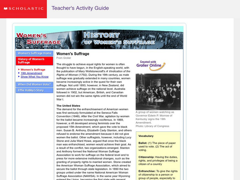
Scholastic: History of Women's Suffrage
This site summarizes the history of women's suffrage throughout various countries and continents, including: United States, Canada, Mexico, Europe, Great Britain, Italy, Germany, Scandinavia, Africa, etc. It also briefly includes the...
Other
Mooney's Flag Report
Great site for doing research on flags. You can search by continent or by country. Site provides historical information and pictures of the flags themselves.
American Geosciences Institute
American Geosciences Institute: Earth Science Week: Ring of Fire
Students identify plate boundaries as well as continents, countries, and bodies of water to become familiar with an area known as the "Ring of Fire."
Other
The Map as History: Europe's Colonial Expanision 1820 1939
European countries began exploring and seeking to dominate the rest of the world during the 15th and 16th centuries, thanks to their ability to control sea routes and to the discovery of the American continent. In the 19th century,...
Other
Escolar: Mapas De Continentes, Mapas Politicos Y Mapas De Paises
Check out this sizable selection of different maps of continents, countries, and states. Each page will give you additional information about the particular country or state.
Curated OER
Educational Technology Clearinghouse: Maps Etc: Pre Colonial Africa, 1872
A map of Africa showing the continent prior to the Berlin Conference of 1885, when the most powerful countries in Europe at the time convened to make their territorial claims on Africa and establish their colonial borders at the start of...
Curated OER
Educational Technology Clearinghouse: Maps Etc: Drawing North America, 1872
A map exercise from 1872 for drawing North America. The map shows the general outline of the coasts, major waters and rivers, and a vertical profile cross-section of the continent from the San Francisco Bay area to Cape Hatteras....
Curated OER
Etc: Maps Etc: Sketch Map of Mid Century Africa, Circa 1850
A map of Africa around the middle of the nineteenth century showing European interests on the continent prior to the Berlin Conference of 1885, which established their territorial claims. The majority of the continent was unexplored at...
Curated OER
Educational Technology Clearinghouse: Maps Etc: South America, 1921
A map from 1921 of South America showing the political boundaries of the time, major cities, railroads, terrain, rivers, and coastal features, and includes an insert map of the Galapagos Islands. " South America, the fourth largest grand...
Curated OER
Etc: Maps Etc: Europe at the Beginning of the Modern Era, 1792
A map of Europe in 1792 during the French Revolution and the beginning of the Modern Era. This map is color-coded to distinguish between various countries throughout the continent, including Great Britain, France, United Netherlands,...
Curated OER
Etc: Maps Etc: Africa Before the Berlin Conference, 1884
This is an interesting map of Africa showing the continent before the Berlin Conference of 1885, when the most powerful countries in Europe at the time convened to make their territorial claims on Africa and establish their colonial...
Curated OER
Maps Etc: The Colonization of Africa, 1870 1910
A map showing the European colonization of the African continent before and after the Berlin Conference of 1885, when the most powerful countries in Europe at the time convened to make their territorial claims on Africa and establish...
Curated OER
Educational Technology Clearinghouse: Maps Etc: Colonial Africa, 1914
A map of Africa in 1914, showing the presence of European powers, including British, French, German, Portuguese, Spanish, Italian, and Belgian possessions. Native states, major cities and major railways are also shown. This map reflects...
Curated OER
Educational Technology Clearinghouse: Maps Etc: Post Wwi Northern Africa, 1920
A political map of the northern part of the African continent after WWI with reference to territories controlled by European countries and showing the former German territories ceded by the Treaty of Versailles to France and Britain....
Curated OER
Etc: Maps Etc: Europe After the Congress of Vienna, 1815
A color map of Europe after the Congress of Vienna in 1815, which redrew the continent's political boundaries after the French Revolution, Napoleonic Wars, and the dissolution of the Holy Roman Empire. This map is color-coded to show...

