National Geographic
National Geographic: Conflict on the Danube
Lesson in which students use maps and text to explore physical and cultural boundaries and the disputes over control of them. Includes two activities with comprehensive and adaptable materials.
Georgia Department of Education
Ga Virtual Learning: Government & Politics: Comparative Citizens, Society, State
AP Government and Politics learning module explores political patterns and how they are influenced by the interactions between state and society. Comprehensive, multi-media resources.
Ducksters
Ducksters: Geography for Kids: African Countries and the Continent of Africa
Learn about the geography and the countries of Africa. Facts like flags, maps, exports, natural resources, people, and languages are on this website.
Geographyiq
Geography Iq
Detailed geographical information on any country is available at this site. Within the World Map section, you can get facts and figures about each country's geography, demographics, government, political system, flags, historical and...
ClassFlow
Class Flow: Our Great Big Beautiful Planet
[Free Registration/Login Required] This flip chart teaches the continents and oceans.
abcteach
Abcteach: Maps
[Free Registration/Login Required] Find outline maps of the continents and the United States and Canada, as well as other country and city maps.
Mocomi & Anibrain Digital Technologies
Mocomi: Asia Continent : Facts and Information
Interesting facts and details about Asia, the largest and most diverse continent.
SMART Technologies
Smart: World Map
This lesson features a world map with labeled countries, a global map, and an interactive map of the seven continents.
ClassFlow
Class Flow: Continental Regions
[Free Registration/Login Required] A flipchart showing the different regions of the world: hot deserts, tundra, equatorial rainforest, Mediterranean, and also Irish landscapes. Some activities are included to present the vocabulary...
Other
Map: Rulers
An interactive map to pull up rulers of nations. Click on a country and a historical list of rulers will show.
Houghton Mifflin Harcourt
Holt, Rinehart and Winston: World Atlas
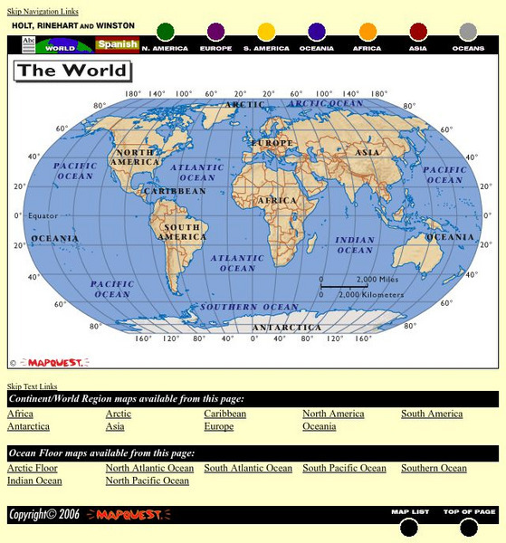
This site provides geographic maps of the world by continent, ocean, and country.
Lonely Planet
Lonely Planet: World Guide
This World Guide allows you to view information about any country anywhere in the world online. It provides you with zooming capabilities for a closer look at the maps and land layouts. Once you've selected your country, you will find a...
abcteach
Abcteach: Social Studies: Places
[Free Registration/Login Required] Generate graphic organizers, report forms, Venn diagrams, shape books and much more on the continents of the world. Sub-directories include links to games, maps, word searches and comprehension...
University of Texas at Austin
Univerisity of Texas: Maps of the Americas
A large collection of maps of all countries in the Americas including relief maps, political maps, and reference maps.
Other
If It Were My Home: Welcome to ifitweremyhome.com
The lottery of birth is responsible for much of who we are. If you were not born in the country you were, what would your life be like? Would you be the same person? IfItWereMyHome.com is your gateway to understanding life outside your...
Arcademics
Arcademics: Toad Hop
Toad Hop is a multiplayer geography game that allows students from anywhere in the world to race against each other while matching countries and capitals!
Siteseen
Siteseen: American Historama: Outbreak and Causes of Ww1
This article provides 25 facts about the outbreak and causes of WW1 in the countries and continent of Europe and in the United States of America.
PBS
Wnet: Thirteen: Africa Teacher Tools: Lesson Plans
Explore this comprehensive site featuring links to lesson plans for Africa. These teacher tools range in content and grade level. Use this site to discover more about the culture and history of Africa.
World Geography Games
World Geography Games: Countries: World
Test your knowledge of world geography with this learning game.
National Geographic
National Geographic: My Wonderful World: World Wall Maps (Pdf)
Make your own full color or black and white mosaic wall map on your own printer. World maps, continents, Asian regions, and oceans are available for downloading, printing, and assembling.
Other
Asia Society: Policy
A comprehensive storehouse of all types of information on Asia, both current and past: maps and statistics, Asian food, travel guides, photographs, articles, timelines, and more. Asia Source is the work of the Asia Society, a national...
Enchanted Learning
Enchanted Learning: World Flags
Enchanted Learning features this website devoted to the study of the world's flags. There are fact sheets, illustrations, current and historical flags, and related links.
ClassFlow
Class Flow: World Regions
[Free Registration/Login Required] This flipchart is designed to quiz students about their general understanding of regions around the world and includes countries that are in many of these regions. Use as a pre-test or review with...
US Department of State
U.s. Department of State: Youth Passport Activity Book [Pdf]
Students will virtually travel the world and complete a passport. Activities include researching flags of countries, stamps, coloring, and completing a puzzle. At the end of the lesson, students will have their very own simulated passport!


