Curated OER
Combining Map and Compass
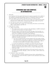
Middle schoolers practice using the map and compass to find a location. In this geography lesson series, students identify basic requirements needed when traveling in the wilderness. They plan a healthy menu for a backpacking trip.
Maths Revisions
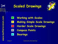
Scaled Drawings
Your carpenters will enjoy learning scaled drawing techniques and applying their new knowledge to make some real-life scale drawings of gardens. Your carpenter scholars will be reviewing some basic skills in a warm-up section of problems...
Curated OER
Topo Map Mania!
Students read and use topographical maps. They also use a compass to find bearing to an object on a map and in the classroom. Ask your students how they might travel to somewhere they have never been to befo
Curated OER
Mapping with a Compass: A Simulated Survey
Students use compasses and grids to map the locations of artifacts found in a simulated dig site. In groups, they role-play as future archeologists excavating a school site. Groups begin at their assigned datum and site the artifacts...
Curated OER
Orienteering Scavenger Hunt
Students take a reading with a compass and use the compass to reach multiple checkpoints in a scavenger hunt activity.
Curated OER
Casting Coins
This wonderful art instructional activity invites students to design and “mint” coins bearing their own symbols. A simple carving andcasting process using Blick Wonder-Cut®linoleum and modeling clay is described in the plan. Coins can be...
Curated OER
Getting to the Point
Students determine location by using the technique of triangulation. They imagine that they are out in the wilderness and have come to the top of a ridge. How can one identify the ridge on the topo map? How can one figure out where you...
Curated OER
Orienteering I
Students are introduced to compass work. They name the parts of a compass. Students describe how the parts of a compass are used. They are shown the proper way to hold a compass. Students are shown that-a-way arrow and its purpose.
Curated OER
Orienteering II
Young scholars name the parts of a compass and comprehend the function of each part. They define paces and tallies and use them in a real world situation. Students are shown the proper use of radio terminology. They use a map and compass...
Curated OER
Classroom Triangles
Middle schoolers use bearing measurements to triangulate and determine objects' locations. Working in teams of two or three, students must put on their investigative hats as they take bearing measurements to specified landmarks in their...
Curated OER
Which Way Is North?
High schoolers investigate the concept of finding locations with the use of a compass and a map. They practice the skill of bearing and set up courses of travel to different destinations around the school grounds. Students also practice...
Curated OER
TE Activity: The Trouble with Topos
Students study the uses of topographical maps including the many forms that they take. They discover that the map features show its intended use such as city maps, wilderness maps, and state maps. They complete a worksheet in which they...
Curated OER
A Sense of Location: The Mental Map
Students consider the ways a mental maps of geographic landmarks can help migrating animals stay on the correct course.
TeachEngineering
Teach Engineering: Topos, Compasses, and Triangles, Oh My!
In this activity, students will learn how to actually triangulate using a compass, topographical (topo) map and view of outside landmarks. It is best if a field trip to another location away from school is selected. The location should...
American Geosciences Institute
American Geosciences Institute: Earth Science Week: Find Your Bearing: Mapping
In this exercise, students use compasses to make a map of the school's campus.
Discovering Lewis & Clark
Discovering Lewis & Clark: Portage Route Survey
Features an example of a route survey conducted by William Clark in 1805 of the falls, rapids, cascades and ravines from the lower portage camp to the upper falls (Black Eagle) and beyond, using a circumferentor (surveyor's compass) to...
Other popular searches
- Bearings and Compass Points
- Measuring Compass Bearings
- Messing Compass Bearings
- Maps and Compass Bearings
- Measuing Compass Bearings
- True Bearings Compass
- Compass Bearings Direction
- True and Compass Bearings
- Maths Ks3 Compass Bearings


