Curated OER
Map Scaling
Second graders use a map scale to determine distances between cities in the state of Florida.
Curated OER
Scale/Ratio
Investigate the use of ratios in scale drawings. Learners scale objects up or down using ratios then find the actual size of something using ratios. They apply their knowledge of ratios as they make their own telescopes in science class....
Curated OER
Our Solar System - Comparing Planetary Travel Distances
NASA presents a mini-unit on distances in our solar system. It incorporates scientific concepts of gravity, mass, density, and payload while your aspiring astronauts also employ mathematics skills. They calculate speed, they determine...
Curated OER
Use Google Maps to Teach Math
Capture the engagement of young mathematicians with this upper-elementary math lesson on measuring time and distance. Using Google Maps, students first measure and compare the distance and time it takes to travel between different...
Curated OER
Drawing to Scale
Learners examine the process of drawing a picture to scale. They analyze and discuss real-life blueprints for a house, and create a scale drawing of an original invention using calculators and rulers.
Curated OER
Customized Topographic Maps and Models
Students explore the information depicted on topographic maps. They construct a 3-D topographic map of a local area. They go on a field trip to the depicted area and compare the 'real world' with their models.
Curated OER
Mapping Perceptions of China
Students discuss what types of things are included on a map. They compare and contrast maps of China with a map they create and practice using different types of maps. They write analysis of their classmates maps.
Curated OER
Exploring Biomes Lesson 4: Mapping Arizona
Once junior ecologists are familiar with Earth's major biomes, they hone in on Arizona's biomes. Using a website about Arizona's natural resources, learners will identify biotic communities. Beautiful maps and worksheets are provided for...
Curated OER
Exploration of Scale Models
Young scholars consider the concept of scale models. In this scale activity, students compare the sizes of various every day toys to the sizes of the larger objects they represent.
Curated OER
Lesson Nine: Size and Scale
Students investigate scale as it is related to maps. In this map lesson, students read Jack and the Beanstalk by Carol North. Students then compare the setting in the story to a landscape picture map to help them study scale.
Curated OER
World Projections
Students identify map projections and examine polar maps. In this map skills lesson, students use a flat world map to identify various projections and calculate the distances between locations by using a map scale.
Curated OER
The Gold Rush
Students identify the routes involved in the Gold Rush on a map. In this map skills lesson, students use a United States map to locate the routes used to travel to California during the Gold Rush. Students demonstrate how to use the map...
Curated OER
Scaled Rubber Band Drawings
Students demonstrate the process of creating a scaled rubber band enlargement of a simple drawing. They observe and discuss a teacher-led demonstration, and create a scaled rubber band enlargement of simple drawings and their invention...
Curated OER
Topo Map Mania!
Students read and use topographical maps. They also use a compass to find bearing to an object on a map and in the classroom. Ask your students how they might travel to somewhere they have never been to befo
Curated OER
Mapping the Canyon
High schoolers compare and contrast topographic maps and bathymetric maps. They investigate how bathymetric maps are made and how to interpret one.
Curated OER
Africa: Introduction, Geography and Mapping
Students study the geography of Africa through the use of maps. They locate, distinguish, and describe the relationships among varying regional and global patterns of geographic phenomena such as landforms, climate, and natural resources.
Curated OER
Proportions and Scale Factor for Measurement
Students explore the concept of proportion. In this proportion lesson, students use google maps to find the distance the their school is from home. Students discuss what a scale factor is through teacher led discussion. Students...
Curated OER
Map Your House
Students are introduced to the concepts of maps as scale models of the whole. After a brief lecture on creating and using an accurate scale when drawing and reading a map. They create a scale drawing of the floorplan of their homes.
Curated OER
US City Quality of Life Analysis and Comparison
Students analyze US census data and criteria to compare and measure the quality of life in the country's fifty largest cities. After accessing the 2005 quality of life world report online, students conduct their study to compare three...
Curated OER
Footprints: Take a Step into Estimation
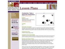
Compare sizes of student footprints with those of elephants and sauropod dinosaurs! Upper graders make estimations of the areas of irregular shapes; young scholars use grids to make and explain estimates within low and high ranges.
National Endowment for the Humanities
Lesson 3: On the Road with Marco Polo: From Hormuz to Kashgar
Young explorers examine the route that Marco Polo and his father traveled to reach China. They examine online maps of the Silk Road and harsh terrain of Afghanistan to determine challenges that may have been encountered during travel.
Curated OER
Waldseemuller's Map: World 1507
Students investigate the 1507 word map. In this world geography activity, students examine the details of each section of the map and then draw conclusions about how the people of 1507 understood the world. Students are evalated on...
Curated OER
Mapping Puerto Rico
Students use maps to discover where Puerto Rico is located. In groups, they use the internet to research the vegetation. They also compare and contrast the relationship between the United States and Puerto Rico's government.
Curated OER
Introducing Topographic Maps: Guiding Students from Concrete Models to Graphic Representations
Students interpret topographic maps and infer human activity as it is influenced by the landscape.


