Curated OER
Mapping Perceptions of China
Pupils discuss what types of things are included on a map. They compare and contrast maps of China with a map they create and practice using different types of maps. They write analysis of their classmates maps.
Rainforest Alliance
Knowing the Essential Elements of a Habitat
To gain insight into the many different types of habitats, individuals must first get to know their own. Here, scholars explore their school environment, draw a map, compare and contrast their surroundings to larger ones. They then...
Curated OER
Essential Elements of Habitat
First graders compare their local area with the Belize landscape. They construct maps of the school area, adding descriptive information. They write haiku poems about their favorite outside places.
Curated OER
You Are Here
Students map local places and learn to use scale and distance. In this mapping lesson plan, students map their school and a favorite place. Students recreate their maps showing distance and scale sizes. Students locate their...
Curated OER
Comparing Ratios
For this comparing ratios worksheet, students solve and complete 3 different problems using the screens shown. First, they write a ratio that compares the shaded part to unshaded part illustrated. Then, students use the same grid to...
Curated OER
Building a Scale Model
Third graders create a model of the solar system. In this solar system lesson, 3rd graders create a scale model of the solar system. Working in pairs students solve mathematical problems to correctly measure the distance each planet is...
Curated OER
Places in My World
Second graders explore where they are located on the globe. In this maps and globes lesson, 2nd graders use a map to show where they live and show the cardinal directions. Students identify characteristics of mountains, flat land,...
Curated OER
Marie Antoinette: The Tragic Queen
Learners view a documentary on Marie Antoinette, who became a symbol of the reviled monarchy. After viewing, students discuss what they saw then create a family line of Marie Antoinette. They compare maps of Europe from her time to ours.
Curated OER
To There And Back
Learners calculate distance on a map by using a mileage scale to calculate the distance from their hometown to Niagara Falls. They, in groups, determine the best route, then compose stories about their journey to Niagra Falls.
Curated OER
Middle Ages Cross Curriculum Project
Middle schoolers complete several projects on the Middle Ages. In this world history lesson, students complete language arts, social studies, math, and science projects. Some of these include: comparing a teenager's life now to that in...
Shakespeare in American Life
Tom Hanks and Caliban: Survivor Superstars
Here’s a clever way to combine language arts and social studies. Shakespeare’s The Tempest is believed to have been inspired by the wreck of the Sea Venture on Bermuda in 1609. The class views a brief scene from Castaway in which Tom...
Curated OER
New Perspectives
Students examine maps that are designed to give different perspectives. They create mental maps that illustrate their own perspectives and those of people from other parts of the world.
Curated OER
Old World and New World - Why Contact Took So Long
Students use a globe to determine why contact between the old world and the new world took a long time. In this map skills lesson, students analyze routes between regions to determine why it took so long for the old world and the new...
Curated OER
Migrating to Texas
Fourth graders explore the migration to Texas from other parts of the United States. Through journal entries they write about the trip as if they were the settlers coming to a new and foreign country. Working in small groups, 4th graders...
Curated OER
Quad Squad
Students pretend they have visited a forest research station on an overnight field trip. They study forest fires, use compass directions, read maps, interpret imagery, and think about the impact of fire on ecosystems.
Curated OER
Conflicting Views
Students complete a Venn diagram comparing the United States and Afghanistan. They research the history of the Taliban and how they relate to the United States and its foreign policy. They write a paper on possible solutions.
Curated OER
Park Brochures
Sixth graders investigate natural environments by researching national parks. In this brochure making lesson, 6th graders explore a specific national park and research it's information by utilizing the web. Students create travel...
Curated OER
Geography: Japan Project Online Lesson, Part 2
Students, in small groups, create and exchange map questions and share them with students in Japan. After examining the maps, they compare and contrast the two maps on the county Web Board. Students use a rubric to evaluate their answers.
Curated OER
Country Mouse, City Mouse?
Students recognize the characteristics of a rural area. They analyze land use to determine whether the map is of a rural (country) area or an urban (city) area.
Curated OER
The Middle Ages
Students read books about the Middle Ages. They discuss characteristics of the Middle Ages. In groups, students construct a castle and draw a map to scale. Pupils create a Venn diagram comparing rules in different countries in the...
Curated OER
Investigation: The Local Bagel Shop
Sixth graders explore economics by solving business math problems. In this ratio and proportion lesson, 6th graders examine different meals to be purchased at a coffee shop and compare which prices make which meals a better purchase....
Curated OER
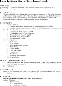
Poetic Justice: A Study of Poe's Famous Works
Students explore Edgar Allan Poe's most famous short stories. In this Edgar Allan Poe lesson, students complete a 25 page packet of activities where they recognize the features of genres and literary devices Poe uses. Students read "The...
Curated OER
Geography: Islands and Alcatraz
Learners, in groups, create maps of islands including map keys and compass roses. They compare and contrast their island communities with that of the island prison, Alcatraz. Students select from a series of projects, including writing...
Curated OER
Where Is Hoku?
Students are introduced to map making and reading. Using maps, they identify the cardinal directions and discuss the importance of a legend. They analyze the human characteristics of the classroom and create overhead view maps of the...


