Curated OER
Sea Surface Temperature Trends of the Gulf Stream
Students explore the importance of the Gulf Stream. Using a NASA satellite images, they examine the sea surface temperature. Students collect the temperature at various locations and times. Using spreadsheet technology, they graph the...
Curated OER
Deer Tracks
Students use satellite images to track to movement patterns of deer and examine deer behavior. They write stories about a day in the life of a field scientist.
Curated OER
The Geography of Aboriginal Languages in Canada
Students study the relationship between geography and the Aboriginal language communities.
Curated OER
Two Ways About It
Students take an imaginary hike in two opposite directions along a lake. They view and interpret satellite images and discuss the pros and cons of hydroelectric dams.
Curated OER
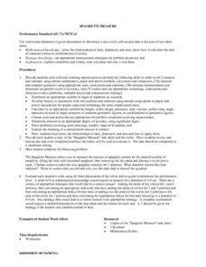
Spaghetti Measure
Students receive a copy of a "Spaghetti Measure" task sheet along with the scoring rubric. Students preview the task and the rubric prior to starting the task. tudeThey determine the circumference of a circle of spaghetti that will...
Curated OER
Warm up to the Gulf Stream
Students find out the temperature difference between the Gulf Stream and the surrounding water. They locate the Gulf Stream on the infrared image of the eastern seaboard of the US.
Curated OER
Guatemala
Fifth graders explore what types of projects the Peace Corp is doing to help Guatemala.
Curated OER
It Takes All Kinds!
Young scholars view video clips and observe similarities and differences between animals. They sort animals into groups for a zoo. They make a graph of their observations and review scientific classifications.
Curated OER
Count Down
Young scholars are introduced to useing websites as a data source. Using bird population predictions, they test their predictions from various websites. They record, organize and graph the data and share their results with the class.
Curated OER
Acids and Alkalis
Students determine and explain the characteristics of alkalis and acids. With their list of characteristics student groups conduct an investigation into whether various household substances are alkali or acid. Their lab findings are...
Science Buddies
Science Buddies: Interpreting Area Data From Maps vs. Graphs
Graphical methods of data presentation are a key feature of scientific communication. This project asks the question, "What's the best way to compare the land area of states: a map or a bar graph?" You'll be measuring performance on two...
Curated OER
Educational Technology Clearinghouse: Maps Etc: Pre Colonial Africa, 1872
A map of Africa showing the continent prior to the Berlin Conference of 1885, when the most powerful countries in Europe at the time convened to make their territorial claims on Africa and establish their colonial borders at the start of...
Curated OER
Etc: Maps Etc: Physical, Political, and Economic Asia, 1872
A map of Asia from 1872, showing physical features including mountain systems, deserts, lakes, rivers with direction of flow, coastal features, and ocean currents, political boundaries and foreign possessions at the time, and commercial...
Curated OER
Etc: Maps Etc: European Possessions of Africa, 1906
A map of Africa after the Berlin Conference of 1885, which established the European colonial territory claims on the continent. This map shows the Belgian, British, French, German, Italian, Portuguese, and Spanish claims, and the Turkish...
Curated OER
Educational Technology Clearinghouse: Maps Etc: Colonial Africa, 1904
A map of Africa shortly after the Berlin Conference of 1885, which established the European colonial territory claims on the continent. These European and independent boundaries include Algeria and the Saharan Sphere of French Influence,...
Curated OER
Etc: Maps Etc: Physical and Political Map of Africa, 1879
Map of pre-colonial Africa, showing the predominately native countries and territories of the African continent in 1879. The counties include the Barbary States of Morocco, Algeria, Tunis, Tripoli and Fezzan, the Egyptian territories of...
Curated OER
Etc: Maps Etc: Cuba, Puerto Rico, and Jamaica, 1910
A map from 1910 of Cuba, Jamaica, and Porto Rico (Puerto Rico), showing provinces, capitals and major cities, mountain systems, rivers, coastal features, and smaller banks and islands. Several inset maps are given, including a general...
Curated OER
Educational Technology Clearinghouse: Maps Etc: Colonial Africa, 1899
Map of Africa in 1899 showing the colonial possessions of European powers on the continent established at the Berlin Conference of 1885. This map shows major cities and trade centers, railroad routes and canals, major river systems, and...
Curated OER
Educational Technology Clearinghouse: Maps Etc: Pre Colonial Africa, 1870
A physical and political map of Africa prior to the Berlin Conference of 1885, which established the European colonial territory claims on the continent. This map shows the African states of Morocco, Algiers (Algeria), Tripoli, Egypt,...
Curated OER
Educational Technology Clearinghouse: Maps Etc: Natural Regions of Africa, 1920
A map from 1920 of Africa and Madagascar showing principal physical features and natural regions. The map is color-coded to show lowlands, uplands and plateaus, the Kongo basin, the older, worn down mountains, and young, rugged...
Curated OER
Etc: Maps Etc: Native Territories and European Possessions in Africa, 1876
A map of Africa in 1876 showing native African States and European possessions of Britain, France, Spain and Portugal prior to the Berlin Conference of 1885. On this map, European possessions include Algeria, Cape Colony, Griquala Land...
Curated OER
Educational Technology Clearinghouse: Maps Etc: Asia, 1899
A map of Asia from 1899 showing country boundaries at the time, foreign possessions, capitals and major cities, rivers, canals, lakes, deserts, terrain, and coastal features. This map shows the principal railways and caravan routes of...
Curated OER
Educational Technology Clearinghouse: Maps Etc: Natural Regions of Asia, 1920
A map from 1920 of Asia showing principal physical features and natural regions. The map is color-coded to show lands below sea level, lowlands, uplands and plateaus, the older, worn down mountains, and younger, rugged mountains. The map...
Curated OER
Etc: Maps Etc: Physical and Political Asia, 1870
A map of Asia from 1870 showing country boundaries at the time, major cities, mountain systems, rivers, lakes, deserts, terrain, and coastal features. An inset map details the area of Palestine, and an outline map of Pennsylvania at the...


