Curated OER
Weather in Your City
Students observe weather conditions of a particular city. Multiple intelligences are explored within this lesson. They locate their particular city on a United States map. Each student writes about their discoveries in his/her journal...
Freecloud Design
Stack the States™
Kids have fun learning US geography and state facts, including capitals, nicknames, major cities, and landmarks. They can choose between the game, or informational flashcards for each state.
Curated OER
South Carolina State Map
In this map of South Carolina worksheet, students color and label major cities and physical features in South Carolina. There is also a map showing the location of the state in the U.S.
Curated OER
Washington, D.C. Map
Here is an outline map of Washington, DC. Some of the points of interest in the city are labeled, as are Maryland, Virginia and Arlington. There are plenty of important monuments and locations not identified, making for a good...
Curated OER
Rockin' Round New York State
Students discuss their favorite rock groups and bands. They create rock groups that will be touring New York State. Students research cities in New York, determine dates of concerts, create touring itineraries, and develop Inspiration...
Student Handouts
Geography of Dr. Martin Luther King, Jr.
Young geographers follow Dr. Martin Luther King's journey during the civil rights movement by identifying major events on a map of the eastern United States, such as his birth in Atlanta, Georgia and his famous...
Curated OER
E-mailing the Chamber of Commerce
Encourage effective internet research and e-mail correspondence as scholars investigate a US capital city they've never visited to find pertinent and relevant information. They begin by picking a city, then visit that city's chamber of...
Curated OER
Understanding Growth of the Phoenix Area
Students study the growth of the Phoenix area using geographic images, maps, tables, and graphs. They study the idea of community.
Curated OER
North Dakota Map
In this North Dakota outline map worksheet, students examine political boundaries of the state and the placement its capital city as well as its major cities. This map is not labeled.
Curated OER
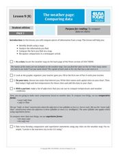
The Weather Page-Comparing Data
Students examine weather patterns in the United States. In this weather lesson, students use a United States map to identify high and low temperatures in two states. Students compare the data and record their findings onto a chart.
Curated OER
Biggest Cities in Each State Quiz
In this online interactive geography quiz learning exercise, students examine the chart that includes the names of 50 U.S. states. Students identify the names of the two largest cities in each...
Curated OER
Denali Park Topographic Maps
Students construct a topographic map of the Denali National Park. They identify different elevations and record historic landmarks in student science journals.
Curated OER
U.S. Political Map
Students explore the symbols found in a map legend. In this map skills lesson, students locate the legend on a political map and explain what each of the symbols mean. Students locate and identify several symbols on the map.
Curated OER
U.S. Political Map
For this political map worksheet, students use the map of the United States and the 7 cities to measure the straight-line distance between the cities. Students add the total number of miles traveled and write their answers in the spaces.
Curated OER
States and Capitals - Lesson 4 - U.S. Political Map
In this U.S. state capitals worksheet, students identify the capital cities of the 50 states using the latitude and longitude coordinates provided.
Curated OER
Song Mapping
Learners explore locations on the United States map. In this map skills lesson, students recite the song This Land Is Your Land and locate various places listed in the song on the map.
Curated OER
Printable Map of Connecticut
In this printable map of Connecticut worksheet, students examine the map of Connecticut that is superimposed on the United States map. They see the capitol city of Hartford on the map. There are no directions given.
Social Studies School Service
Ancient China: Introduction, Map
What a great resource for introducing your youngsters to the world of ancient China and the earliest stages of its timeline. Included are creative ideas for organizing your room, as well as an engaging lesson, anticipatory set,...
Curated OER
Printable Texas State Map
In this map of Texas worksheet, students see a clipart picture of the state of Texas superimposed on the United States map. The capitol city of Austin is highlighted on the map.
Curated OER
We've got the whole world in our hands
Students explore spatial sense in regards to maps about the globe. In this maps lesson plan, students label oceans, locate the continents and poles, follow directions, and explain the symbols on a map.
Curated OER
Mapping West Virginia
Fourth graders explore West Virginia. In this Unites States geography lesson, 4th graders discuss the type of land and the cities in West Virginia. Students create two overlays, with transparencies, that show the natural land and the...
Curated OER
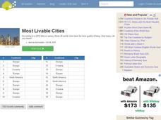
Most Livable Cities Quiz
In this online interactive geography quiz activity, learners respond to 20 identification questions about the most livable cities in the world. Students have 4 minutes to complete the quiz.
Curated OER
United States of America: 1860
In this United States historical map worksheet, students examine the boundaries of the states and territories of the nation in 1860. This map is unlabeled.
Curated OER
United States of America: 1860
In this United States historical map instructional activity, students examine the boundaries of the labeled states and territories of the nation in 1860.


