Other
Nyc Organization Chart
Develop a better understanding of the New York City Government with this helpful organization chart.
Other
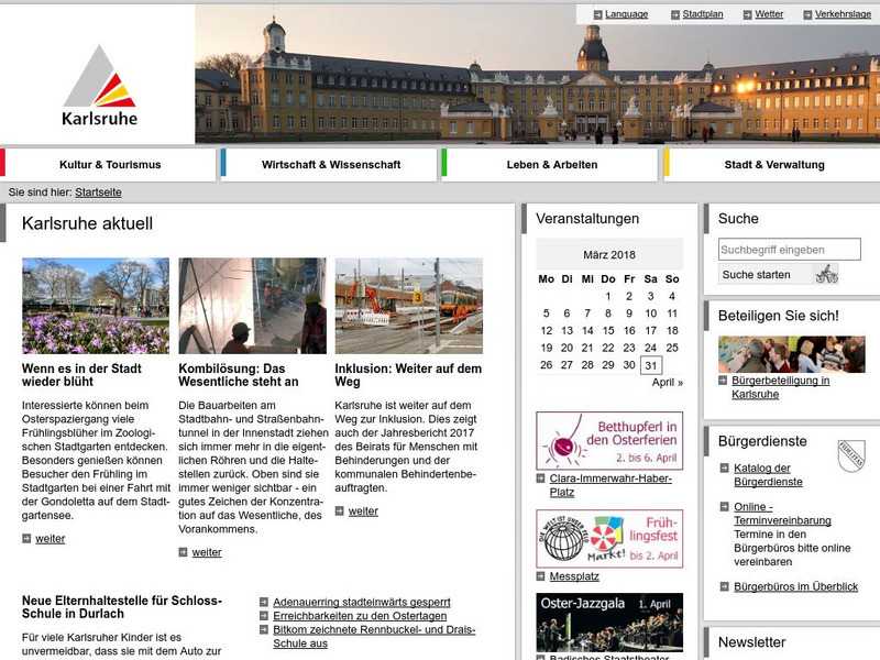
Stadtinformation Karlsruhe
Official site of the city of Karlsruhe. All the relevant information concerning city government and services, culture, freetime activity, sports, and so on. Includes current issue, plus archives, of both a local newspaper and a local...
Other
Modern City and Country Maps of Germany
A German Government user-friendly site that gives links to sites with excellent, up-to-date maps of Germany.
Other
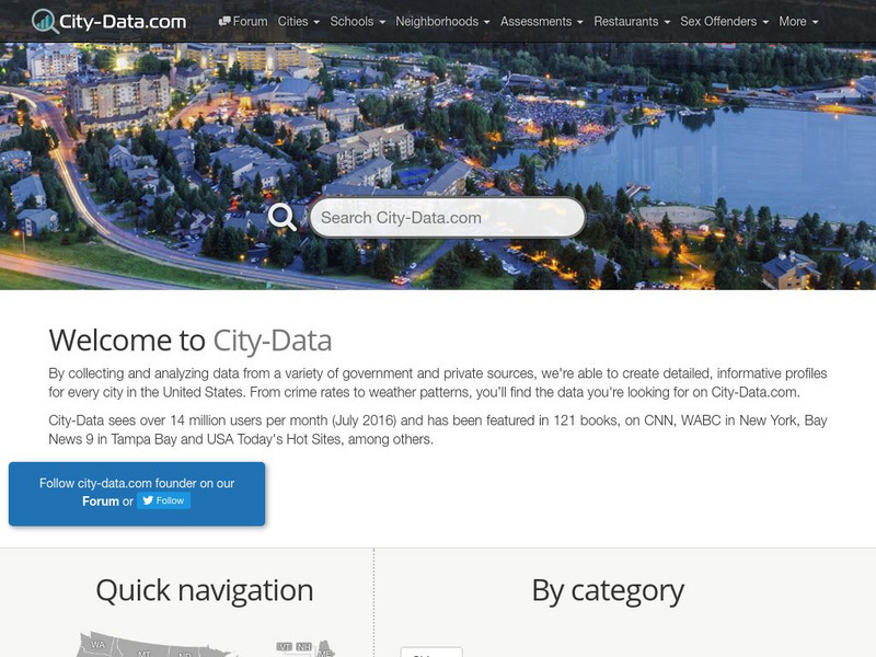
City Data
A great source for finding stats and data about U.S. cities compiled from a variety of government and commercial sources. Profiles both large and small cities and includes maps, pictures, population, income and geographical data.
US Government Publishing Office
Ben's Guide to u.s. Government: Your Neighborhood (3 5)
Elementary site presents a colorful neighborhood. By clicking on the buildings, text appears to explain the services offered by the post office, fire station, police station, home, hospital, school, and library.
Curated OER
Etc: Maps Etc: City of Mexico and Suburban Towns, 1899
"The city [Mexico City] is in what is called the Federal District, covering an area of some four hundred and fifty square miles - the government of the district like the District of Columbia is directed, by the national legislature,...
Curated OER
A View on Cities: Philadelphia: Government of the People
Government of the People (Philadelphia)
Curated OER
Etc: Maps Etc: India at the Close of the Government of Warren Hastings, 1785
A map of British India at the close of the Government of Warren Hastings. Hastings was the Governor-General of Bengal from 1773 to 1785 under the East India Company, accused of corruption (acquitted in 1795). This map is color-coded to...
Curated OER
Educational Technology Clearinghouse: Maps Etc: City of Quebec, 1919
A road map of the City of Quebec from the Official Automobile Blue Book of 1919. The map shows the St. Lawrence River and ferry crossing toward Augusta, the St. Charles River and bridge to Limoilou, major streets, railways and stations,...
Other
Travel Photos: Israel
Mr. Frysinger, a seasoned traveler, presents many photos from Israel focusing on the land and the people. The photos are accompanied by captions telling where they were taken, and in some cases, information about the particular place....
Houghton Mifflin Harcourt
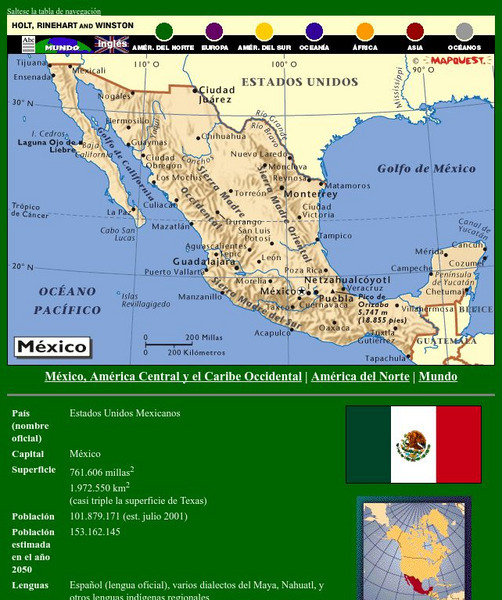
Holt, Rinehart and Winston: America Del Norte: Mexico
This site has a map of Mexico in Spanish, with informational data also presented in Spanish about the country. Land mass, population, life expectancy, literacy, industry, agriculture, minerals and resources are among the topics...
Houghton Mifflin Harcourt
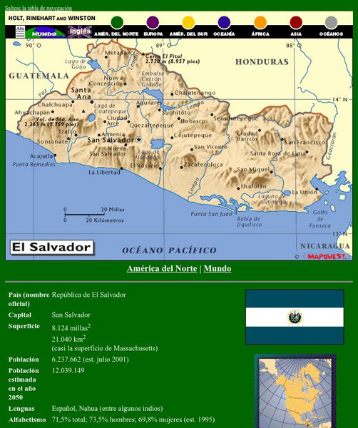
Holt, Rinehart and Winston: America Del Norte: El Salvador
This site has a map of El Salvador in Spanish, with informational data also presented in Spanish about the country. Land mass, population, life expectancy, literacy, industry, agriculture, minerals and resources are among the topics...
Houghton Mifflin Harcourt
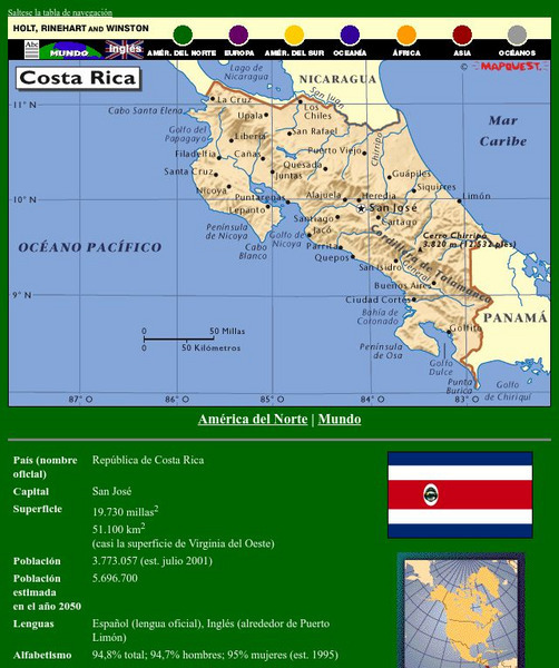
Holt, Rinehart and Winston: America Del Norte: Costa Rica
This site has a map of Costa Rica in Spanish, with informational data also presented in Spanish about the country. Land mass, population, life expectancy, literacy, industry, agriculture, minerals, and resources are among the topics...
Houghton Mifflin Harcourt
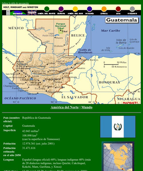
Holt, Rinehart and Winston: America Del Norte: Guatemala
This site has a map of Guatemala in Spanish, with informational data also presented in Spanish about the country. Land mass, population, life expectancy, literacy, industry, agriculture, minerals, and resources are among the topics...
Houghton Mifflin Harcourt
Holt, Rinehart and Winston: America Del Norte: Honduras
This site has a map of Honduras in Spanish, with informational data also presented in Spanish about the country. Land mass, population, life expectancy, literacy, industry, agriculture, minerals and resources are among the topics...
Houghton Mifflin Harcourt
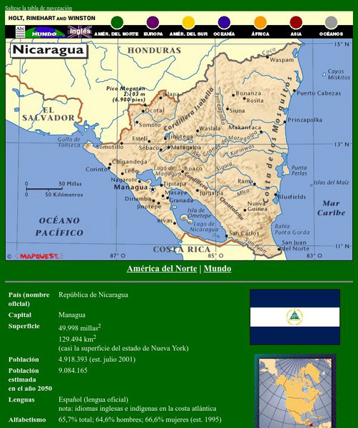
Holt, Rinehart and Winston: America Del Norte: Nicaragua
This site has a map of Nicaragua in Spanish, with informational data also presented in Spanish about the country. Land mass, population, life expectancy, literacy, industry, agriculture, minerals, and resources are among the topics...
Houghton Mifflin Harcourt
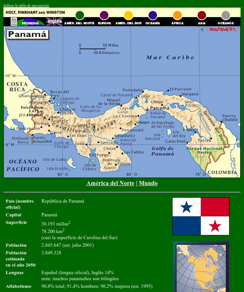
Holt, Rinehart and Winston: America Del Norte: Panama
This site has a map of Panama in Spanish, with informational data also presented in Spanish about the country. Land mass, population, life expectancy, literacy, industry, agriculture, minerals and resources are among the topics...
Houghton Mifflin Harcourt
Holt, Rinehart and Winston: Caribe: Cuba
This site has a map of Cuba in Spanish, with informational data also presented in Spanish about the country. Land mass, population, life expectancy, literacy, industry, agriculture, minerals, and resources are among the topics addressed....
Houghton Mifflin Harcourt
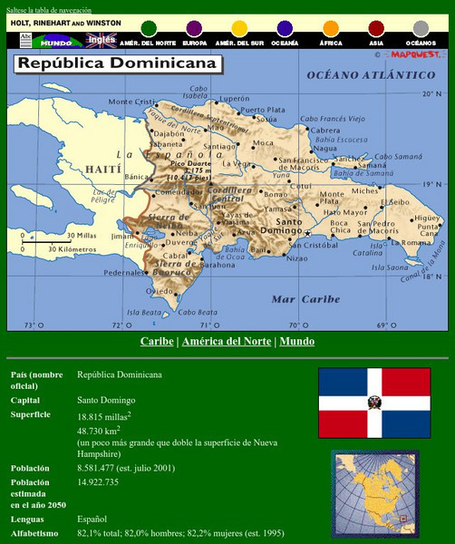
Holt, Rinehart and Winston: Caribe: Republica Dominicana
This site has a map of the Dominican Republic in Spanish, with informational data also presented in Spanish about the country. Land mass, population, life expectancy, literacy, industry, agriculture, minerals, and resources are among the...
Houghton Mifflin Harcourt
Holt, Rinehart and Winston: America Del Sur: Argentina
This site has a map of Argentina in Spanish, with informational data also presented in Spanish about the country. Land mass, population, life expectancy, literacy, industry, agriculture, minerals, and resources are among the topics...
Houghton Mifflin Harcourt
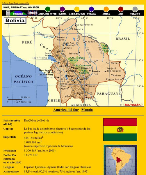
Holt, Rinehart and Winston: America Del Sur: Bolivia
This site has a map of Bolivia in Spanish, with informational data also presented in Spanish about the country. Land mass, population, life expectancy, literacy, industry, agriculture, minerals, and resources are among the topics...
Houghton Mifflin Harcourt
Holt, Rinehart and Winston: America Del Sur: Chile
This site has a map of Chile in Spanish, with informational data also presented in Spanish about the country. Land mass, population, life expectancy, literacy, industry, agriculture, minerals and resources are among the topics addressed....
Houghton Mifflin Harcourt
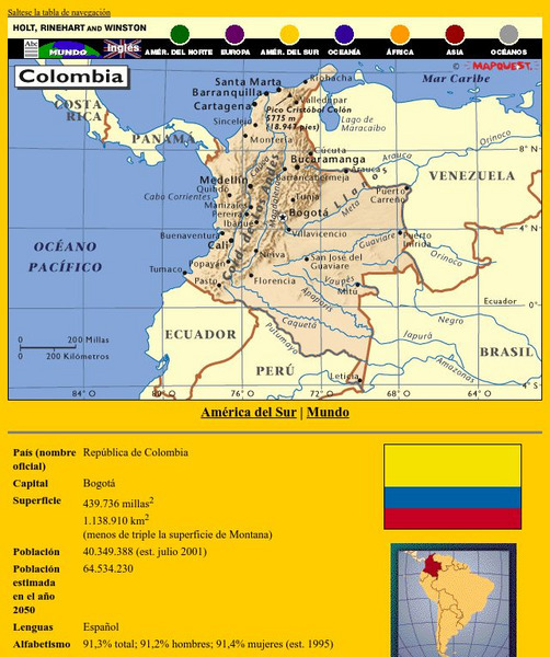
Holt, Rinehart and Winston: America Del Sur: Colombia
This site has a map of Colombia in Spanish, with informational data also presented in Spanish about the country. Land mass, population, life expectancy, literacy, industry, agriculture, minerals and resources are among the topics...
Other popular searches
- Local City Government
- City Government in Virginia
- New York City Government
- Baltimore City Government
- Kentucky City Government
- Mayors and City Government
- Writing City Government
- City Government Architecture
- Problems in City Government
- Los Angeles City Government

