Curated OER
This is My Neighborhood
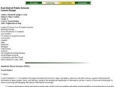
Students predict the things that they may see, smell, or hear in their neighborhood. They take part in a neighborhood walk, creating a rough map of their neighborhood as they go. Upon return to the classroom, students create a final map...
Curated OER
Hawaii: A Stolen Star
Explore the islands of Hawaii. Investigate Hawaiian culture and compare their personal traditions to Hawaiian traditions. They locate Hawaii on a map and research the history of Hawaii.
Curated OER
Solving the Puzzle
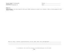
Young scholars create a map showing the United States borders at a specific period in history and produce three questions to be answered by examining the map. They also write a productive paragraph explaining who, what, when, where,...
Curated OER
Landscape Picture Map
Students design a landscape picture map. In this landscape picture mapping activity, students understand when and why to use a landscape picture map. Students discuss landscape picture maps.
Curated OER
Lesson 3: Seven Day Road Trip
Students plan a seven day road trip. For this travel lesson, students plan a driving trip that includes five major cities or attractions in Florida or another state of their choice. They show the trip on a map, calculate distances that...
Curated OER
Surveying the Land
Students explore the different kinds of maps and the purpose of each. In this Geography lesson, students work in small groups to create a map which includes the use of a map key.
Curated OER
Map Creation
Second graders identify a map, symbol, key, and compass rose. Students create and print a map for teacher evaluation using the computer. Students identify the symbols on their map and orally present them to the class.
Curated OER
Is there a map in that story?
Eighth graders examine different pieces of literature from specific isolated Pacific islands. In this Geography lesson plan, 8th graders read and interpret a written selection. Students construct a map of the stories setting.
Curated OER
Map Reading
After examining a map from 1803 and 2003, they explore how to become map readers. They describe what they see on the map from 1803 and compare the information to the map from 2003. Students create their own map of the neighborhood that...
Curated OER
Journey to Gettysburg
Students use latitude and longitude to map the path of the Battle of Gettysburg.
Museum of Tolerance
Where Do Our Families Come From?
After a grand conversation about immigration to the United States, scholars interview a family member to learn about their journey to America. They then take their new-found knowledge and apply their findings to tracking their family...
Curated OER
Mapping the Sea Floor
High schoolers review their prior knowledge on topographical maps. Using a map, they examine the sea floor off the coast of San Diego, California. With a partner, they chart the sea floor of an area and use cutouts to create a visual...
Curated OER
Mapping My Trip to the 2002 Winter Olympics!
Eighth graders map their route from their local community to Salt Lake City, Utah for the Winter Olympics. Using atlases, they gather topographical information and use the internet to research any landmarks they might pass on the way....
Curated OER
Mapping West Virginia
Fourth graders explore West Virginia. For this Unites States geography lesson, 4th graders discuss the type of land and the cities in West Virginia. Students create two overlays, with transparencies, that show the natural land and the...
Curated OER
Geography With Dr. Seuss
Students read the book, The King's Stilts by Dr. Seuss and discuss the geographical information given in the book. Then they discuss and locate on a map the physical features that make up the continent of Africa. They create an original...
Curated OER
Geography Skills
Students practice their geography skills. In this geography skills lesson, students locate, plot, and label places on maps and globes.
Curated OER
How Do I Get There? Planning a Safe Route to School
One much-needed skill for young learners is direction giving. Have your class plan and draw a safe route for them to travel from home to school. They will also draw places and items that are in between home and school in order to build a...
Curated OER
Using Non-Text Features
Second graders examine graphs and charts from their local newspaper. As a class, they discuss what the data means and how it relates to the article. In groups, they are shown two sets of graphs or charts and they practice explaining...
Curated OER
Local Traffic Survey
Students conduct a traffic survey and interpret their data and use graphs and charts to display their results.
Curated OER
Population and Population Density
High schoolers read and interpret graphs. For this population lesson, students explore population and population density as they read several data graphs and respond to questions.
Curated OER
COLONIAL FLYERS/TRAVEL BROCHURES TO THE COLONIES
Students investigate concepts of history and geography in this lesson. They create travel brochures for travelers who are crossing the Atlantic Ocean to populate the colonies of early America. The brochure has topographical information...
Curated OER
Follow the Yellow Brick Road
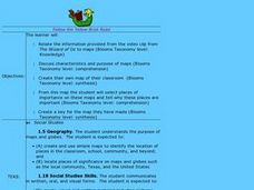
Students watch a portion of "The Wizard of Oz" and discuss how a map could be useful to Dorothy. They identify key components of maps and design a map of their classroom, including a key.
Curated OER
Facts, Fictions and Perceptions of Regions
Students examine the different characteristics of the regions of the United States. They discuss places they have visited in the U.S., and in small groups conduct research on a selected region of the U.S. Each group labels a map of...
Other popular searches
- Maps Graphs and Charts
- Graphs, Charts and Maps
- Graphs\, Charts and Maps
- Charts, Graphs, Maps
- Maps, Charts, Graphs, Tables


