Curated OER
Scale Skills
In this mapping skills learning exercise, students read an excerpt that describes three different types of scales and how to calculate distance on a map. They respond to two short answer questions using the map provided on the sheet and...
Curated OER
Mapping
Introduce middle or high schoolers to topographic maps with this PowerPoint. After a review of longitude and latitude, display and describe contour lines and intervals. Also explain map scale. This is a useful presentation for a social...
American Institute of Architects
Architecture: It's Elementary!—First Grade
Build an interest and appreciation for architecture in your young learners with this fun 10-lesson art unit. Engaging children in using their five senses, the class first observes the environment around them, paying...
Curated OER
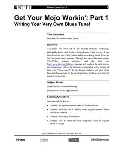
Get Your Mojo Workin': Part 1 Writing Your Very Own Blues Tune!
Upper graders listen to the blues. They discuss blues scale, read a description of the blues, and work together to write an original piece. A lesson like this ties into American history and African-American musical contributions very...
Curated OER
Mercalli Scale Illustrated
Young scholars study the Mercalli Scale and analyze how it is used to rate earthquakes. They construct a booklet with drawings that represent each rating of the scale. They study why engineers develop rating scales for earthquakes.
Benjamin Banneker Association
Celebrate Benjamin Banneker
Inventor, astronomer, surveyor, mathematician, clock maker. Learners celebrate the life of Benjamin Banneker by building creative analog clocks, making scale models, and solving problems related to surveying. The activities model the...
Curated OER
Diversity of Life: Geologic Time Scale
Students investigate the history of Earth by creating a geologic time scale. In this Earth History lesson, students practice sequencing events in their life as a way to get familiar with creating a time scale. Students...
Curated OER
Pentatonic Scale
In this music worksheet, students read information about the pentatonic scale and the notes that are included in it. Students discover that the pentatonic scale is typical of Chinese music. There are no questions on the page.
Richmond Community Schools
Map Skills
Young geographers will need to use a variety of map skills to complete the tasks required on this worksheet. Examples of activities include using references to label a map of Mexico, identify Canadian territories and European...
C-SPAN
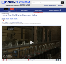
Civil Rights Movement: Sit-Ins
Part of the protests of the Civil Rights Movement were small scale sit-ins at lunch counters. This form of on-the-ground activism is the focus of a C-SPAN resource that includes four video-clips about the sit-ins by pupils at a lunch...
Curated OER
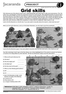
Grid Skills
In this geography worksheet, students use grid references on a map to locate places in the pictures given. They also identify another advantage of using a grid map, which they have an overhead view of the content to prevent any features...
Curated OER
Making a Living and Leisure Activities
Students investigate the economic and daily activities in a typical African community. They design and construct a small scale house, play an African board game, create African money, discuss vocabulary, and write an essay.
San Francisco Symphony
Admirable Armonica Admirers
What do Ben Franklin and Wolfgang Mozart have in common? Find out about the musical invention, the armonica or glassy-chord. Learners will read about how Ben Franklin invented this new instrument and how Wolfgang Mozart came to play it....
Curated OER
Population Pyramids
Students explain the significance of population trends on world regions. They define relevant population vocabulary and examine age-gender patterns at various scales.
Curated OER
BOLTSS Map
In this geography worksheet, students identify the six features always used on maps. They identify each of these features by the acronym BOLTSS. Students examine the Melbourne Cricket Ground shown and respond to the 4 questions that follow.
Curated OER
Planning a Healthy City
Ninth graders create a scaled model city. They create a blueprint that provides for the economic and cultural needs of a community. They identify where essential elements of the city should be located and explain the rationale for the...
Curated OER
Thematic Maps of Your School
Young scholars are able to list the essential elements of a thematic map, understand and use scale effectively to represent a geographic area, use research skills to develop a body of information, plan and draw an accurate thematic map...
Curated OER
Give Me The C and D Canal!!!
Students estimate the distance from Baltimore to Philadelphia via the water route before the Chesapeake and Delaware Canal was built. Students study canals and how transportation and economic necessities dictate the building of a canal.
Curated OER
Indian Ragas
Young scholars explore Indian ragas and learn the differences between an Indian raga and the Western scale. They sing the familiar song "America," first in the Western major scale and then in two Indian ragas (bhairavi and purvi) on a...
Curated OER
Map Activities
In this geography learning exercise, students follow the directions and shade 3 different regions of a UK political map, shade European Union countries on a political map of Europe, match 4 physical feature of Africa to their...
Curated OER
A Look at the Population Density of the United States
Middle schoolers acquire census information and create maps of the population density of the United States on different scales. They role play the roles of workers of a retail company and they use the population data to market to their...
Curated OER
Honoring the Past
Students explore the beginnings of the United States and the freedoms we enjoy. They discover important events, people, monuments in Washington, D.C., and its history. Students investigate ways to honor and remember important people and...
Curated OER
Talking Over the Wall
Students explore how conflict resolution techniques can be used to resolve difference of opinion, both on a global and local scale. Students write in a journal about conflict using a phrase from the article as a starting point. ...
Curated OER
Congressional Travel
Students determine the distances traveled by the members of the legislative branch of the US Government. In this travel distance lesson, students locate Washington, DC on a globe using the longitude and latitude of the city. They...


