Curated OER
Identifying Border States of the U.S.
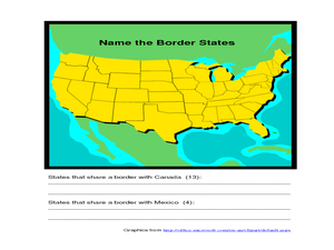
In this identifying border states of the U.S. worksheet, 3rd graders visually identify then write the names of the states that border Canada and Mexico; page 1 is a lesson, page 2 is the worksheet.
Curated OER
Mystery State #32
There is no better way to start a lesson, than with a good problem-solving activity. Give your class the chance to see if they can use each of the five clues to determine the name of mystery state number 32. Hint: It's the eastern most...
Curated OER
The Great Lakes
In this Great Lakes worksheet, students observe the Great Lakes location on a partial U.S. map, write their names in the acronym HOMES, list them in order from largest to smallest, and identify states that border them. Students write...
Richmond Community Schools
Map Skills
Young geographers will need to use a variety of map skills to complete the tasks required on this worksheet. Examples of activities include using references to label a map of Mexico, identify Canadian territories and European...
Curated OER
State to State Scavenger Hunt
In this states worksheet, students utilize the Internet to access one specific website to locate the answers to five fill in the blank statements about the states found on a United States map.
Curated OER
Mystery State #43
How much does your class know about the states in the union? Could they determine the name of a state from given clues? Here, pupils consider each of the five clues to name mystery state number 43. Note: There are two handouts on one...
Curated OER
Mystery State #15
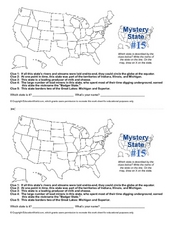
Do you know the name of the Badger State? Using five fantastic clues, your super sleuths will determine the name of mystery state number 15. A wonderful way to warm up the class!
Curated OER
Mystery State #12
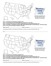
What's better than learning about US geography? Having fun while your doing it! After reviewing each of the five given clues, learners attempt to name the mystery state. A great way to reinforce geography skills and deductive reasoning...
Curated OER
United States: Physical Features Fun
In this map worksheet, students color and trace eleven listed features on a map of the United States. Students answer six additional questions about the map. A United States map is not provided. However, websites are provided to find...
Curated OER
Bordering States & VA Regions
In this Virginia geography worksheet, students respond to 2 fill in the blank questions and 16 multiple choice questions regarding the bordering states and regions of Virginia.
Curated OER
Mystery State #27
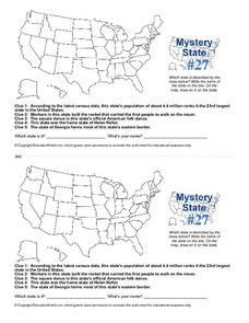
In this mystery state worksheet, learners answer five clues to identify the state in question. They then locate that state on a map.
Curated OER
Mystery State #36
In this United States mystery worksheet, students determine which state is described by the 5 clues listed on the sheet and then mark it on the outline map of the United States.
Curated OER
Using a Political Map
In this online interactive map activity learning exercise, students examine a political map of New Jersey and respond to 9 fill in the blank questions.
Curated OER
Mapping World War II: During and After
In this World War II learning exercise, students follow the provided instructions to mark 2 maps according to events and outcomes of the war.
Curated OER
Mystery State #4
In this mystery state learning exercise, students answer five clues to identify the state in question. They then locate that state on a map.
Curated OER
Mystery State #18
In this mystery state worksheet, students answer five clues to identify the state in question. They then locate that state on a map.
Curated OER
Mystery State #51
For this mystery state worksheet, students answer five clues to identify the state in question. They then locate that state on a map.
Curated OER
North American Biomes
In this Science worksheet, learners color a biome map of North America. Students color the map by solving the clues listed on a separate sheet of paper.
Curated OER
Mystery State #19
In this mystery state worksheet, learners answer five clues to identify the state in question. They then locate that state on a map.
Curated OER
Mystery State #8
In this mystery state worksheet, students answer five clues to identify the state in question. They then locate that state on a map.
Curated OER
Map of Australia
In this geography of Australia worksheet, students color and label a map with major states, cities and physical features. The Australian state borders are shown but not labeled.
Curated OER
Globe Skills Lesson 5
In this map skills activity, students read a text selection about locations during the American Revolution and then respond to 8 fill in the blank questions.
Bismarck Public Schools
Chapter 9 Review WKST
Here is a traditional multiple-choice, true/false, and fill-in-the-blank assessment on the presidency of James Monroe in the United States. It was designed to supplement a particular textbook chapter, but could be used to assess learning...
Curated OER
Biome Map
In this biomes worksheet, learners color the map of North America according to the biome clues. Students then answer questions about the North American biomes.


