Curated OER
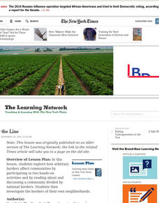
Drawing The Line
Students explore how arbitrary borders affect communities by participating in two hands-on activities and by reading about and discussing a community divided by national borders. They investigate the borders of their own neighborhoods.
Curated OER
Quarters from the Coast
Learners discuss Fifty State Quarters Program, compare and contrast location of land and water on map of United States, while also becoming aware of physical shape of nation and home state, and explore coastal areas in United States.
Curated OER
Unite These States
Students explore the historical events and people associated with the 13 colonies. The geographic locations of the 13 colonies and ultimately, of all 50 states are investigated.
Curated OER
Globe Skills Lesson 11The Vietnam War
Students develop their globe and map skills, In this geography lesson, students examine the Vietnam War as they complete an activity that requires them to plot latitude and longitude.
Curated OER
Grades 6-8 Lesson Plan - Cities as Transportation Centers
Learners examine maps of the 1800's and 1900's. In this geography skills lesson plan, students collaborate to read core maps and identify transportation centers and travel networks.
Bismarck Public Schools
Chapter 9 Review WKST
Here is a traditional multiple-choice, true/false, and fill-in-the-blank assessment on the presidency of James Monroe in the United States. It was designed to supplement a particular textbook chapter, but could be used to assess learning...
Curated OER
The Brief American Pageant: America on the World Stage
America's presence in Alaska and the Caribbean are the focus of this short presentation. Two detailed maps help to illustrate America's growing influence in the regions past its continental borders, which could supplement a more thorough...
Curated OER
Biome Map
In this biomes worksheet, learners color the map of North America according to the biome clues. Students then answer questions about the North American biomes.
Curated OER
The Power of Maps & Native American Cultures
Sixth graders discover where and how five Native American cultures lived in North America in what is currently the United States. They examine their way of life and the regions they inhabited. Additionally, 6th graders will understand...
Curated OER
Life on the Border
Students discuss different types of boundaries. They research the United States/Mexico border and answer questions about their findings. They create collages, posters, or multimedia presentations showcasing various areas of concern...
Curated OER
Oil Dependency Among Nations
Students research oil dependency amongst different nations in the world. In this oil dependency lesson plan, students use maps to locate oil sources, consider government actions on oil, and predict U.S. oil dependency.
Curated OER
Places in My World
Second graders explore where they are located on the globe. In this maps and globes lesson, 2nd graders use a map to show where they live and show the cardinal directions. Students identify characteristics of mountains, flat land,...
Curated OER
States with Attitude, Latitude and Longitude Dude
Sixth graders identify states whose boundaries are formed by lines of latitude and longitude or natural borders such as rivers. They trace a map of the U.S., and fill in borders, rivers and lines of latitude and longitude.
Curated OER
Traveling Cat Flown Home to Family
Students locate Wisconsin and Belgium on a world map, then read a news article about a cat that stowed away on ship from the U.S. to Europe. In this current events lesson, the teacher introduces the article with map and vocabulary...
Illustrative Mathematics
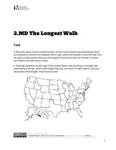
The Longest Walk
How long of a line can you draw within this activity? Learners pick two points outside and within the map to create the longest line they can. After drawing 10 lines, learners plot the length of each line on a line plot. Then they...
Curated OER
"Mill Springs Battlefield"
Learners investigate the Civil War caused deep division in the border states and discover the significance of Kentucky to the Union and the Confederacy. They examine how battle casualties were and are honored in the local community.
Curated OER
Reshaping the Nation
Students learn why the census makes a difference. In this U.S. Census lesson plan, students learn how to read and use a cartogram while they explore new ways to represent data.
Curated OER
Why Kosovo? Why Now?
Middle schoolers explain the establishment of the modern state of Yugoslavia and the breakup of the country. They examine the human characteristics of the region - ethnic groups, languages, and religions.
Curated OER
Vermont History True / False
In this Vermont history instructional activity, students read two and a half pages of information about Vermont history. After reading, students complete 10 true or false questions about what they read.
Curated OER
Land or Sea?
Sixth graders access a database to search for desired information, using "and" or "or" connectors where necessary. They choose a connector and search a prepared database of European countries to locate which countries border certain...
Curated OER
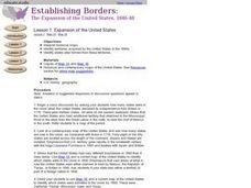
The Expansion of The United States, 1846-1848
Students interpret historical maps,identify territories acquired by the United States in the 1840s. Also they identify states later formed from these territories. The primary sources for the lesson are the maps found in the lesson's...
Curated OER
Establishing Borders: U.S. Expansion
Students interpret historical maps and locate territories annexed by the United States in the 1840. In groups, they research the war with Mexico over Texas from both perspectives and answer on a worksheet about expansion.
Curated OER
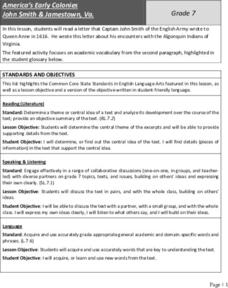
America’s Early Colonies: John Smith and Jamestown, Va
John Smith's 1616 letter to Queen Anne of England offers ELLs an opportunity to learn about a bit of early American history. The four-page packet includes the full text of the letter. In addition, the packet includes a worksheet...
Curated OER
Tracing Our Own Family Pilgrimages
The Pilgrims may have arrived in North America by way of the Mayflower, but chances are, your class members' ancestors came to the United States in another way. Guide them through an exploration of their own heritage, countries of...


