Curated OER
Greece: The Landscape
Young scholars work in small groups to create a topographic map of Greece. They must include labeled line drawings of bordering countries and bodies of water. Students use salt and flour clay to make Greece three dimensional, showing the...
Curated OER
The Landscape
Students recognize and recreate the political boundaries and physical features of the nation of Slovakia. They create topographic maps of Slovakia. The maps should include labeled line drawings of bordering countries. Slovakia should be...
Curated OER
The Lost Flyer
Fourth graders, using Microsoft Word, create a notice of a lost pet flyer. They use a border, exaggerated fonts, colors and clip art.
Curated OER
Spanish-American War
Young scholars view a video called Battling Beyond the Borders about the Spanish-American War. They discuss the role of newspapers in the war and then analyze political cartoons of the time, writing explanatory sentences about them.
Curated OER
Mosaics
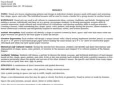
Sixth graders discuss and identify shapes, spaces, colors, patterns, or tesserae in mosaics and compare them to cultural symbols of the Roman Empire. They design and create mosaics using paper.
Curated OER
Make a Birthday Card
Students use folded paper to design a birthday card to send to a famous person on their birthday paying attention to details such as borders and color. They then draw and label 10 things the person could receive as a birthday present.
Curated OER
Identify your bunk!
Students identify their bunk bed at summer camp by decorating it. In this bunk bed lesson plan, students get materials such as glue, twigs, and noodles to write their name and identify their bunk.
Curated OER
The Geographic Doctor Seuss
Students define the term region using semantic mapping, listen to the Dr. Seuss story Yertle the Turtle, and discuss the conflict over borders in the story. They draw a map divided into regions.
Curated OER
Free Printables: Classroom Labels
In this classroom label activity, students cut out the labels and signs that are on the page. Teachers use the activity generator to determine the text that will appear on the labels or signs. There are a number of labels to choose from...
Curated OER
All Aboard the Peace Train
Second graders discuss the story "The Little Engine That Could" and highlight the quality of perseverance. They write a paragraph about a time they needed perseverance to succeed.
Curated OER
The Name Game
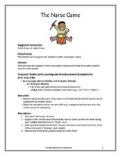
Young scholars identify animals and their babies. In this animal name instructional activity, students come up with other animals whose babies have the same name. Young scholars use the names of animals and their babies to write poems.
Curated OER
Dispute Over Slavery in Kansas Territory
Students analyze primary sources on slavery from Kansas Territory. In this Civil War lesson, students evaluate the antislavery and pro-slavery arguments and summarize key points. Students write a persuasive paper from the antislavery...
Curated OER
Dinosaur Math
Students participate in an activity to discover patterns. They make cutouts of bones and decorate them in patterns. They work together in pairs and removes the number of bones they roll on the die. They also practice writing their numbers.
Curated OER
AFRICA: "The Orphan Boy"
Students read a story of the Masai people The Orphan Boy. They create a list of characteristics of the Masai people. They write a descriptive poem about the Masai people.
Curated OER
Mali
Seventh graders begin the lesson by reading primary sources about the country of Mali. Using maps drawn in the past, they discuss what they can gather about the country from the map and how it has changed over time. They use a graphic...
Curated OER
Valentine Handprint Poem
Students make a handprint underneath a Valentine poem to give to their parents. In this Valentine poem lesson plan, students also glue conversation hearts around the edge of the page for a border.
Curated OER
Colonization: Africa
Young scholars analyze maps of Africa. They label physical features, tribal kingdoms, and European settlements, among other topics on the maps. They write reflective paragraphs on their work.
Curated OER
Porky Pig: Spelling
In this spelling practice instructional activity, students follow 6 steps to make a pig out of paper. Students then write their spelling words around the outer edge of their finished pigs.
Curated OER
Desert Poetry
In this desert poetry worksheet, students use the letters in DESERT to begin each line of an acrostic poem about the desert. Students cut out the poem, mount it on colored paper and design a border.
Curated OER
Plate Tectonics: An "Eggs"periment
Students investigate plate tectonics by observing a cracked egg shell. In this Earth science activity, students draw borders of continents on an egg shell, only to watch it crack in a glass. Students record the breakup of the "Earth"...
Novelinks
The Winter’s Tale: Bio Poem
Readers of Shakespeare's The Winter's Tale demonstrate their understanding of the play by selecting a character and crafting a bio poem that reveals his or her fears and aspirations.
Curated OER
Ticky Goes to Jr. Map School
First graders sing "We All Live Together," by Greg and Steve. They look at a map and sing the "Soggy Waffle Song" to study about the compass rose. Students write N, E, S, W on the borders of paper that goes under a 100's chart. The...
Curated OER
Walking that Line
Students attempt to describe and use longitude and latitude. They will identify different countries, their neighbors, and borders around the world. Included in the lesson the students identify natural features that control the borders of...
Curated OER
Paint the States - 50 & D.C.
Students select and research a state as an individual project and present their findings to the class. Then, they write a one page paper and create a collage or painting of their state on a mural. Finally, students create and illustrate...


