Curated OER
South America Map
In this South America learning exercise, students view a blank map of South America that they can color or label. Students do this for all the countries in South America.
Curated OER
The Roman Empire-Map Activity
In this Roman Empire worksheet, students complete a map activity in which they label and color civilizations, countries and physical features as instructed. There are no maps included.
Curated OER
Blank Map: The United States of America
In this map worksheet, students use the blank outline map of the United States to label the 50 states or for any other study purpose. Each state boundary is shown with no name labels.
Beacon Learning Center
What Goes Up Must Come Down
After your class has completed The Cay by Theodore Taylor, assess understanding of the plot. First, model how to fill out a plot line for your class. Next, have class members fill in the plot of The Cay on the provided story map. Invite...
Curated OER
Geography of Canada
All about Canada! Learners explore the geography and providences of Canada by watching videos, studying maps and conducting internet research. By the end of this lesson, your class should be able to locate major areas and compare and...
Curated OER
States On A Map
Third graders locate the states of Main and Kansas on a map. In this state location lesson plan, 3rd graders read the book Sarah, Plain and Tall and discuss what states she traveled through.
Curated OER
Blank Map of Canada
In this Canadian geography activity, students use a blank map of Canada to color and label important geographical features and cities. Students will need to do their own research before labeling this map.
Curated OER
Seasons and Day Time
Learners label a diagram of the Earth rotating about the sun and indicate the direction of the rotation and the seasons at each location. They indicate the seasons, the poles, the hours of daylight at each pole, the direction of rotation...
Curated OER
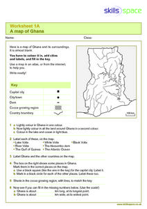
A Map of Ghana
In this Map of Ghana worksheet, students are given a blank map and key. They are told to label major features and color according to directions.
Curated OER
Reading a Map
Third graders become familiar with the vocabulary and skills related to mapping. In this guided reading lesson, 3rd graders find proper nouns on from the map. Students read Goldilocks. Students make a map...
Federal Reserve Bank
Messy Bessey's Holidays
Teach your class some fairly complex terms—factors of production, human resources, capital resources, natural resources, and intermediate goods—with a storybook (Messy Bessey's Holidays), plenty of visuals and handouts, and related...
Curated OER
Map of Papua New Guinea
In this geography of Papua New Guinea worksheet, students color and label a map with major cities and physical features. Students will need to do their own research to label this blank map.
Curated OER
Words with Short A, Short I, and Short O #3
For this short a, short i, and short o worksheet, students match words to pictures, complete the sentences, label pictures, and more with the short vowels. Students complete 4 activities.
Curated OER
Saudi Arabia -- Future city
Seventh graders summarize an article on Masdar. For this summarizing lesson students clearly explain three of the four points provided in an outline of the article. The students write an essay and identify six physical features of the...
Curated OER
Gift of the Magi
While reading O Henry's "The Gift of the Magi," your class will define and identify situational irony and allusion. Use a study guide (not included, but easy to produce) to record and discuss examples of allusion as you read. Map the...
Curated OER
Physical Geography of Africa
Fifth graders investigate the topography of Africa. In this physical geography lesson, 5th graders research the six regions of Africa and complete a physical map. Students locate various landforms in Africa. Students...
Curated OER
Help! I Am Lost at Fox Chapel
Sixth graders create a map to locate places on campus and share the map with another student. The other students use the map to locate certain places and validate for accuracy via a checklist. The parents use the completed map at open...
Curated OER
Letters from Rifka
Fourth graders read Letters from Rifka and discuss the feelings of people forced to leave their homes and countries. For this migration lesson, 4th graders relate their feelings about moving from their home forever. Students trace...
Curated OER
The 50 States and its Holidays
Though the format of this ELL lesson is confusing (the standards listed are for plate tectonics, yet the objectives are for American geography and holidays), a teacher could glean some ideas from the main idea. Here, pupils complete a...
Curated OER
Digging For Dinosaurs
In this dinosaur themed activity, students work together as a team of paleontologists to draw the dinosaur bones they discovered at a dig site. They must label their drawing on a grid map and then provide data about the length and...
Curated OER
This Land is Your Land? This Land is My Land!
Students research the various territory acquisitions in United States history and create an annotated map that tells the history of U.S. expansion. Working in small groups, students outline the land acquisitions and purchases made by...
Curated OER
New: Around the World
First graders identify and demonstrate how symbols and models are used to represent features of the environment. They use a map and a globe to label where the students in the book came from, point out the continent, and show which ocean...
Curated OER
Settling the Plymouth Colony
Students label blank maps with the names of the New England Colonies. They explain the difficulties that the Pilgrims had and how hard they worked to survive in Plymouth.
Curated OER
Where in the United States Are We?
Students spend the lesson plan identifying the location of the fifty states and the capitals. Using a software program, they retrace te outline of each state numerous times. To end the lesson plan, they write a story about a state and...


