Beacon Learning Center
What Goes Up Must Come Down
After your class has completed The Cay by Theodore Taylor, assess understanding of the plot. First, model how to fill out a plot line for your class. Next, have class members fill in the plot of The Cay on the provided story map. Invite...
Curated OER
Mapping China
Students identify cities in China on a map. In this map skills instructional activity, students locate the continent of Asia and the country of China. Students use a blank map to label China and bordering countries.
Curated OER
Maps in Kindergarten: Rosie’s Walk
Students are read, Rosie's Walk by Pat Hutchins. In this sequencing lesson, students discover the importance of knowing how to create a map and read it. They listen to the story and complete various map making activities.
Curated OER
Geography of Canada
All about Canada! Learners explore the geography and providences of Canada by watching videos, studying maps and conducting internet research. By the end of this lesson, your class should be able to locate major areas and compare and...
Curated OER
States On A Map
Third graders locate the states of Main and Kansas on a map. In this state location lesson plan, 3rd graders read the book Sarah, Plain and Tall and discuss what states she traveled through.
Curated OER
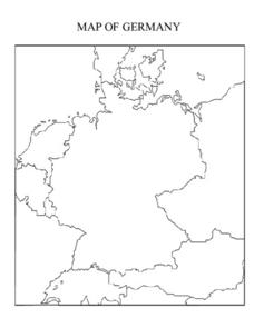
Map of Germany
In this map worksheet, pupils can color and label a blank map of Germany. This map show Germany and it's surrounding neighbors.
Curated OER
"Yarning" About Latitude and Longitude
Students identify various locations using latitude and longitude. In this map skills lesson plan, students use yarn and labels to create a "human globe." Students identify the Prime Meridian, the Equator, and Northern and Southern...
Curated OER
Blank Map of Canada
In this Canadian geography activity, students use a blank map of Canada to color and label important geographical features and cities. Students will need to do their own research before labeling this map.
Curated OER
Seasons and Day Time
Learners label a diagram of the Earth rotating about the sun and indicate the direction of the rotation and the seasons at each location. They indicate the seasons, the poles, the hours of daylight at each pole, the direction of rotation...
NOAA
Into the Deep
Take young scientists into the depths of the world's ocean with the second lesson of this three-part earth science series. After first drawing pictures representing how they imagine the bottom of the ocean to appear, young scholars...
Curated OER
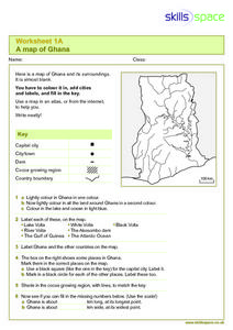
A Map of Ghana
In this Map of Ghana worksheet, students are given a blank map and key. They are told to label major features and color according to directions.
Curated OER
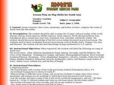
Lesson Plan on Map Skills for South Asia
Seventh graders observe and discuss an overhead transparency map of South Asia. In small groups, they label a blank map of South Asia, and listen to a lecture on the realm.
Curated OER
Reading a Map
Third graders become familiar with the vocabulary and skills related to mapping. In this guided reading lesson, 3rd graders find proper nouns on from the map. Students read Goldilocks. Students make a map...
Federal Reserve Bank
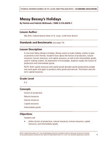
Messy Bessey's Holidays
Teach your class some fairly complex terms—factors of production, human resources, capital resources, natural resources, and intermediate goods—with a storybook (Messy Bessey's Holidays), plenty of visuals and handouts, and related...
Curated OER
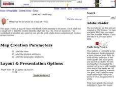
"Label Me" Texas Map
In this Texas map worksheet, students research, label and discuss the top ten major cities in Texas on a map, label the physical attributes and identify the surrounding states around Texas.
Curated OER
Hemispheres & Continents
Students learn in cooperative learning groups to determine how the equator and the Prime Meridian divide the earth into hemispheres and use Venn diagrams. Students will locate and label the hemispheres, continents, and oceans.
Curated OER
Map of Papua New Guinea
In this geography of Papua New Guinea worksheet, students color and label a map with major cities and physical features. Students will need to do their own research to label this blank map.
Curated OER
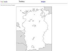
Outline Map of Turkey
In this outline map of Turkey worksheet, students see a blank map of the country with the adjoining countries shaded in gray. There are no labels on the map.
Curated OER
State to State Scavenger Hunt
In this states worksheet, students utilize the Internet to access one specific website to locate the answers to five fill in the blank statements about the states found on a United States map.
Curated OER
South America Layered
Seventh graders create an overlay map of South America. They show the relationships between population, landforms and economies with their maps.
Curated OER
Words with Short A, Short I, and Short O #3
For this short a, short i, and short o worksheet, students match words to pictures, complete the sentences, label pictures, and more with the short vowels. Students complete 4 activities.
Super Teacher Worksheets
United States of America
Here is the perfect assessment to test your young learners on labeling the 50 states! Each state is given a number on a blank map of the United States, and a second page lists the numbers in order for learners to identify.
Bismarck Public Schools
Chapter 9 Review WKST
Here is a traditional multiple-choice, true/false, and fill-in-the-blank assessment on the presidency of James Monroe in the United States. It was designed to supplement a particular textbook chapter, but could be used to assess learning...
Curated OER
The Country of South Africa-Map Activity
In this South Africa map worksheet, students label given features and places on a blank map. A reference web site is given for additional activities.


