Curated OER
Mapping the News
Students explore cartography. In this map skills and map making lesson, Students work in groups to create wall size world maps including legends, compass roses, latitude and longitude, and physical features. Students collect...
Curated OER
Tiles, Blocks, Sapphires & Gold: Designing a Treasure Map
Young cartographers in groups hide treasure at school and then create a map to find it using pattern blocks and tiles. They make paintings with clues to create a visual representation of the location of their treasure. Groups present...
Curated OER
Where in the Latitude Are You? A Longitude Here.
Students distinguish between latitude and longitude on the map. In this mapping lesson, students participate in mapping skills to recognize spatial relationships, and where to find natural resources on the map. Students create...
Curated OER
Mapping Your School Grounds
Learners create a map of their school grounds. In this mapping lesson plan, students work in teams to make a map of their school grounds. Learners note major features, observe, and record wildlife in the school grounds.
Curated OER
Explorers’ Experience
Learners investigate the Exploration Age. In this research skills lesson, students discover the impact of exploration as they locate information about selected explorers. Learners design and create relief maps that feature exploration...
Curated OER
Moving to a Path Map
Students accurately demonstrate non-locomotor/axial movements such as bend, twist, stretch, swing. They accurately demonstrate eight basic locomotor movements.
Curated OER
Analyzing Two Dances and Making a Dance Map: The Nutcracker
Young scholars discuss dance elements and create a dance map. They choose a dance theme and incorporate movement into their dance maps and choreography. They also experiment with different types of music.
Curated OER
Do the Tallywalker
Students study the basics of mapmaking, then make a tally walker, (geographic location device used in secret).
Curated OER
Exploring an Atlas
Learners explore global geography by participating in an atlas activity. In this countries of the world instructional activity, students collaborate in small groups and analyze an atlas while researching continents, countries and...
Curated OER
All Aboard!
Students research the history and background of snowboarding as well as the two main types of competition; the Giant Slalom and the Halfpipe. They find the schedule of past and future events and plot the locations of as many of these...
Curated OER
The Marvelous World of OZ
Students investigate the major themes in fantasy maps, expand basic map reading skills, write imaginative narrative essays based on the OZ map, and create their own fantasy map detail based on a core map.
Curated OER
Map-Making Basics
Students study maps. In this geography and art lesson, students create their own map of the classroom.
Curated OER
Weather Forecasting Unit
Students study weather concepts, mapping, characteristics in this series of lessons.
Curated OER
Changing Images of Childhood in America: Colonial, Federal and Modern England
Students compare and contrast maps of New Haven, Connecticut from today and the past. After taking a field trip, they draw sketches of the types of architecture and discuss how the buildings have changed over time. They read journal...
Curated OER
Capitals, Oceans, And Border States
Students investigate geography by completing games with classmates. In this United States of America instructional activity, students examine a map of North America and identify the borders of Mexico and Canada as well as the Pacific and...
Curated OER
Christopher Columbus
Help first graders gain an understanding of the beginnings of our nation by learning more about Christopher Columbus. They begin by listening to a read aloud of Christopher Columbus and His Voyage to the New World (another title...
Curated OER
Welcome to Making Masterpieces
Students examine factors that affect conservation of art works after identifying the nine agents of deterioration. They study techniques and thought processes behind art conservation.
Curated OER
Cartography
Students follow directions to draw a map of an island. They complete the island map adding their own details using symbols and a legend.
Curated OER
Voyage to the New World
Third graders investigate the history of North America by creating a map. In this world geography lesson, 3rd graders analyze the voyage Christopher Columbus took to arrive at the new world by creating a map of his...
Curated OER
Comparing Distances
Students practice estimating distances by analyzing a map. In this length measurement lesson, students view a map with a distance key and use their measurement skills to estimate the distance between two cities. Students utilize an...
Curated OER
African Country Study and PowerPoint Presentation
Students investigate the geography of Africa. In this African culture lesson, students research the lifestyles of African residents and create a PowerPoint presentation based on a single African country. Students share their...
Curated OER
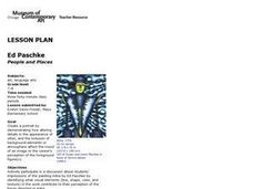
People and Places
Fifth graders investigate how the geography of the land effected the human experience of the Lewis and Clark Expedition. They research using primary and secondary sources, design a map.
Curated OER
Photo/Mat Weaving
Pupils explore the art of mat weaving. In this tapestry lesson, students create maps with paper or photographs. Pupils understand age appropriate skills and technique of map weaving. Students learn the cultural aspects of map weaving.
Curated OER
Informed Drawing Through Observation
Students practice observation techniques to improve their drawing skills. In this drawing technique lesson, students assess drawing as an art media and discuss realism. Students view examples of animal drawings and practice drawing using...
Other popular searches
- Basic Map Skills Worksheets
- Basic Map Skills Boston
- Basic Map Skills Vosstown
- Hiking Basic Map Skills


