Curated OER
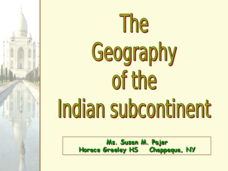
The Geography of the Indian Subcontinent
Gloriously adorned with a glimpse of the Taj Mahal, these slides detail important facts and characteristics of South Asian cultures, such as India, Pakistan, Afghanistan, and several other surrounding countries. Slides cover the...
Curated OER
Christopher Columbus: The Man, the Myth, the Legend
Learn more about maps by examining Christopher Columbus's voyage to the New World. Kindergartners will learn about basic map skills and how to identify the compass rose, oceans, and land masses. They will also discover the purpose of...
Curated OER
Asia Rivers Map Quiz
In this online interactive geography quiz worksheet, students examine the map that includes 18 Asian rivers. Students match the names of the rivers to the appropriate locations on the interactive map.
Curated OER
Central & Southwest Asia: Labeled Map
In this Central and Southwest Asia outline map worksheet, students examine boundaries of each of the countries in the region. This map is labeled.
Curated OER
Asia Physical Map
In this Asia physical map learning exercise, students make note of the major landforms and bodies of water located on the continent.
Curated OER
Kinds of Maps
In this map worksheet, students match a set of descriptions with the names of different types of maps and answer true/false questions and short answer questions about using maps.
Curated OER
Asia and the South Pacific: Political Map
In this Asia and the South Pacific map worksheet, students examine national political boundaries and national capitals in this region of the world.
Curated OER
Central and Northern Asia: Political
In this Central and Northern Asia outline map, students examine the political boundaries of the nations in this region and note the location of their capital cities. This unlabeled map may be used in a variety of classroom activities.
Curated OER
Southeast Asia and the South Pacific: Political
For this Southeast Asia and the South Pacific political map worksheet, students examine boundaries of each of the countries and the placement of the capital cities. The major bodies of water are labeled.
Curated OER
Silk Roads Big Map
Students create an oversized map from Europe to East Asia. They include information such as Silk Roads, geographical features, major cities and cultural information on their map.
Curated OER
Asia
In this map of Asia worksheet, students view and label on a map of Asia its regions, major cities, landmarks, compass rose and a legend.
Curated OER
An Introduction To Southeast Asia Today
Students investigate the region of Southeast Asia. They research the history, geography, and spread of ethnicity throughout the region. The various lessons consist of class discussion and group work to find common themes shared in...
Curated OER
South Asia
Students study South Asia. They complete various activities including answering questions following lectures, researching current events articles, viewing videos of Gandhi, South India, Pakistan, and Nepal. They select activities...
Curated OER
The Interconnectedness of Ancient Peoples Map Study
Seventh graders begin this lesson by viewing various maps of the Ancient World. As a class, they take notes on the changes of different areas in Europe and Asia as their teacher lectures to them. They answer questions about the...
Curated OER
Using Charts and Graphs to Study East Asia's Modern Economy
Students examine East Asia's modern economy. In groups, classmates use the internet to compare the resources, products, and economy of specified countries. After collecting the data, pupils create charts, tables and graphs. They...
Curated OER
Introduction to Southeast Asia - Indonesia
Students explore Southeast Asia. In this Indonesia lesson, students listen to a lecture about the location of Indonesia and complete map activities. Students also examine Indonesian art forms and explore the process of dying.
Curated OER
Map of India
In this map of India worksheet, students label the capital city, the bodies of water and the compass points, then color the surrounding colors according to directions.
Curated OER
Saudi Arabia -- Future city
Seventh graders summarize an article on Masdar. In this summarizing lesson students clearly explain three of the four points provided in an outline of the article. The students write an essay and identify six physical features of the...
Curated OER
Exploring the Hudson in 1609
While this lesson focuses on a study of the Hudson River, it could be used as a template for a discussion of map skills, converting measurements, and plotting a route. The lesson includes vocabulary and other resources to make it a...
Curated OER
Map of Asia
In this map worksheet, 3rd graders will study a map of Asia. Students will use this map to label and/or familiarize themselves with various aspects of the continent.
Curated OER
The Road Map & the Middle East
Will walls help? Read to learn how Prime Minister Ariel Sharon proposes to build walls around Isreal in hopes of isolation from Palestine. Complete an online Webquest, analyze maps, listen to audio clips, answer discussion questions, and...
University of California
The Vietnam War (1945 – 1975)
Have you ever wanted to do something so perfectly you wound up not doing it well at all? Young historians use primary and secondary documents to analyze the United States involvement in the Vietnam War. The issues surrounding the...
Curated OER
Asia Lakes, Rivers, Bays, and Seas Map Quiz
In this online interactive geography quiz learning exercise, students respond to 35 identification questions regarding Asia's lakes, rivers, bays, and seas.
Curated OER
Mapping China
Learners identify cities in China on a map. In this map skills lesson, students locate the continent of Asia and the country of China. Learners use a blank map to label China and bordering countries.
Other popular searches
- Map of Asia
- Map Skills Worksheets Asia
- Southwest Asia Climate Map
- South East Asia Map
- Southwest Asia Outline Map
- Southwest Asia Map
- East Asia Map
- Blank Map of Asia
- Map of East Asia
- South Asia Maps
- East Asia Geography Maps
- Blank East Asia Map


