Hi, what do you want to do?
Khan Academy
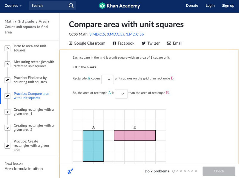
Khan Academy: Understanding Area
Compare the amount of unit squares that cover figures. Students receive immediate feedback and have the opportunity to try questions repeatedly, watch a video tutorial, or receive hints related to the concept of area.
George Mason University
Area Formula Lab
In this set of worksheet activities, students will be guided to discover formulas for area of polygonal shapes and circles.
Better Lesson
Better Lesson: Using Area as an Architect (Stations Day 1)
In this multi-day activity, 3rd graders make 3 different models of an orphanage floor plan using Google Drawing, Virtual Graph paper, and a construction of rectilinear shapes, to calculate the area of each room using units square.
Khan Academy
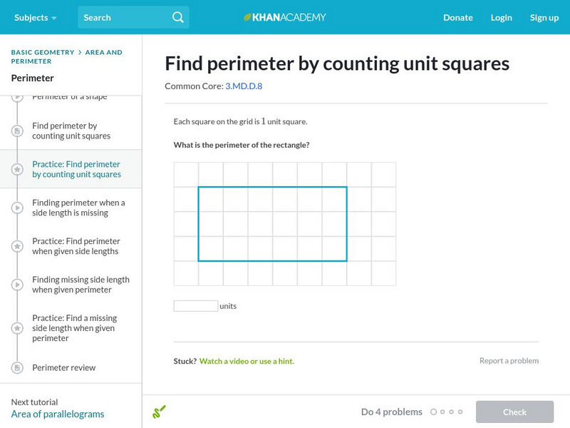
Khan Academy: Find Perimeter by Counting Unit Squares
Calculate the perimeter of a rectangle from its side lengths. Students receive immediate feedback and have the opportunity to try questions repeatedly, watch a video or receive hints.
Math Is Fun
Math Is Fun: Us Standard Area
Students learn how to measure area using US Standard Units. A definitions, examples, and practice problems are included.
Better Lesson
Better Lesson: What Is Area?
Area is the concept of covering a region with "unit squares".
Homeschool Math
Homeschool Math: Fraction Multiplication and Area
This fifth-grade lesson explores the area of a rectangle with fractional side lengths. We tile the rectangle with unit rectangles and show that the area is the same as would be found by multiplying the side lengths. We multiply...
Math Is Fun
Math Is Fun: Conversion of Area
View examples to learn how to convert area in square feet to area in square meters. If you need help, follow a link to a conversion chart.
Illustrative Mathematics
Illustrative Mathematics: 6.g Same Base and Height, Variation 2
This is the second version of a task asking students to find the areas of triangles that have the same base and height. This presentation is more abstract as students are not using physical models. They still determine the area of each...
National Council of Teachers of Mathematics
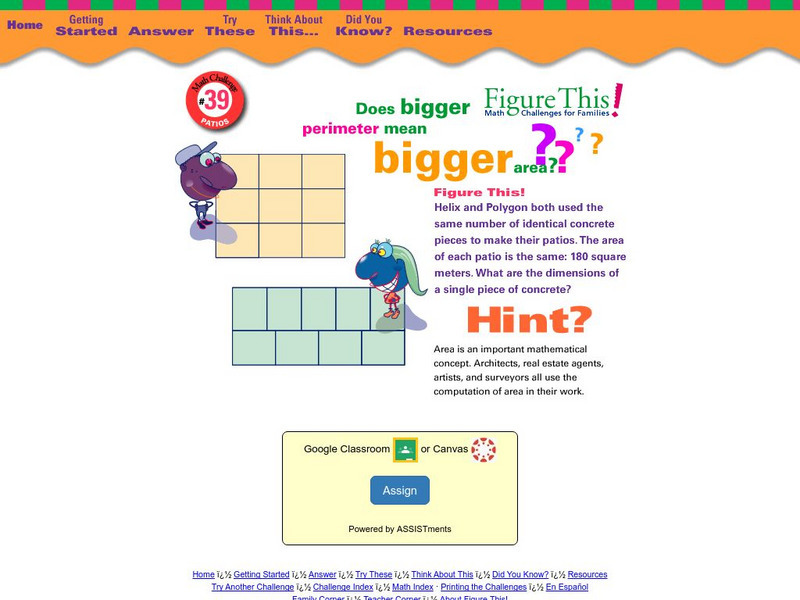
Nctm: Figure This: Patios
Does bigger perimeter mean bigger area? Answer this question when you try this math challenge from the NCTM Math Challenges for Families series. Discover how understanding area and perimeter can be useful in real world situations.
Other
All math.com: Us/metric Conversion Tables
Convert metric measurements to U.S. Measurements and the reverse, too. Easy to follow tables have sections for area, length, mass,temperature and volume.
Curated OER
Etc: Maps Etc: United States Population Density, 1850
A map from 1912 of the United States, subtitled "Distribution of Population and Railways in 1850." The map is color-coded to show population densities ranging from areas with fewer than 2 inhabitants per square mile to areas of 90 or...
Curated OER
Etc: Maps Etc: United States Population Density, 1900
A map from 1912 of the United States, subtitled "Distribution of Population and Railways in 1900" showing the increase in population and expansion of the railroad network since 1850. The map is color-coded to show population densities...
Other
Stat Soft: Statistics Glossary
Dozens of statistical terms are defined and illustrated in this glossary.
Utah Education Network
Uen: Design Your Own Bedroom
Many students dream of designing their ideal bedroom. In this exercise, students will be required to limit their designs by size (as a specific volume) and price (a specific amount). They must design the floor plan, including furniture...
Curated OER
Etc: Maps Etc: Population in the United States, 1900
A map from 1910 of the United States showing the distribution of the population in 1900. The map is keyed to show areas of population with densities ranging from under 2 inhabitants per square mile to 90 and over inhabitants per square...
Curated OER
Etc: Maps Etc: Manufacturing Districts in the United States, 1910
A map from 1910 of the United States showing the primary manufacturing districts at the time. The map is keyed to show areas where the averaged value of products of manufacture per square mile ranges from less than $1,000 per square mile...
Curated OER
Educational Technology Clearinghouse: Maps Etc: Distribution of Population, 1820
A population map of United States and territories in 1820 showing the distribution of the European-American population at the time and the general tribal lands of the Native Americans east of the Mississippi River. The map shows the...
Curated OER
Educational Technology Clearinghouse: Maps Etc: Distribution of Population, 1830
A population map of United States and territories in 1830 showing the distribution of the European-American population at the time and the general tribal lands of the Native Americans east of the Mississippi River. The map shows the...
Curated OER
Educational Technology Clearinghouse: Maps Etc: Distribution of Population, 1880
A map of the United States showing the distribution of the population in 1880. The map is keyed to show areas of population with densities ranging from under 2 inhabitants per square mile to 90 and over inhabitants per square mile.
Curated OER
Etc: Maps Etc: The United States and Neighbors, 1898
A map from 1898 of North America, Central America, Greenland, and the Caribbean to Puerto Rico, subtitled "The United States and its Neighbors in North America." The map is color-coded to show the possessions of Greenland (to Denmark),...
PBS
Pbs Mathline: Bubble Mania [Pdf]
Bubble Mania is a lesson plan that focuses on the concept of measurement as it applies to the diameter, circumference, and area in a bubble. Extension activities and connections, related worksheets, and additional resources are included.
Calculator Soup
Calculator Soup: Cubic Yards Calculator
Use this calculator to calculate cubic yards volume for a variety of different areas. Enter measurements in US units or metric units. Calculate volume from your measurements in inches (in), feet (ft), yards (yd), centimeters (cm), or...


