Curated OER
Geography, Climate, and Community in the Dominican Republic
Students familiarize themselves with the geography and culture of the Dominican Republic. In this Dominican Republic lesson, students use the given scenarios as starting points to analyze the geography and culture of the Dominican...
Curated OER
Real World Investigation- Math and Geography- Elevation Changes
For this math and geography real world investigation, 6th graders plan a driving trip to a city that is located several states away from their home while recording the elevations of three cities that are included in the trip. They use...
Civil War Trust
Contrasting the North and South before the War
Learners create a standing cube with four panels that display information on the North and South's economy, geography and climate, society, and means of transportation before the Civil War. Through discussion and reading...
Curated OER
What They Left Behind: Early Multi-National Influences in the United States
Students research the impact of European voyages of discovery and colonial influence on different aspects of American culture. They access a number of online sources and reference maps to trace the influences of England, France, Holland,...
Virginia Department of Education
World History and Geography: 1500 A.D. (C.E.) to the Present
Intended to help Virginia teachers align their curriculum to the state's history and social science standards, this packet provides a wealth of materials for any social studies or science instructor. Loaded with plans,...
Curated OER
The Nifty Fifty-What's Your Size?
Students explore state populations. In this state geography lesson, students use a variety of technology tools to research and graph population and area of assigned states.
Curated OER
Map Study
In this geography worksheet, students study the United States. Students respond to 6 multiple choice questions about the map.
Curated OER
State Capitals Quiz- Social Studies Geography Lesson Plan Grades 3-6
Students take an online multiple choice quiz on the state capitals. There are fifty multiple choice questions. After the quiz is over, students can print out the results.
Curated OER
States And Capitals
In this states and capitals worksheet, students research, analyze and memorize the fifty United States states and their capitals. Students complete a word scramble puzzle containing the fifty states and capitals.
Curated OER
Where is Kansas?
Students explore U.S. Geography by analyzing a map. For this state vs. country lesson, students utilize a U.S. map and locate the state of Kansas before researching the history and customs of the state. Students collaborate as a class to...
Curated OER
Geography Journey
Fourth graders examine the geographic features that define places and regions and answer questions about the state of California. They discuss the components of a map legend and answer worksheet questions using a map of California as a...
Curated OER
Germany States Map Quiz
In this online interactive geography quiz worksheet, students examine the map that includes 12 German states. Students match the names of the states to the appropriate locations on the map.
Curated OER
States and Capitals, Mountains and Rivers
Students identify geographical locations in the midwestern United States. In this geography lesson plan, students identify 12 states and capitals and geographical features in the region by using U.S. maps. Students use blank maps to fill...
Curated OER
A Tough Nut to Crack
Sixth graders explore agriculture by examining world geography. In this pecan cultivation lesson, 6th graders identify the history of the famous nut and the impact it has on the U.S. economy, diet and human body. Students define...
Curated OER
What State Are You In?
Students identify the major U.S. cities. In this U.S. geography lesson, students work in pairs and use game cards to name various cities in the United States.
Curated OER
Maps Can Help Us
First graders explore the geography of Montana by analyzing geographic maps of the area. In this Native American reservation lesson, 1st graders discuss the similarities and differences between reservations in the state of Montana....
Curated OER
Dark Days on the Prairie
Learners explore U.S. geography by researching agriculture. In this dust bowl lesson plan, students complete a cause and effect worksheet based upon the dust bowls that covered a large portion of Oklahoma and Texas in the early 1900's....
Curated OER
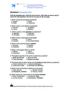
Worksheet 1: Geography Quiz
Students take a geography quiz and circle the multiple choice answer that answers each question correctly. The quiz is quite-challenging, and an atlas may be required to help the students. An answer sheet is provided.
Curated OER
The Geography of Russia
In this geography of Russia worksheet, students read a 4 page article about the geography of Russia and complete short answer questions and assignments based on the article. Students complete 6 assignments.
Curated OER
States/Capitals L-N: Matching
In this geography practice activity, students match the 17 listed states to the appropriate 17 listed capital cities located in the United States.
Curated OER
States and Capitals Unit
Fifth graders explore the regions, states, and capitals that make up the United States. Through the five lessons in this unit students locate and name the fifty states and their capitals.
Curated OER
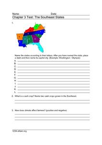
Chapter 3 Test: The Southeast States
In this geography worksheet, students complete a test about the southeastern United States. They name the states, tell about the climate and crops, complete a matching activity about the landforms. and another about the industry.
Curated OER
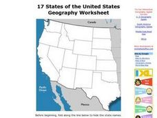
17 states
For this states worksheet, students label states in the United States that are on the west side of the country. Students label 17 states.
Curated OER
Map It With Pixie
Fourth graders use the computer program 'Pixie' to create a topographic, detailed map for the state they live in. In this mapping skills lesson, 4th graders use Pixie to make a map of their state that includes topographic features, state...
Other popular searches
- State Political Maps
- State of Georgia Maps
- State Outline Maps
- State and Local Maps
- State Outlines Maps
