Curated OER
The Historical Geography of Mesopotamia
Students show how the geography of the Mesopotamia region has impacted the beginnings of civilization. They show how this area has long been the site of the rise and fall of great empires, and how the geography of this region has a lot...
Curated OER
Seventh Grade Geography Research Paper Project
Seventh graders work on a cross curricular project in both geography and writing classes. Students conduct research on Latin America using both non print and print sources and follow the MLA form of research. Students turn in source and...
Curated OER
Exploring Our Country: An United States Scavenger Hunt
Students visit a selected web site and search answers to given questions. They investigate census data for a several states. They explore data such as business, geography, and people. Students demonstrate ways to navigate through a...
Curated OER
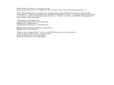
Arkansas History Lesson Plan: Identifying Arkansas on a Map
Students investigate their hometown of Arkansas. In this U.S. Geography lesson, students identify Arkansas on a map and distinguish it form the other states. Students investigate the history, state line, and personal...
Curated OER
Teaching the Five Themes of Geography Through Picture Books
Read the story Make Way for Ducklings and introduce little ones to the five themes of geography. Reread the story, while displaying transparencies to reinforce the five themes. In groups, learners view pictures and identify the themes on...
Curated OER
World Map and Globe-Equator, North Pole, and South Pole
Students identify the Equator, North Pole, and South Pole on a map. For this geography lesson, students use a world map and circle the North and South Pole. Students locate the Equator on a globe and use a map marker to highlight it.
Curated OER
Geography Words
This activity uses maps of South America and Canada to combine basic geography vocabulary and using prepositions. Students use the maps to answer questions about the locations of various countries on the two maps. This would be a good...
Curated OER
Regents High School Examination: Global History and Geography, 2005
In this global history and geography standardized test practice worksheet, students respond to 50 multiple choice, 1 essay, and 15 short answer questions that require them to review their knowledge of world history and geography.
Curated OER
Regents High School Examination: Global History and Geography, August 2004
For this global history and geography standardized test practice worksheet, learners respond to 50 multiple choice, 1 essay, and 15 short answer questions that require them to review their knowledge of world history...
Curated OER
Studying the States!!!
Students explore the fifty states of America. They also learn the capitals and locations of the states. They also study the population, mottos, flags, and interesting historical facts about each state.
Curated OER
Unite These States
Young scholars explore the historical events and people associated with the 13 colonies. The geographic locations of the 13 colonies and ultimately, of all 50 states are investigated.
Curated OER
USA: Physical Map
For this United States physical map worksheet, learners investigate the major landforms and bodies of water located throughout the country.
Curated OER
Geography Journey
In this geography worksheet, students use a map of Amtrak train routes (not included) to answer 10 short answer questions. Students describe physical features and landmark cities they would see if traveling by train across the country.
Curated OER
United States Map- Rivers
Students identify major rivers on a map of the United States. In this geography lesson, students discuss what a river is and use a map marker to identify the symbol of a river on a map.
Curated OER
United States Map - Lesson 11
Students explore lakes of the United States. In this geography activity, students identify noteworthy lakes on a map of the United States.
Curated OER
Mapping Population Changes In The United States
Students create a choropleth map to illustrate the population growth rate of the United States. They explore how to construct a choropleth map, and discuss the impact of population changes for the future.
Curated OER
Geography
Second graders explore the major rivers of Arkansas. They locate the major rivers in Arkansas on a state map. Students discuss how water is used in the region and the state of Arkansas.
Curated OER
The World (With an emphasis on the United States)
Fourth graders recognize the different continents. They are introduced to longitude and latitude and how to find locations using these measurements. This series ends with an emphasis on the fifty states of the United States and their...
Curated OER
Organizaton of American States Project
Young scholars discover the Organization of American States by researching currents issues in those countries. They create a PowerPoint presentation and share with the class.
Curated OER
Regions of the United States
Students explore the regions of the United States. In this geography lesson, students read the text When I Was Young in the Mountains and compare the setting of the story with their geographical setting. Students use a physical map to...
Curated OER
Let's Discover Texas!
Young scholars begin the lesson by taking a pre-test on their prior knowledge of the state of Texas. In groups, they participate in various activities to examine the geography, history, climate and vegetation of the state and record...
Curated OER
Australia
In this map of Australia worksheet, students research and study a map of Australia. Students label Australia's regions, major states and important landmarks.
Curated OER
Sunken Millions
This PowerPoint provides a game show format with multiple choice questions about fresh and salt water. Topics include sources of water, water geography, uses of water, and the water cycle.
Curated OER
The Silly States: Where Is Your State and City?
First graders read The Scrambled States of America and discuss whether it is real or fantasy as compared to the United States. For this geography lesson, 1st graders identify their city or state on a map and work in groups to color the...
Other popular searches
- State Political Maps
- State of Georgia Maps
- State Outline Maps
- State and Local Maps
- State Outlines Maps


