Curated OER
Nevada State Quarter
In this online interactive Nevada quarter learning exercise, students examine a Nevada quarter picture and answer 4 questions regarding it. This learning exercise may be printed for classroom use.
Curated OER
Utah State Quarter
In this online interactive Utah quarter activity, students examine a Utah quarter picture and answer 4 questions regarding it. This activity may be printed for classroom use.
Curated OER
Opening Doors to Social Studies with Children's Literature: The Desert Alphabet Book
Students explore the geography of the United States. In this social studies lesson, students identify the major deserts on a map of the United States.
Curated OER
U.S. Puzzle Map Bulletin Board
Learners create cutouts of each state. They research different states noting their similarities and differences. They describe each state's location in relation to the state's surrounding them.
Curated OER
Mural Mania
Students research and discuss symbols and features of their state. They create a mural representing their state and design a quarter for their state.
Curated OER
Let's Travel!
Students review the rules and expectations, they earn points each day by making the correct behavioral choices. They read maps and do Internet reserach, students become aware of United States and or world geography. Students check...
Curated OER
What You Can Learn From a Map
Learners discover how to interpret maps. In this geography skills instructional activity, students explore geographic themes as they complete worksheet activities regarding road maps, shaded relief maps, and topographic maps.
Curated OER
Colonies and Revolution: Comparing US and Mexican History
Students examine the emergence of the United States and Mexico as independent nations. They compare the colonial history of the two countries and discover the emergence of social classes.
Curated OER
Washington Map
In this Washington state outline map instructional activity, students examine political boundaries of the state and the placement its capital city as well as its major cities. This map is not labeled.
Curated OER
Take Me Out To the Ball Game
Young scholars use a map to graph and locate major league teams of different sports. In groups, they analyze the population data of the United States and compare it with the amount and location of the major league teams. They share their...
Curated OER
Mapping West Virginia
Fourth graders explore West Virginia. In this Unites States geography lesson, 4th graders discuss the type of land and the cities in West Virginia. Students create two overlays, with transparencies, that show the natural land and the...
Curated OER
Southeast States
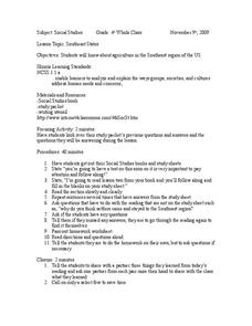
Fourth graders acquire knowledge about the settlement of the southeast region of the United states. For this united states geography lesson, 4th graders learn to analyze and understand the ways in which groups in society have...
Curated OER
The Original 13 Colonies and 3 Regions
Seventh graders review the content of American History and focus upon the original thirteen colonies. They also study the geography of the region. It is recommended that students have other lessons delivered on the topic prior to this one.
Curated OER
Let's Play Geography Twister
Students practice geography skills by playing a game based on Twister. Students manipulate their position on a map by placing their arms and legs on the appropriate state or country called out by the teacher.
Curated OER
The Role of Geography -- The United States and the Republic of Turkey
Preteens review the five themes of geography. In groups, they examine the United States and Turkey to discover how geography can impact the way people live. They create a foldable for each country, listing information for each of the...
Curated OER
United States & Canada: How Are We The Same? How Are We Different?
Students compare and contrast similarities and differences between Canada and the US. In this geography lesson, students read various articles and identify similarities and differences in economies, cultures, geography, climate,...
Curated OER
Geography and Artifacts of Mexico
Students review the structure of government in Mexico and discuss how it is different than the United States. Using artifacts, they must label and identify the city or state in which the artifact originated. They use the artifact clues...
Curated OER
The Geography of Tornadoes OR
Young scholars learn some basic facts about tornadoes and map two selected tornado statistics by state, and observe, analyze and speculate about the pattern(s) created by the completed map.
Curated OER
Human Migration in the United States
Students investigate the factors involved in human migration in the United States. Students analyze maps of different regions in the United States to determine how a variety of factors influence human settlement and development.
Curated OER
Geography General Space
Students use jump ropes to form the state or country of the teacher's choice. When they finish, all students stand around the capital of the state
Curated OER
The Asian American Experience in the United States: A Chronological History
Eleventh graders understand push-pull factor in Asian Amencan immigration. They identify patterns of Asian immigration to the United States and recognize their correlation to the concurrent socio-economic and political conditions of that...
Curated OER
Geography: why is Arkansas a great place to grow rice?
Second graders become familiar with the geography of Arkansas and analyze why it is a good place for certain crops to grow. In this rice lesson, 2nd graders list reasons Arkansas is a good place to grow rice. Students become...
Curated OER
Cooking With Geography
Sstudents use desktop publishing to create "real world" documents from information received from collaborating classes. They create an electronic presentation from Internet research. They experience foods from different states and regions.
Curated OER
Themes of Geography in the News Contest
Students discuss current events in the world today. After choosing one to focus on, they identify the themes of Geography present in them and practice using new vocabulary. They use the internet to find all of the themes present in...
Other popular searches
- State Political Maps
- State of Georgia Maps
- State Outline Maps
- State and Local Maps
- State Outlines Maps


