Curated OER
The Desert Alphabet Book
Young scholars explore world geography by researching a science book with their classmates. In this desert identification lesson, students utilize a U.S. map to locate the geographical locations of deserts. Young scholars create an oral...
Curated OER
Life on the Trails
Fourth graders explore U.S. Geography by completing a worksheet. For this west coast geography lesson, 4th graders discuss the Santa Fe and Oregon-California trails and the people who traveled them in the 1800's. Students define...
Curated OER
2nd Grade - Act. 22: The World Game
Second graders play World Game to become more familiar with continents, oceans, countries and states.
Curated OER
Mapping the News
Students explore cartography. In this map skills and map making lesson, Students work in groups to create wall size world maps including legends, compass roses, latitude and longitude, and physical features. Students collect...
Curated OER
Puzzles and Brain Teasers
In this geography worksheet, students match the state with its capital city. Students match the capitals for all 50 states. The states are divided up by 10 on each page.
University of New Mexico
New Mexico Land of Enchantment
Third graders research Native American Cultures surrounding New Mexico. They analyze the history and geography of the state. They play a guessing game that incorporates the indigenous plants and animals of New Mexico. In groups, learners...
Curated OER
Spanish Influence in the U.S.
Eighth graders research the role of the first Spanish conquistadors who explored the now United States. Using the internet, they gather information on different explorers and write a paper about why he is important in American history. ...
Curated OER
Projects For USA Units
Students study different regions of the United states through interdisciplinary activities. This lesson presents very creative, artistic ways for students to explore the variety of regions found in the United States.
Curated OER
New Jersey State Quarter
For this state quarter worksheet, students study the diagram of the state quarter of New Jersey. Students answer questions based on the information on the quarter.
Curated OER
World Map and Globe
Students locate and identify continents and countries. In this world map lesson, students locate and identify one country on each continent.
Curated OER
Introduction to the United States Map
Students identify the United States of America and it's states on a map. In this mapping lesson, students examine a globe and find the United States as well as a few land marks (Florida and the Great Lakes). Students then look at a...
Curated OER
State Heads
Students create a narrative image that depicts a formal shape of a state. They review the state facts of whatever state they chose. They draw a person and then add text in the shape of the state they chose.
Curated OER
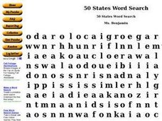
50 States Word Search
In this fifty states worksheet, students identify and locate all fifty states of the United States of America. There are 50 states located in the word search.
Curated OER
Discovering the Physical Geography of Washington
Pupils develop a mental map of the state of Washington and draw it on paper. Using the Virtual Atlas, they identify the physical features of the state and draw them on their map. They also examine the populations and diversity of the...
Curated OER
Using Literature to Introduce the Five Themes of Geography
Young scholars listen to a read aloud of "If You Grew Up With Abraham Lincoln". Using the text, they identify examples of the five themes of geography and write them down. Using a map, they plot the places mentioned in the book and sort...
Curated OER
Welcome to New York State
Students choose one region of New York state, and create a travel brochure that includes information such as geographical features, tourist attractions, accesibility, economic features, and historical events that occured in that region.
Curated OER
Geography of Spain
Students explore Spain. In this geography skills lesson, students investigate a political map of Spain and record the names of states, capitals, and landforms. Students then practice tagging the states, capitals, and landforms on blank...
Curated OER
Oaxaca Geography and the Climate
Students examine the diverse geography of the country of Mexico and the state of Oaxaca. They analyze how the geography of the state of Oaxaca affects its climate and create maps showing the different climate areas.
Curated OER
USA States and Capitals
Fifth graders explore U.S. geography by completing a map identification activity. In this states and capitals instructional activity, 5th graders examine a map of all 50 U.S. states and identify them as well as their capital cities....
Curated OER
United States Capitals Map Quiz
In this online interactive states and captials quiz instructional activity, students examine the 50 pictured states and try to name all of the state capitals.
Curated OER
Geography of Puerto Rico - Review Questions
In this geography of Puerto Rico learning exercise, students answer short answer questions about facts of geography in Puerto Rico. Students complete 10 questions.
Curated OER
Global Connections Geography Review
In this beginning world geography PowerPoint, students answer basic questions about continents and oceans, as well as land and water that surround or can be found in the United States. Correct responses earn a mark on the...
Curated OER
To Be Or Not To Be a State? That Is the Question
Eighth graders research Puerto Rico's culture, religion, language, government, etc. and identify differences and similarities with the United States. They participate in a debate about whether or not Puerto Rico should become a state.
Curated OER
Agriculture Cares for the World
Students explore world geography by analyzing agriculture. In this dietary habits lesson, students discuss the role parents play in their children's diet and where the food comes from. Students write agricultural research paragraphs and...
Other popular searches
- State Political Maps
- State of Georgia Maps
- State Outline Maps
- State and Local Maps
- State Outlines Maps


