Curated OER
Geography: Ancient Rome
Students research Ancient Rome, the Mediterranean Region, Roman myths, and Latin. In this Roman life lesson, students study maps of the region, learn their language and customs, research the Punic wars, the catastrophe of Pompeii, and...
Curated OER
Geography of Spain
Middle schoolers explore the geography of Spain. In this geography skills lesson, students create a map on their school gym floor in the shape of Spain. Middle schoolers identify the locations of the Spanish states and capitals.
Curated OER
Geography Tutor: Five Themes of Geography: DVD-Video Assignment
In this geography skills worksheet, students watch the National Geographic video "Five Themes of Geography." Student then respond to 8 short answer questions about content of the video.
Curated OER
Africa: Geography Concept Map
In this geography skills worksheet, students complete a graphic organizer where they list African countries and their geographic features, languages spoken, natural resources, and historical facts.
Curated OER
Geography And The Gulf War
Students develop maps, tables, graphs, charts, and diagrams to depict the geographic implications of current world events, and analyze major human conflicts to determine the role of physical and cultural geographic features in the...
Curated OER
Mapping the News
Students explore cartography. In this map skills and map making lesson, Students work in groups to create wall size world maps including legends, compass roses, latitude and longitude, and physical features. Students collect current...
Curated OER
GEOGRAPHY: SPACE CENTERS
Students examine the descriptive science dealing with the surface of Earth, its division into continents and countries, climate, natural resources, inhabitants and industries of the various divisions and analyze the political geography...
Curated OER
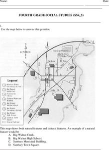
Fourth Grade Social Studies
In this social studies worksheet, 4th graders answer multiple choice questions on state maps, city maps, road maps, political maps, and more. Students complete 25 multiple choice questions.
Curated OER
Maps Can Help Us
First graders explore the geography of Montana by analyzing geographic maps of the area. In this Native American reservation lesson, 1st graders discuss the similarities and differences between reservations in the state of Montana....
Curated OER
Where is Kansas?
Students explore U.S. Geography by analyzing a map. In this state vs. country lesson plan, students utilize a U.S. map and locate the state of Kansas before researching the history and customs of the state. Students collaborate as a...
Curated OER
Matching Worksheet: Geography
In this vocabulary worksheet, students match geography words to their definition. Students identify the definition to words dealing with the physical and human features of land, and terms dealing with interpreting a map. They solve 12...
Curated OER
The Physical World: Continents and Oceans
In this world map worksheet, study the map of the continents and oceans. Students label each of the 12 sections of the world map.
Curated OER
Geography, Ecology, and Folklife
Students identify how do geography and ecology influence a region's folklife. Then they investigate this question and consider how an outsider might view their own region in this lesson. Students also identify how the natural world, even...
Curated OER
California Geography
Fourth graders explore geography of four distinct regions of California: mountains, coast, central valley, and desert. They locate California on map, identify state's boundaries and borders, and explore agriculture, a major economic...
Curated OER
Geography of the Study of the Spanish-speaking People of Texas
Students identify the physical features, demographic characteristics, and history of the four Texas towns featured in Russell Lee's photo essay, "The Spanish-Speaking People of Texas." They conduct Internet research, and create a travel...
Curated OER
Physical Features
Students draw physical land features using ClarisWorks or Kid Pix, write their definitions, create slideshow, and create class geography book.
Curated OER
D. A. M. Agriculture Lesson Plan
Students explore agricultural concepts and how humans modify the physical environment. They participate in card sorting activities to determine agricultural concepts: Dependence, Adaptation, Modification (D. A. M.). Students identify...
Curated OER
Political Legends and Map Symbols
Learners identify the legend and map symbols. In this map skills lesson, students use a world map to find various locations using a map key.
Curated OER
Australia Outline Map
In this Australia and Oceania outline map worksheet, students make note of the major landforms and bodies of water located within this region.
Curated OER
Australia Map
In this Australia outline map worksheet, students make note of the political divisions of the 5 provinces and territories of the nation.
Curated OER
Geography Journey
Fourth graders examine the geographic features that define places and regions and answer questions about the state of California. They discuss the components of a map legend and answer worksheet questions using a map of California as a...
Curated OER
Our States, My State
Here is a very nice lesson on the shape of the United States, and the shapes of the individual states for your young geographers. They utilize worksheets embedded in the plan to color in a variety of states and to become familiar with...
Freecloud Design
Stack the States™
Kids have fun learning US geography and state facts, including capitals, nicknames, major cities, and landmarks. They can choose between the game, or informational flashcards for each state.
Curated OER
The Big Circle
Students explore geography by participating in a mapping activity. In this concentric ring lesson, students utilize a poster board, string and markers to identify their current location within the entire world. Students write about their...
Other popular searches
- Europe Physical Geography
- Canada Physical Geography
- Physical Geography of Africa
- Physical Geography of Europe
- Human and Physical Geography
- Physical Geography of Japan
- Physical Maps of Europe
- American Physical Geography
- Africa Physical Geography
- Earth's Physical Geography
- African Physical Geography
- Physical Geography of Canada


