Curated OER
Sanctuary: Quail Island Banks
Students explore visual arts by examining a diorama in class. In this geography lesson, students examine an island off the coast of New Zealand and identify the physical attributes of the land. Students answer study questions regarding...
Curated OER
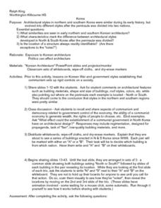
Korea Research
Students investigate the details surrounding Korean Architecture. They look at some of the different styles and see how they may differ from some others found in the world. The research is done in order to appreciate the uniques cultural...
Curated OER
Ghost Canoe
Fourth graders are read the book "Ghost Canoe" by their teacher. Using a map, they locate the physical characteristics of Washington State and describe how people adapted to their environment before statehood. They discover how people...
Curated OER
Living in the Desert: Reading Comprehension
In this comprehension worksheet, students read a short selection about sand gazelles, then answer 5 multiple choice questions. Answers provided.
Curated OER
Maryland
In this Maryland reading comprehension worksheet, students read a 2-page selection regarding the state and they answer 10 true or false questions pertaining to the selection.
Curated OER
The Battle of Horseshoe Bend: Collision of Cultures (54)
Learners discover the political and cultural conflicts that led to the Battle of Horseshoe Blend, Alabama, and evaluate historical maps of the Battle of Horseshoe Bend. They research American Indian cultures that were located in their...
Curated OER
Give Me The C and D Canal!!!
Learners estimate the distance from Baltimore to Philadelphia via the water route before the Chesapeake and Delaware Canal was built. Students study canals and how transportation and economic necessities dictate the building of a canal.
Curated OER
Around The World
Students search the Internet through a sequence of steps to reach the country of their nationality. They research and collect information about their country.
Curated OER
Home S-s-sweet Home The Eastern Massasauga Rattlesnake
Students investigate the eastern massasauga rattlesnake's habitat. They examine how the habitat allows the snake to survive by completing a variety of activities.
Curated OER
What Does Korean Literature Reveal About War?
Students are exposed to a wide variety of war related literature in order to comprehend the influence of conflict upon the lives of the Korean people. The information is used to complete a research report.
Curated OER
Draw A Coastline
Middle schoolers identify, locate and draw at least ten different geographical features on a map. Using the map, they must make it to scale and include their own legend and compass rose. They share their map with the class and answer...
Curated OER
Geography: Islands and Alcatraz
Students, in groups, create maps of islands including map keys and compass roses. They compare and contrast their island communities with that of the island prison, Alcatraz. Students select from a series of projects, including writing...
Curated OER
Give Me the C and D Canal!!!
Students estimate the distance between Baltimore to Philadelphia via the water route before the Chesapeake and Delaware Canal was built. They familiarize themselves with canals and how transporation and economic necessities dictate the...
Curated OER
Mapping Mexico
In this Mexico map activity, students label features and places on a blank map of Mexico. A reference web site is given for additional activities.
Curated OER
Ancient Egypt
For this ancient Egypt worksheet, 6th graders use maps in chapter 5 of a Houghton Mifflin text to label items on an outline map and answer a set of 10 related questions.
Curated OER
Pánfilo de Narváez, Nuñez de Cabeza de Vaca
Young scholars identify the route that Narváez and de Vaca sailed, and the mishaps that occurred during their exploration of Florida. They illustrate each of the vocabulary words or create mini barges using sticks and cloth.
Curated OER
Landform Bingo
Students review landform terms and review fact and opinion. They make fact and opinion statements and play landform BINGO.
Curated OER
Choosing an Appropriate
Students use the classified ads of a local newspaper and read descriptions of people's goals, interests, experience, and skills, then find an appropriate employment ad for that person. Next, they find an appropriate ad for themselves.
Curated OER
Regions of the US: Gulf Stream, States and Their Capitals
Fifth graders identify one way of dividing the US into geographical regions and then consider alternate ways of doing the same. They locate each of the fifty states and their capitals on a map. They research the Gulf Stream region.
Curated OER
Crossing the Narrows: Idea & Dream,...to 1937
Students decide which group they would like to be a member of discussing the Tacoma Narrowns Bridge. Each group researches the same questions but have different answers depending on the group they are in.
Curated OER
Math & Social Science
Students are given data and are to calculate averages and yearly totals of how many cars travel the Tacoma Narrows Bridge. They also make a graph of the data.
Curated OER
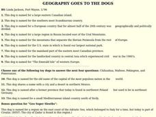
GEOGRAPHY GOES TO THE DOGS
Students use countries and dogs from around the world to answer the questions.
Curated OER
Discovering the Past Using the Future: Remote Sensing and the Lost City of Ubar
Young scholars use a video, maps, worksheets and Internet research to explore the role that sensing played in locating Ubar - the lost city of Arabia.
Curated OER
Rome Comes to Third Grade
Students explore the world of Ancient Rome in this thirteen lessons unit. the rise and fall of the Roman Empire is probed. The ideals that inspired the people's sense of purpose are developed in these lessons.
Other popular searches
- Arabian Peninsula
- Arabian Peninsula Map
- Arabian Peninsula History
- Arabian Peninsula Geography
- Arabian Peninsula Culture
- Iberian Peninsula
- Blank Map Iberian Peninsula
- Arabian Peninsula Desert
- The Arabian Peninsula
- Scandinavian Peninsula
- Pictures Arabian Peninsula
- Arabian Peninsula Government


