Curated OER
The Ocean Floor
Practice reading comprehension by approaching oceanography through 2 pages of informational text. The text compares the ocean floor to the Grand Canyon to gives students perspective, and gives a brief coverage of the earth's crust and...
Curated OER
A Line Graph of the Ocean Floor
Young scholars develop a spreadsheet and import the information into a line graph. In this spreadsheet and line graph lesson, students develop a spreadsheet of ocean depths. They import the information into a word processed document....
NOAA
Into the Deep
Take young scientists into the depths of the world's ocean with the second lesson of this three-part earth science series. After first drawing pictures representing how they imagine the bottom of the ocean to appear, young scholars...
Curated OER
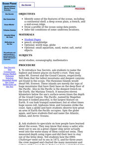
Ocean Planet: Sea Secrets
Students identify ocean features and draw a profile using data points on a map. Through discussion and research, they discover the importance of oceanography and plot a profile of the ocean floor in search for a vessel full of precious...
Curated OER
One World Ocean
Students compare and contrast the properties of salt water in the oceans/seas and freshwater elsewhere on the planet. They also analyze mixing caused by currents in the ocean, including the effects of warm and cold water as well as with...
Curated OER
Trade in the Indian Ocean: Should China End Zheng He's Treasure Voyages?
Young scholars examine the amount of trade that occurs in the Indian Ocean. Using China as an example, they discuss the reasons why it ended its treasure voyages in the area and predict what would have happened if the voyages continued....
Curated OER
Sunken Slave Ship
Students investigate shipwrecks. In this marine archaeology instructional activity, students create the site of a shipwreck by using a tub filled with sand and items from a "ship". Students excavate the site and analyze the findings.
Curated OER
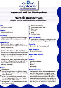
Wreck Detectives
Junior archaeologists examine types of artifacts from the Bronze Age on the internet. In collaborative groups, they create a story about a ship from this period and then construct a model of the ocean floor after their ship has sunk....
Curated OER
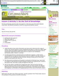
Lesson 3 Activity 1: On the Trail of Knowledge
Students plot the earthquake epicenter data on the base map of the North Atlantic ocean floor using different symbols or colors to characterize different values.
Curated OER
What's in the Water?
Students examine how pollutants can affect ocean animals. In this pollution lesson plan, students read a story about the ocean floor, think about what would happen to the plants and animals if the ocean became dirty or polluted, and...
Curated OER
Oceans of the World
Second graders demonstrate their ability to find the five oceans on a globe and on a world map and relate their knowledge of mountains and other physical characteristics of land masses to the physical characteristics of the ocean floor.
Curated OER
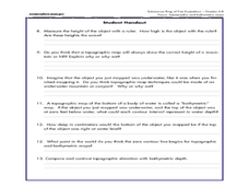
A Watered-Down Topographic Map
Eighth graders explore the ocean floor. In this topography instructional activity, 8th graders compare topographical maps to bathymetric charts. They will create a topographic map and note landmarks and other land features.
Curated OER
Water Pressure
Students spend time examining the concept of water pressure. In groups, they research the amount of air pressure that is felt at different levels above sea level. Using a calculator, they calculate the water pressure given different...
Curated OER
Lost Liners Scavenger Hunt
Students practice research skills by scouring Internet for facts and information about the lost ocean liners Titanic, Lusitania, and Empress of Ireland.
Curated OER
TOPSY TURVY MAPS
Eighth graders use the data analyzer and motion detector to collect data and measure distances. They create topographic maps drawn to scale of a given setup and relate the concepts to the creation of historical ocean maps.
Curated OER
Learning Lesson: That Sinking Feeling
Students discover the origin of the Great Ocean Conveyor. They participate in a demonstration showing how salinity and temperature affect water density. They also examine the new sea ice that forms every winter.
Curated OER
The Globe Game
Students locate continents, oceans, and major mountain ranges on the globe. In this globe lesson, students play a toss the globe game. They name the continent, ocean, or major mountain range that is located closest to their right thumb...
Curated OER
Mapping and Personifying Nations
Eleventh graders analyze the geography, actions, and relationships of countries involved in World War II. They create a map of Europe, Northern Africa, and the Pacific, and analyze and evaluate their self-made map of Europe and the...
Curated OER
Living at the Seashore
Students examine how the proximity of all areas of Japan to the ocean influences lifestyles and determines occupations for the people. This lesson includes lesson extensions and a concept list.
Curated OER
Finding Our Place in the Community
Third graders search TDC database for images of our hemisphere, continent, ocean, country, state, and city. They identify their place in the hemisphere, continent, ocean, country, state, and city.
Channel Islands Film
Island Rotation: Lesson Plan 1
How do scientists provide evidence to support the theories they put forth? What clues do they put together to create these theories? After watching West of the West's documentary Island Rotation class members engage in a series of...
Smithsonian Institution
Reflections of the Sea
Students, after listening to a selection of Gulliver's Travels, complete a worksheet about basic terms associated with boats, ships, and sailing. They create flag after researching semaphore flagging systems.
Aurora Trust
Journey Under the Sea
Discover the interesting world of maritime archaeology and explorations under the sea with this nice set of worksheets, which cover such topics as search tools and techniques of underwater archaeology, carbon dating,...
Curated OER
Mapping the Canyon
Students compare and contrast topographic maps and bathymetric maps. They investigate how bathymetric maps are made and how to interpret one.
Other popular searches
- Ocean Floor Landforms
- Ocean Floor Diagram
- Ocean Floor Mapping
- Ocean Floor Spreading
- Ocean Floor Diagram Labeled
- The Ocean Floor
- Ocean Floor Research
- Ocean Floor Models
- Model of Ocean Floor
- Ocean Floor Activity
- Mapping the Ocean Floor
- Ocean Floor Sediments


