Curated OER
The Sands of Arabia
Sixth graders apply geographic information to the study of World History. For this Geography lesson, 6th graders create a political/physical map of the Middle East, develop questions and answers about the culture of the Middle East, and...
Curated OER
Claiming Land
Students examine several European maps with conflicting representations of the same geographic region. They uncover why different European nations produced different maps. In addition, they determine the role maps played in helping...
Curated OER
Map Making
First graders explore maps to realize the concept that maps are simply small representations of a much bigger picture. They discuss the importance of maps in everyday life, examine a map of the school, and then make a map of their...
Curated OER
Indianapolis Government
Students read about a girl who takes a trip during the time of the State Capital moving to Indianapolis and then write their own essay about a trip that they took. In this Indianapolis Government lesson plan, students use maps and...
Curated OER
Homes Around the World
Students investigate houses and homes from around the world and create a map collage. They compare how the homes are similar and different and why houses match the weather and geography.
Curated OER
Map Making with Lewis and Clark
Students develop maps based on a virtual internet expedition of The Louisiana Purchase land area. They create the maps based on an actual outdoor expedition of their communities. Student create two maps, one based on the Louisiana...
Curated OER
World Map and Globe - Lesson 1 Introduction to the Globe
Students explore the earth with maps and globes. In this map lesson plan, students use maps and globes to locate oceans and continents.
Curated OER
Cherstey: What was Cherstey like in the middle ages?
Students examine maps of a medieval village. In this medieval town lesson, students identify major buildings and make inferences about village life. Students could draw a modern day map of medieval Cherstey.
Curated OER
Where is Flat Stanley?
Students create a story map of the basic elements and significant events of the book Flat Stanley. Students brainstorm places they would like to visit if they had been flattened and then, write about an imagined experience. Students...
Curated OER
Eastern Europe: Passport to Understanding
Seventh graders explore Eastern Europe. They analyze data on select countries. Students prepare a short oral presentation on the country they researched. They locate their country using an interactive map.
Curated OER
Indian Resistance
Students observe the pictures and maps of the Sequoyah Indians. In this Sequoyah lesson plan, students use the maps and pictures to discuss observations and write responses of the Indian point of view.
Curated OER
World Map Labels
In this geography skills worksheet, students identify the countries and bodies of water labelled on the maps of the world, Africa, Asia, Canada, Europe, the Caribbean, the Middle East, North America, Australia, and South America.
Curated OER
Slavery and the Underground Railroad
Fourth graders study slavery escape routes of the Underground Railroad on maps, read an account of an escape and then write narrative essays about a fictional slave's escape.
Curated OER
Oceania Map Quiz
In this online interactive geography quiz worksheet, students respond to 14 identification questions about Oceania. Students have 2 minutes to complete the quiz.
Curated OER
Defining Regions
Fifth graders will work in cooperative learning groups to research North American regions and create presentations to share with their classmates. To show what they have learned, 5th graders will create maps of North American regions.
Curated OER
First Amendment: Bill of Rights
Twelfth graders explore the First Amendment and the rights that are protected by the First Amendment. They discuss how the First Amendment is important to their daily lives. Students research the amendment and complete a concept map.
Curated OER
Spanish Cities Map Quiz
In this online interactive geography quiz worksheet, students respond to 11 identification questions about Spanish cities. Students have 3 minutes to complete the quiz.
Curated OER
Italian Cities Map Quiz
In this online interactive geography quiz worksheet, learners respond to 12 identification questions about Italian cities. Students have 3 minutes to complete the quiz.
Curated OER
Chinese Cities Map Quiz
In this online interactive geography quiz worksheet, students respond to 10 identification questions about Chinese cities. Students have 3 minutes to complete the quiz.
Curated OER
Africa Map Quiz
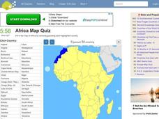
In this online interactive geography quiz worksheet, students respond to 53 identification questions about the countries of Africa. Students have 6 minutes to complete the quiz.
Curated OER
Leapin' Landmarks: Locating 10 Man-made Landmarks Around the World
Third graders label continents, oceans, and major mountain ranges on maps and use the maps to write an informational report about landmarks. In this landmarks lesson plan, 3rd graders write about 1 major landmark.
Curated OER
French Cities Map Quiz
In this online interactive geography quiz worksheet, students respond to 13 identification questions about French cities. Students have 3 minutes to complete the quiz.
Curated OER
Europe Map Quiz
In this online interactive geography quiz worksheet, students respond to 45 identification questions about the countries located in Europe. Students have 5 minutes to complete the quiz.
Curated OER
United States Map Quiz
In this online interactive geography quiz worksheet, students respond to 50 identification questions about the shapes of countries shown. Students have 5 minutes to complete the quiz.
Other popular searches
- Map Skills Lesson Plans
- Map Skills Worksheets
- Elementary Map Skills
- Geography Map Skills
- Basic Map Skills
- Social Studies Map Skills
- Globe and Map Skills
- Beginning Map Skills
- United States Map Skills
- Map Skills, Continents
- Early Explorers Map Skills
- Free Map Skills Worksheets


