Student Handouts
Letter from Christopher Columbus to Luis de Sant Angel Announcing His Discovery (1493)
When Christopher Columbus landed, he found many things to comment on. Have your class read this letter that he wrote to Luis de Sant Angel in 1493. The text is split up into sections. Each section is paired with two to three...
Curated OER
Landforms All Around
Students create a "Landform Dictionary". They develop an overlay map and participate in hands-on activities to identify the key characteristics of landforms. They discuss the plant and animal life of these areas. Handouts for the lessons...
Ms. Catsos
Ancient Rome Map Worksheet
It wasn't just the great leaders of ancient Rome that shaped their civilization—the geography of the region played a major role as well. After first identifying major land masses, bodies of water, and city states on a map of Europe,...
Curated OER
Taste of India
Bring a little taste of India into the classroom. This colorful presentation provides information regarding India's people, food, location, religion, and culture. An interesting trip to a fascinating place. Tip: Make it a real taste of...
Curated OER
Exploring Regions of Our World
Examine how climate and landforms affect plants and animals that live in particular areas. Discover that these same factors affect peoples' homes, jobs, and recreational activities. Pupils research ecosystems and biomes, and then write...
Curated OER
From Coast to Coast
Students identify and describe characteristics of natural landforms such as mountains, islands, rivers, and inlets, research information about landforms that would be encountered on imaginary trip from one place to another, and design...
Curated OER
Landforms Mobile
Students work together in groups to research the various types of landforms found on the Earth and locate them on a map. As a class, they discuss how the landforms affect the way people live in those areas. To end the lesson, they use...
Curated OER
Earth Science Jeopardy
This jeopardy game has 5 categories and 5 point levels, and is designed with a section of hodge podge, geography, and earth science review questions. The questions are clear and the point selections are designed to darken once used.
NOAA
Into the Deep
Take young scientists into the depths of the world's ocean with the second instructional activity of this three-part earth science series. After first drawing pictures representing how they imagine the bottom of the ocean to appear,...
Space Awareness
Let's Map the Earth
Before maps went mobile, people actually had to learn how to read maps. Pupils look at map elements in order to understand how to read them and locate specific locations. Finally, young cartographers discover how to make aerial maps.
Annenberg Foundation
Reading Maps
Can you read a map? Scholars use an interactive technology tool to analyze maps of various kinds to gather evidence and data to better understand their meanings and usefulness. Using newly obtained knowledge, they form an interpretation...
Beverly Hills High School
Mapping Napoleon's Empire at Its Height (1812)
The complicated political history of Europe becomes apparent as young historians create a map of the borders of France when Napoleon's Empire was a its height in 1812.
Curated OER
Children's Crusade
In this geography activity, students read an excerpt about the Crusaders compromised of two of children. They use the map given to determine how far apart each army marched before reaching the Mediterranean Sea. In addition, students...
Curated OER
Where in the World is Utah Wheat?
Students examine the role of climate and landforms in the use of Utah's land. In this geography lesson plan, students analyze the relationship between geography and agriculture in the state as they examine data regarding wheat production...
Curated OER
The Happy Game: Physical Features
Students love to test their knowledge, use this game to see what your students know about landforms and other basic geographic terminology.
Curated OER
A Feature Presentation - Geographic Landforms
Students investigate, identify and compare the various geographic terms that can be used to describe the landforms occurring in the Hawaiian islands.
Curated OER
Building on the Land
Ninth graders study how cities affect the environment and design an ecologically-sound city. They focus their study on the benefits and constraints of life on the Northern Great Plains.
Curated OER
Regions of South America
Students explore facts about South America in the four lessons of this unit. Booklets are created from the materials produced as the class delves into the topic.
Curated OER
Lesson: Journey of a Tree
Third graders explore the operation of a Christmas farm and how trees are shipped. After taking a tour of a Christmas tree farm and researching transportation, location and cost issues, 3rd graders create a map to show the distribution...
Curated OER
This Land is Our Land
In this landforms worksheet, students draw four different landforms they saw after they went on a walk in their local area or neighborhood.
Curated OER
Sharing The Land
Young scholars investigate different geographical terms and concepts. This is done with practicing with maps of the United States to find major coasts, lakes, and rivers. They also put together a floor map of the United States. Students...
Curated OER
A Shuttle's Eye View
Students explore the goals of the Shuttle Radar Topography Mission as a springboard to exploring the topographical features of their own state or region. They synthesize their understanding of landforms and topography by mapping their...
Curated OER
Landforms and Bodies of Water
A simple worksheet helps your learners with geographic terms. This could be used as a template for future worksheets which have learners identify some geographic terms, then complete an essay about one of the terms.
Curated OER
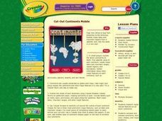
Cut-Out Continents Mobile
Students research major natural features on all seven continents. They compare and contrast continents, their sizes, shapes, and major landforms. Students create a unique display of the continents to show major landforms.
Other popular searches
- Landform Maps
- France Geography Landform
- Landform Map of Virginia
- Landform Vocabulary
- Geography Land Forms
- East Asia Land Forms
- Geographic Land Forms
- Landform Change
- 3d Models Land Forms
- Landform Regions of Canada
- Land Forms in Egypt
- Ocean Land Formations


