Curated OER
Tall as a Mountain, Flat as a Plain
Students examine pictures of various landforms before placing them on a chart under the appropriate label.They sing songs about landforms to the tune of "She'll Be Comin' 'Round the Mountain." Next, they use non-edible baker's dough to...
Alabama Learning Exchange
Forces that Change the Land
Students conduct Internet research find information about the following landforms: mountains, canyons, and valleys. They create travel brochures of their findings.
Curated OER
Landforms By Hand: Geography, Map Skills
Learners experiment with landform vocabulary by using their own hands and a bar of soap as media.
Curated OER
Mapping Landforms of South Carolina
Third graders analyze South Carolina maps. For this geography lesson, 3rd graders locate the five land regions in the state are and discuss how the regions are different. Students identify the major bodies of water and analyze how they...
Curated OER
Understanding Topographic Maps
Underclassmen create a cone-shaped landform and then draw a contour map for it. Then they examine a quadrangle (which was easily located with an online search), and relate it to what they experienced. The accompanying worksheet is...
Curated OER
Landforms E-mail Project
Students identify and explain geographic terms. They write descriptions of the terms. Students discuss landforms and draw pictures to illustrate them. Students compose and present oral reports about landforms.
Curated OER
Australian Landforms
In this geography worksheet, students identify the various landforms of Australia. They use an atlas to draw in and color these various landforms on the given blank map of Australia.
Curated OER
USA: Physical Map
In this United States physical map worksheet, students investigate the major landforms and bodies of water located throughout the country.
Curated OER
Landforms
Young scholars study how landforms affect all aspects of a community. Students work in groups to identify landforms from other works of art. In cooperative groups Young scholars select a work of art depicting a particular land form and...
Curated OER
Georgia's Regions
Students understand that Georgia has 5 main land regions. They are able to identify the geographic regions of Georgia and describe the regions by completing a research project about a given region with 100% mastery.
Compton Unified School District
How Can We Locate Places?
How can we locate places? Maps, of course! Expose second graders to the tools available in maps and discuss how these tools can help people find locations. Students also look at communities, including what makes a community and the...
Smithsonian Institution
Eastern Indian Wars
Many know that Native Americans were forced off their lands and moved west, but how did these people react? The Red Sticks faction of the Creek nation opted to defend themselves and their lands in a series of wars called the Eastern...
Curated OER
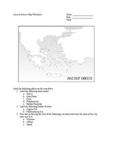
Ancient Greece Map Worksheet
Since the beginning of time, geography has shaped the development of human civilization, and ancient Greece is no exception. This instructional activity supports young historians with exploring this relationship as they first identify...
Curated OER
Explore Surface Types on a Journey Around Earth
Young scholars explore satellite data. In this technology cross-curriculum math and world geography lesson, students locate specific map areas using a microset of satellite data. Young scholars use technology and math skills to determine...
Curated OER
Water Creates a Cave
Students study the role of water in limestone cave formation and create a cave on karst-like grid on paper.
Curated OER
Sand Art Creation
Students create a model of a geological land-form. In this art lesson, students will create a model of a land-form using sand.
National Endowment for the Humanities
On This Day With Lewis and Clark
Walk in the footsteps of Lewis and Clark as they discover the wonders, beauty, and dangers of the American frontier. After gaining background knowledge about Thomas Jefferson and the Louisiana Purchase, young explorers use primary...
Curated OER
War of 1812
Eighth graders locate the major land forms and bodies of water on a map of Louisiana. In groups, they discuss the role of the Mississippi River in the Battle of New Orleans and how land and water affect the outcome of battles. To end...
Curated OER
Maps and Models
Students study maps of New Mexico examining settlement patterns over time and the location of water sources. They research the history of their community and discover how cultural groups interacted, adapted to their physical...
Curated OER
Map Skills
Learners create two types of maps. In this map skills lesson, students discuss map vocabulary and view maps of Florida. Learners draw a free hand map of Florida and include major cities, bodies of water and land forms. Students work...
Curated OER
Where Should We Land?
Students discuss the difference between major landforms as a class. In groups, they rate the landforms based on the needs of the community that wish to settle there. They also discuss the push and pull factors of the colonists that made...
Curated OER
Vocabulary Words of the Southwest
A simple vocabulary definition worksheet has young geographers of the Southwest putting term meanings into their own words. The fifteen words include (but are not limited to) adobe, butte, canyon, economy, erode, fossil, and landform....
Curated OER
“Pardon This Interruption-Columbus Has Landed!!!”
Students research, design, rehearse, record, and present a 60 second Public Service Announcement, based on Columbus' arrival in the America. The students, working in groups, utilize the design process in creating their PSA. This lesson...
Curated OER
The Holy Land
Explore the culture, geography, and religion of Ethiopia. Learners complete a viewing guide while watching a film on Ethiopia as the first Christian country in Africa. Additionally, they create group presentations and write paragraphs...
Other popular searches
- Landform Maps
- France Geography Landform
- Landform Map of Virginia
- Landform Vocabulary
- Geography Land Forms
- East Asia Land Forms
- Geographic Land Forms
- Landform Change
- 3d Models Land Forms
- Landform Regions of Canada
- Land Forms in Egypt
- Ocean Land Formations


