Curated OER
Where is ? ? ? ?
Students explain and explain the concept of a grid system. They define absolute and relative location and develop an imaginary city on graph paper using a grid system.
Curated OER
The Global Grid System-World Map Activity
Young scholars demonstrate how to use the global grid system. In this map skills instructional activity, students use a world map to locate various locations. Young scholars identify locations based on the global grid system. Students...
Curated OER
Lesson 7: Smart Grids
Energy conservation is a hot topic these days; introduce your kids to the Smart Grid solution through a video clip and several interactive online tools. They discuss areas of household energy consumption, examining a pie chart...
Curated OER
Landscape Picture Map: Making a Map Grid
Students create a map grid system. In this map lesson, students discuss how mapmakers use a grid system to make giving directions easier. Students learn how the grid system works and create a grid system on their landscape pictures.
Curated OER
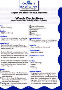
Wreck Detectives
Junior archaeologists examine types of artifacts from the Bronze Age on the internet. In collaborative groups, they create a story about a ship from this period and then construct a model of the ocean floor after their ship has sunk....
Curated OER
Where in the World
Students explore the global grid system. In this globe lesson, students identify latitude and longitude lines and how these can tell the coordinates of any place. They use the Internet to find the exact coordinates for their town.
Curated OER
Absolute Location Using GPS Technology
GPS is great for identifying your position, but is it finding your relative or absolute location? Ninth graders explore the difference between absolute and relative location, use the standard grid system coordinate system, and use GPS to...
Curated OER
Location, Location, Location: Using a Grid to Determine Context
Seventh graders are introduced to making inferences about artifacts. Using a grid system, they locate the artifacts and determine where they originated from. They use this information to make conclusions about the way people lived...
Curated OER
Put Me in My Place: Using Alphanumeric Grids to Locate Places
Learners practice locating points on a large wall grid and create and label a neighborhood map. For this geography lesson, students spell and discuss places as the teacher places them on the map. They discuss the concept of an...
Curated OER
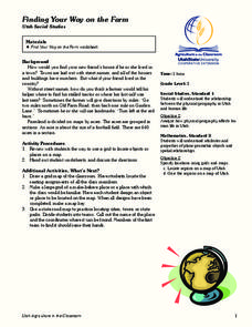
Finding Your Way on the Farm
Third graders make a grid map. In this directionality lesson, 3rd graders review how to use a grid to locate objects or places on a map. Students draw a grid map of the classroom and locate seating assignments. Students create a grid of...
Curated OER
Locating Places - Making a Map Grid
Students learn how to use a letter and number map grid. In this map grid lesson, students look at a landscape map and describe how to locate the airport. They compare the descriptions of different students to determine how they are the...
Curated OER
Locating Places
Learners demonstrate how to use the map grid system. In this map skills lesson, students are given coordinates to locate several locations on a world map. Learners use the map grid system to identify these locations.
Curated OER
Economic Decisions in Other Systems: Comparative Systems
Students identify and describe the charactertics in each economic system. In groups, they discuss how economic decisions are made in each system and use the Internet to research Chad, United States and North Korea's economic systems. ...
ABCya
Hanukkah Word Search
Hanukah is the theme of an online word search that challenges players to locate several holiday-related words. Scholars choose a grid size then highlight words as festive music plays.
Curated OER
Gridding An Archaeological Site
Students investigate using some of the basic skills of an archaeologist while using a Cartesian coordinate system. They establish a grid system for a dig site and determine the locations for different artifacts. Students use the...
Curated OER
MAP GRIDS, CLIMATES AND HEMISPHERES
Students compare/contrast the grid and latitude/longitude system used on a globe. They describe the areas which are considered to be a tropical, temperate, and polar, based on knowledge of climates.
Curated OER
Searching the Attic
Students investigate an attic or basement to "discover" family artifacts. They develop a grid map using string, create a naming system for the grid, and analyze items of interest.
Curated OER
School Sleuths Treasure Map
Students are explained how a grid and compass work. They are also explained that archaeologists use grids as a record of the exact location of artifacts. Students define the term datum as a point of reference on grids from which all...
Curated OER
Why Archaeologists Dig Square Holes
Students examine how archaeologists establish and maintain the context of artifacts. They interpret a plan view of an archaeological site and explain the importance of the grid system.
Curated OER
Metrics And Measurements
Students engage in a study of measuring distances between geographical locations on a map. They are able to define and use the map scale in conjunction with the metric system. For this lesson they make their own maps and measure the...
Curated OER
Latitude on World Maps - World Map Activity 2
Learners explore the concept of latitude. In this geography activity, students discover the global grid system and complete a map activity which require them to record the latitude of various cities in the world.
Curated OER
Searching the Attic
Students conduct field research, including the use of a grid system, in order to discover important or interesting family artifacts.They map discoveries of important artifacts on a grid map in order to track and better analyze...
Curated OER
Rivers And Capitals
Students become familiar with the use of GIS for research and become aware of the importance of rivers to cities. They also analyze the placement of cities and learn the names of rivers in the United States.
Curated OER
Indiana Tornado Project
Learners become familiar with the use of GIS for research, natural phenomena in Indiana, and analyzing collected information.
Other popular searches
- Global Grid System
- Grid System Drawing
- Mapping Grid System
- Grid System Art
- Drawing With a Grid System
- Texas Grid System
- Grid System Worksheets
- Map Features Grid Systems
- Map Features "Grid Systems
- Map Features "Grid Systems"
- Alphanumeric Grid Systems


