State Energy Conservation Office-Texas
State Energy Conservation Office: Learning About Photovoltaic Systems [Pdf]
Explains how photovoltaic systems work and how Texas homeowners are using them. Discusses how a homeowner can use solar energy and still be on the electricity grid system.
ClassFlow
Class Flow: Finding Locations on a Grid
[Free Registration/Login Required] Students will be able to use a letter/number grid system to determine location on a grid.
Khan Academy
Khan Academy: Smart Buildings, Transport, and Grids
The advantages and security risks of "Smart" uses of technology in buildings, transportation, and grids are discussed.
US Geological Survey
U.s. Geological Survey: Teaching About and Using Coordinate Systems [Pdf]
Provides lessons and activities for teaching about the different types of coordinate systems including the Cartesian coordinate system, the Geographic Coordinate System, the Universal Transverse Mercator grid, and the State Plane...
National Gallery of Art
National Gallery of Art: Wallovers
A wallpaper-designing program that turns your freehand drawing into repetitive patterns. A good introduction to repetition as a design principle and to grid systems.
Other
Marine Geoscience Data System: Tools: Create Maps and Grids
Create your own custom maps and grids with the map tool available on this site.
TeachEngineering
Teach Engineering: What's Wrong With the Coordinates at the North Pole?
Students complete a self-guided exercise in worksheet format combined with Google Earth that helps them explore practical and observable differences between different projection and coordinate systems. The activity improves their skills...
That Quiz
That Quiz: Practice Test: Graph Points
This resource allows users to test their knowledge about graph points.
PBS
Pbs: How Art Made the World: Human Body in Egypitan Art
PBS documentary considers how ancient Egyptian artists chose to represent the human body and answers questions about how the cultural values of a society, such as the desire for order, shape its art. With close-ups of Egyptian art that...
Other
University of Akron: Research Challenges Location of 'Tornado Alley'
Geographer Michael Frates redefines the concept of Tornado Alley by using a grid system to map tornado activity in the U.S. Download the Tornado Alley map and locate the other tornado active areas: Hoosier Alley, Dixie Alley and the...
K-5 Math Teaching Resources
K 5 Math Teaching Resources: Coordinate Grid Paper Set [Pdf]
This pdf contains several types of blank coordinate grids.
BBC
Bbc News: 'Big Bang' Experiment Starts Well
Watch a narrated animation on the Large Hadron Collider, its experiments, structure, and computer system. Then, browse this site's sections to explore facts about and functions of CMS, ATLAS, ALICE, LHCb, the LHC Computing Grid, and the...
PBS
Pbs Learning Media: Traffic Jam
This lesson challenges young scholars to solve congestion and traffic delays in an intersection through modifying traffic signal operation. Students are required to collect traffic data, optimize the timing of a traffic signal via the...
The Washington Post
Washington Post: Chuck Close
Follow the evolution and creative process of the monumental work done by artist Chuck Close.
Khan Academy
Khan Academy: Coordinate Plane Word Problems (Quadrant 1 Challenging)
Try some coordinate plane word problems focusing on quadrant 1. Miss the problem, and Kahn offers some tutorials for help.
TeacherLED
Teacher Led Interactive Whiteboard Resource Two Quadrant Graph
Use this interactive white board activity to explore coordinate planes and graphing ordered pairs.
Khan Academy
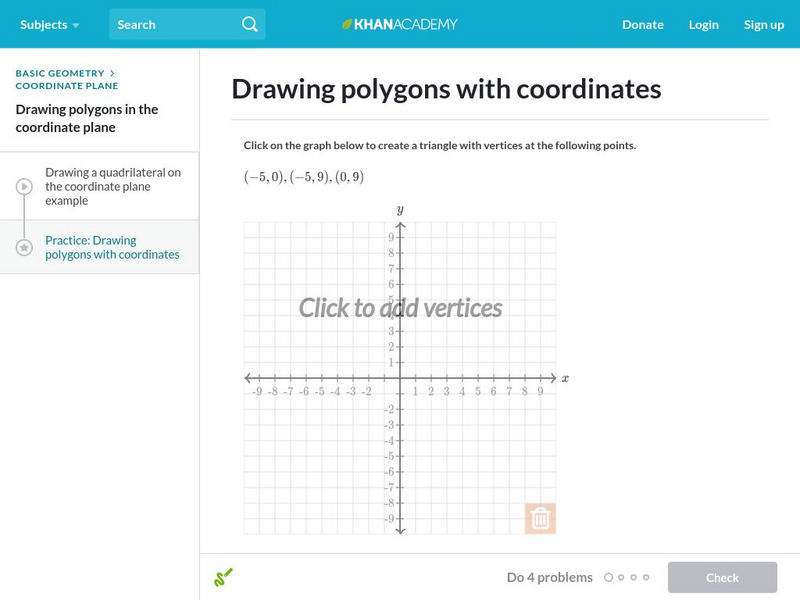
Khan Academy: Drawing Polygons With Coordinates
In this exercise, students practice drawing polygons with coordinates. Students receive immediate feedback and have the opportunity to get hints and try questions repeatedly.
Khan Academy
Khan Academy: Drawing Polygons With Coordinates
Practice drawing shapes on the coordinate plane. Students receive immediate feedback and have the opportunity to try questions repeatedly, watch a video or receive hints.
Khan Academy
Khan Academy: Area and Perimeter on the Coordinate Plane
Find the area and perimeter of quadrilaterals using their coordinates. Students receive immediate feedback and have the opportunity to try questions repeatedly, watch a video or receive hints.
ClassFlow
Class Flow: Slope
[Free Registration/Login Required] This lesson provides class experiences with whole group instruction on understanding slope.
ClassFlow
Class Flow: Slope Review
[Free Registration/Login Required] This flipchart provides another day of review of finding the slope of a line.
ClassFlow
Class Flow: Graphing Coordinates
[Free Registration/Login Required] In this lesson, students will learn step by step how to graph coordinates on a coordinate plane.
Curated OER
Educational Technology Clearinghouse: Maps Etc: Southern California, 1911
A map of Southern California from 1911 showing the major cities and towns, railroads, National Park boundaries, National Forest boundaries, Indian reservation boundaries, mountain systems, lakes, rivers, and coastal features. A grid...
Curated OER
Educational Technology Clearinghouse: Maps Etc: California (Southern), 1920
A map of Southern California from 1920 showing the counties and county seats, major cities and towns, railroads, National Park boundaries, National Forest boundaries, Indian reservation boundaries, mountain systems, lakes, rivers, and...
Other popular searches
- Global Grid System
- Grid System Drawing
- Mapping Grid System
- Grid System Art
- Drawing With a Grid System
- Texas Grid System
- Grid System Worksheets
- Map Features Grid Systems
- Map Features "Grid Systems
- Map Features "Grid Systems"
- Alphanumeric Grid Systems
![State Energy Conservation Office: Learning About Photovoltaic Systems [Pdf] Handout State Energy Conservation Office: Learning About Photovoltaic Systems [Pdf] Handout](https://d15y2dacu3jp90.cloudfront.net/images/attachment_defaults/resource/large/FPO-knovation.png)


