Hi, what do you want to do?
Google Cultural Institute
Google Cultural Institute: Acropolis Museum
Take a virtual tour of the Acropolis Museum in Greece, which documents the history of Athens back to prehistoric times. The first and third floors can be explored, as well as a collection of high-quality photographs of sculptures and...
University of Pennsylvania
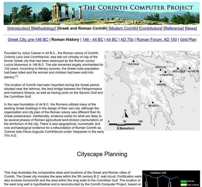
Corinth Computer Project: Roman Colony of Corinth
An absolutely great site to include in your study of the Roman occupation of Greece. Lots of information on the current Corinth Excavations being done. Be sure to access the Quick Time movie of the forum in Corinth as it is today.
Savvas Learning
Pearson Education: Greek and Hellenistic Civilization [Pdf]
This is a summary of chapter three of a textbook on world history. It looks at the contributions of the ancient Greeks to western civilization, the breadth of their civilization in the Mediterranean and the Black Sea regions, and their...
Stanford University
Stanford History Education Group: Athenian Democracy Sac
[Free Registration/Login Required] Lesson in which young scholars use primary source material from ancient Greece to determine the extent of its democracy. Includes downloads for teacher materials, student materials, PowerPoint and...
Columbia University
Columbia University: Ancient Architecture
Learn about ancient architecture and explore 360 degrees panoramas of buildings in Egypt, Greece, Portugal, Italy, and Sicily. Includes an interactive plan of a 3D reconstruction of the Parthenon, and features the project page for this...
Other
Ancient greece.org: History of Greece: Periods Overview
A timeline of the ancient periods of Greek history.
Other
Ancient greece.org: History of Greece: The Stone Age
A brief article regarding the history of the stone age.
Other
Ancient greece.org:history of Greece: The Dark Ages
A brief article discussing the history of the dark ages. Links to other periods of time within Greek history.
Curated OER
Macmillan/mc Graw Hill: The World: Vol. 1: The Ancient World: Lesson 2 Quiz
A short quiz on ancient Greece and its conflicts with Persia.
Other
The Eras and Sculptures in Greek History: The Hellenic Age
Describes the main features of the Hellenic Age in ancient Greece, and examines Hellenic sculpture and the different styles and influences.
EL Education
El Education: It's All Greek to Me
This book was created by 7th grade students in Portland, Maine as part of a learning expedition on ancient civilizations, focusing on ancient Greece.The book includes collage-like portraits and background information on famous figures...
Curated OER
Macmillan/mc Graw Hill: The World: Vol. 1: The Ancient World: Lesson 1 Quiz
A short quiz on ancient Greece.
Other
Athens News Agency
The Athens News Agency (ANA) is the daily national news agency of Greece; lists the top Greek news stories of the day. Written in English.
Other
Athens News Agency
The Athens News Agency (ANA) is the daily national news agency of Greece; lists the top Greek news stories of the day. Written in English.
Stephen Byrne
History for Kids: Greek Daily Life
History for Kids presents an overview written for elementary students of daily life of the ancient Greeks. Students learn about Greek government, agriculture and industry, houses and food. Teacher resources included.
Lin and Don Donn
Ancient Greece for Kids
This page examines education for boys and girls in Sparta, Athens and other Greek cities. It takes the form of an extended piece of writing, with links to further information. It includes information on music and poetry. There are sound...
Other popular searches
- Ancient Greece
- Ancient Greece Word Search
- Democracy in Ancient Greece
- Ancient Greece and Rome
- Ancient Greece Geography
- Ancient Greece Map
- Ancient Greece Olympics
- Geography of Ancient Greece
- Ancient Greece Lesson Plans
- Ancient Greeks
- Ancient Greece Democracy
- Government in Ancient Greece


![Pearson Education: Greek and Hellenistic Civilization [Pdf] eBook Pearson Education: Greek and Hellenistic Civilization [Pdf] eBook](https://static.lp.lexp.cloud/images/attachment_defaults/resource/large/FPO-knovation.png)


