Curated OER
States And Shapes
Students work together and investigate the shapes of 50 states. They identify the states that they find hardest to recognize. The group then list the states in order from most difficult to just difficult to recognize and create a...
Curated OER
The Silly States: Where Is Your State and City?
First graders read The Scrambled States of America and discuss whether it is real or fantasy as compared to the United States. In this geography lesson, 1st graders identify their city or state on a map and work in groups to color the...
Curated OER
Focused Learning Lesson: World Geography
High schoolers compare human activities and the physical characteristics of the land and how they have given some regions labels. They also analyze the cultural changes occuring in these regions.
Curated OER
Landforms By Hand: Geography, Map Skills
Students experiment with landform vocabulary by using their own hands and a bar of soap as media.
Curated OER
Degree Confluence Project: At the Intersection of Geography and Technology
Students participate in a Longitude-meets-latitude project comes together on the Web!
Curated OER
Geography - Climate
Tenth graders explore how to analyze a climograph and identify the differences between two different climates. They explain how important climate is to their everyday lives
Curated OER
Geography: Lengths, Perimeter, and Area of Similar Objects
Sixth graders explore characteristics of similar objects. Using attribute blocks, they explore the ratios of the perimeter, area and side length in similar shapes. They calculate and compare the area of shapes.
Curated OER
History and Geography: Making a New Nation
Fifth graders examine the contributions of the different groups that built the American Nation. They identify the successive waves of new immigration, explain their attraction to America, and study the importance of Ellis Island.
Space Awareness
Let's Map the Earth
Before maps went mobile, people actually had to learn how to read maps. Pupils look at map elements in order to understand how to read them and locate specific locations. Finally, young cartographers discover how to make aerial maps.
EduGAINs
Migration—Push and Pull Factors
What causes people to move from one place, one city, or one country to another? Using the provided migration questionnaire, learners interview family members about the factors that cause them to be pushed from an area or pulled to...
Population Connection
Meeting Human Needs
How to meet the needs of people around the globe—a question many ask. The fifth in a six-part series about human population and its effects on the globe, the eye-opening lesson includes discussion, a homework activity, and an in-class...
Population Connection
Where Do We Grow from Here?
Did you know that the population is expected to grow to 11 billion by 2100? The resource serves final installment in a six-part series on the global population and its effects. Scholars interpret data from the United Nations about the...
Population Connection
The Peopling of Our Planet
How many people live on the planet, anyway? The first resource in a six-part series covers the topic of the world population. Scholars work in groups to conduct research and make population posters after learning about the global...
School Improvement in Maryland
Demographic Investigation
What are the factors that influence voting patterns? How do these factors influence government funding? Is participation the squeaky wheel gets the grease? Class members interpret graphs and analyze trends to determine what...
Curated OER
The Seven Continents Scavenger Hunt
Who doesn't enjoy an engaging scavenger hunt? Here, scholars listen to, and discuss, the informative text, Where is my Continent? by Robin Nelson. They then explore the seven continents and four major oceans using...
Society for Science & the Public
Easter Islanders Made Tools, Not War
When studying artifacts, especially tools, how do archaeologists determine what the devices were used for? In what ways might researchers' previous experiences influence their perception of an artifact? An article about researchers'...
Association of Fish and Wildlife Agencies
Schoolyard Biodiversity Investigation Educator Guide
In 1980, in the tropical rainforests of Panama, scientists discovered 1,200 species of beetles living in and around just 19 trees, with most of the species new to science—that's biodiversity! In the activity, learners work in teams to...
Curated OER
New England Jeopardy
Jeopardy style games are fun ways to help students review for tests or solidify concepts recently covered in class. This Jeopardy game focuses on the industrial economy of New England. Students will need to know general information on...
Texas State Energy Conservation Office
Investigation: Tour de Texas
Teams of Texas tourists gather into groups to analyze what they can do with $50 worth of an alternative fuel. They write checks, keep a balance sheet, and map out their sight-seeing route taking into consideration the location of...
Core Knowledge Foundation
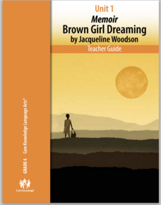
Unit 1: Memoir - Brown Girl Dreaming by Jacqueline Woodson
The memoir, Brown Girl Dreaming by Jacqueline Woodson, is the focus of a unit designed for fourth graders. Scholars begin each lesson with a warm-up, then listen to a read-aloud of a section of the book. Pupils complete word work,...
Core Knowledge Foundation
Unit 1: Contemporary Fiction - They Call Me Güero: A Border Kid’s Poems by David Bowles
They Call Me Güero: A Border Kid's Poems by David Bowles is the focus of a five-week language arts unit unit. Fifth graders listen to various poems and participate in thoughtful discussions, examining vocabulary and learning new words in...
Curated OER
Urban Geo Worksheet
In this urban geography worksheet, students respond to 20 short answer questions about urban geography after they have read a related article. The article is not included.
Curated OER
My Top Interdisciplinary Social Studies Lesson Plans
Here are some top social studies lesson plans and activities which present concepts in a memorable fashion.
Curated OER
Map Your State: Regions of Arizona
Fourth graders define vocabulary and locate physical features on maps. In this mapping instructional activity, 4th graders explore regions of Arizona through landforms found on topographic maps. Students research the history...


