Curated OER
MAPS AND TOPOGRAPHY
Students analyze the details of a topographic map and create one of their own by utilyzing a map of elevations.
Curated OER
Cookie Topography
Students construct a cross section diagram showing elevation changes on a "cookie island." Using a chocolate chip cookie for an island, they locate the highest point in centimeters on the cookie and create a scale in feet. After tracing...
Curated OER
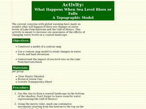
What Happens When Sea Level Rises or Falls
Students examine the impact of sea level on land formations. In this geography and map activity, students construct a contour map model illustrating how much of the clay "coastline" is covered as water is added. Metric measurement is...
Curated OER
Maps
Students investigate threee types of maps. In this algebra lesson, students idenitfy different maps and explore how they relate to the area keeping cllimate and topography in mind. They discuss maps used to navigate land. air and sea.
Curated OER
Basic Mapping Skills
Establish and study the parts of a map with your class and, then they will work in small groups to create their own detailed map, including a legend. There are specific instructions to follow on what needs to be included.
Curated OER
Cross Section and Slope
Students draw cross sections of given contour maps. In this math instructional activity, students interpret the different symbols used in the map. They determine slope and steepness through direct measurement.
Curated OER
TOPSY TURVY MAPS
Eighth graders use the data analyzer and motion detector to collect data and measure distances. They create topographic maps drawn to scale of a given setup and relate the concepts to the creation of historical ocean maps.
Curated OER
Sonar Mapping
Students use a shoe box to create a seafloor model and use cardboard for layering inside of the shoe box to simulate the ocean floor. They probe the ocean floor to simulate sonar echoes. Finally, students graph their data to get a...
Curated OER
Contour and Cross-Section Skills
In this geography worksheet, learners identify the Wolf Creek Crater and how it was formed. They examine a contour map given of how the crater would look from above. Then, pupils use a ruler to draw lines as on the graph to the side....
Curated OER
Sonar Simulation
Students compare and contrast side-scan sonar to other methods used to find objects underwater. In this underwater search instructional activity, students describe side-scan sonar and make inferences about the topography of an unknown...
PBS
Accessible Shapes
All the 2-D and 3-D measurement work you need is in one location. Divided into three sections, the geometry lesson plans consist of visualization of three dimensions, classifying geometric figures, and finding surface area and volume....
Alabama Learning Exchange
WATER You Doing to Help?
Auntie Litter is here to educate young scholars about water pollution and environmental stewardship! Although the 15-minute video clip is cheesy, it's an engaging look at the water cycle and conservation. Learners start by illustrating...
Curated OER
A Whole Lot of Shakin' Goin' On!
Students gather data about the 1906 and 1989 earthquakes, make comparisons between the two, and determine the factors that influence the amount of shaking that occurs in an area due to an earthquake. They identify that the distance is...
Curated OER
Worksheet 19 - Topographical Maps
For this map worksheet, students use information from given topical maps and locate the maxima and solve one dimensional wave equations. This two-page worksheet contains four problems.
Curated OER
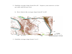
Slope and Topographic Maps
Students investigate slopes as they study topographic maps. In this algebra instructional activity, students discuss and apply the concept of slopes to graphing and analyzing data.
Curated OER
Our Keystone FFA Spring
High schoolers identify where their water sources and explore a watershed on a map. In this watershed lesson students walk a wetland, and identify sources of pollution.
Curated OER
Interior of the Earth
Sixth graders identify and describe the composition and physical properties of the layers of the Earth. They also explain how scientists used the scientific process to know about the center of the Earth. Finally, 6th graders read a...
Curated OER
A Contouring We Go
Students examine the built environment and infrastructures of their community by constructing contour equipment, using the equipment, and comparing their results to current topographical maps of the same area
Curated OER
T3 Lesson Plan: Number 3
Sixth graders investigate local water. In this water cycle lesson, 6th graders take samples from surrounding water sources. Students record data from the samples, compare and graph the results.
Curated OER
Chain Across the Hudson Lesson Plan A - Locating the Chain
Students read a letter from George Washington requesting them to identify on a map a location that would stop the advance of British warships. They choose a location and justify their choice.
Curated OER
Prairie Adaptations
Twelfth graders consider the survival of prairie plants. They examine how some tallgrass prairie species are adapted to the conditions of their ecosystem. They make a prediction of how a species might change given new conditions.
Curated OER
Worksheet 21 - Vector
In this vector worksheet students find the geometric interpretation of the change in a vector. They identify vector fields for specified functions. This two-page worksheet contains five multi-step problems.
Curated OER
How Much is There to Eat?
Students examine food production related to population density. In this interdisciplinary lesson, students gather data regarding food production in the American South and in India. Students follow the outlined steps to calculate the...
Curated OER
Principles of Flight: Where are We?
Students explore the concept of topographical maps. In this topographical map lesson, students discuss how airplanes know where to fly. Students use topographical maps to simulate a field trip on the computer.
Other popular searches
- Contour Maps
- Contour Maps and Elevation
- Contour Maps Topography
- Contour Lines Maps
- Contour Lines on Maps
- Contour Lines Map Reading
- Reading Contour Maps
- Contour Interval Map Scale
- Worksheets Contour Maps
- Geography Contour Maps
- Isolines and Contour Maps
- Music Contour Maps


