Sophia Learning
Sophia: Note Taking: Concept Maps and Flow Charts
This slideshow lesson focuses on note taking using concept maps and flow charts; it provides background information, 6 types of concept maps or flow charts with best uses, uses in the classroom, uses while reading or researching, and how...
Other
University of Twente (Nl): Concept Mapping
Provides a great example of a concept map, along with information on concept mapping and mind mapping. Mentions the importance of prior knowledge in the integration of new information.
Center for Educational Technologies
Nasa Classroom of the Future: Concept Mapping
Learn how a concept map can help you pull together information you already know and, in the process, learn something new. Includes steps to concept mapping and a helpful example.
ReadWriteThink
Read Write Think: Concept Map
This concept map is a way for you to show relationships between words and concepts. An arrow connecting two words shows that those words are related in some way. When you're finished, you can group words that go together with a circle or...
Other
Fdlrs: Thinking Maps: Examples From Brevard Public Schools
See examples of the use of the eight graphic organizers from Thinking Maps. These maps help students organize their learning and identify ways to reflect different kinds of text. The several examples from each grade K-6 show how to use...
Other
Reading Quest: Strategies for Reading Comprehension: Concept of Definition Map
Sometimes teaching students about creating definitions is difficult because they do not understand about multiple meanings or depth in meaning. This is a chance to teach students, using the concept map included, how to create definitions...
BBC
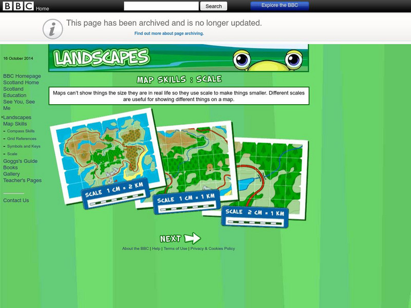
Bbc: Landscapes: Scotland: Map Skills: Scale
Lesson for elementary students on map skills uses a map of Scotland to teach about the concept of scale.
Georgia State University
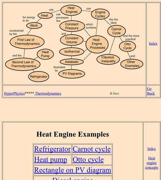
Georgia State University: Hyper Physics: Heat Engine Concepts
An indexing page for the HyperPhysics site. The page contains a concept map of links to a variety of other pages which discuss concepts related to heat engines. All pages contain informative graphics and excellent explanations.
Other
Homework Online: Lord of the Flies, the Map
Here is a small concept map drawn based on the descriptions of the island in William Golding's novel, Lord of the Flies.
Daily Teaching Tools
Daily Teaching Tools: Graphic Organizers: Concept Wheels
Webs for preparing to write including concept wheels with 4, 6, and 8 spokes.
Other
Overlap Maps
A map interactive provides an opportunity for observations through overlapping maps. Students are able to better recognize spatial awareness through this program.
Other
Freeology: Free Graphic Organizers
Blank templates of all types of graphic organizers from Venn Diagrams to Vocabulary Sketches are available for free at this resource.
California Digital Library
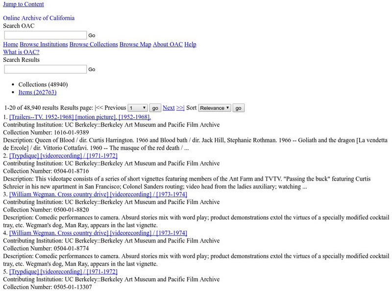
Calisphere: Maps
A broad selection of images featuring maps can be found on this site by Calisphere. By clicking on individual images you'll find high quality photographs and image information.
ReadWriteThink
Read Write Think: Character Map
Help students analyze a particular character with this character map that helps them examine character appearance, actions, and how others respond to them. Ideas for its use are provided.
Curated OER
Educational Technology Clearinghouse: Maps Etc: Newfoundland, 1903
A map from 1903 of the Canadian province of Newfoundland, showing cities, towns and ports, railways, lakes, rivers, and coastal features, as well as the coastal districts of White Bay, Bonne Bay, Bay of Exploits, Bonavista Bay, St....
Curated OER
Educational Technology Clearinghouse: Maps Etc: Plan of New Orleans, 1903
A plan from 1903 of the city of New Orleans, showing roads, the Mississippi River, and important landmarks. Landmarks indicated on the map include the: City Hall, Custom House, Mint, U.S. Courts, U.S. Marine Hospital, St. Louis...
Curated OER
Educational Technology Clearinghouse: Maps Etc: North America, 1840
A map of North America in 1840 at the time when the concept of "Manifest Destiny" was being applied to annex the Oregon Territory, Texas, and much of northern Mexico into the United States. The map is color-coded to show the extent of...
Curated OER
Etc: Maps Etc: Sketch Map of the Russian Campaign, 1812
A sketch map of Western Russia at the time of Napoleon's invasion in 1812. "The disastrous campaign which opened in June, 1812, was conducted on so vast a scale that a brief sketch can provide only the slightest conception of the...
Other
The True Size
In an effort to illustrate the spatial concepts of maps, this program provides the ability to select countries or continents and move them over others to better visualize the sizes of each of them.
Curated OER
Concept Map Particles and Waves
Acting as a subtopic of the General Chemistry Virtual Textbook's section on Atoms and the Periodic Table, this site discusses wavelength and the uncertainty principle. Information is also provided on de Broglie wavelength and electron...
New York Times
New York Times: From Sketch to Screen: "A Very Long Engagement"
Launch an audio slideshow, narrated by the director of the film, about storyboarding sequences in "A Very Long Engagement." An interesting site for considering the work of the storyboard artist, whose sketching technique is wonderfully...
Curated OER
Ed Tech Clearinghouse: Koppen Climate Classification of North America, 1911
A map from 1911 of the climate regions of North America using the classification system developed by Wladimir Koppen, based on the concept that native vegetation is the best expression of climate. The major groups are (A)...
Other
Zoom Earth: Aerial and Satellite Images
Type in the location you are searching for, and satellite imagery will produce an aerial map for you. Helps students better understand these concepts by providing a visual for them.
Other
Bucks County Community College: Visual Organizers
This site walks you through the benefits of visual organizers, and focuses on a variety of types: tables, charts, graphs, timelines, flowcharts, diagrams, and webs.
Other popular searches
- Cell Transport Concept Map
- Blank Concept Maps
- Genetic Concept Map
- Weather Concept Map
- Krebs Cycle Concept Map
- Science Concept Map
- Phylum Chordata Concept Map
- Concept Map Rubrics
- Inspiration Concept Map
- Dna Structure Concept Map
- Concept Map in Science
- Rock Concept Maps


