Hi, what do you want to do?
Curated OER
Linkages Between Surface Temperature And Tropospheric Ozone
Students organize and analyze data regarding changes in tropospheric ozone and then hypothesize about the consequences of these changes.
Curated OER
Circle the Earth - Explore Surface Types on a Journey around Earth
Students use CERES percent coverage surface data with a world map in locating landmasses and bodies of water at Earth's Equator.
Social Studies for Kids
Social Studies for Kids: Latitude and Longitude
A collection of latitude and longitude mapping activities ranging from pin-pointing exact locations on the globe to researching the history behind this basic geography concept.
SMART Technologies
Smart: Latitude and Longitude
Try to locate famous landmarks using latitude and longitude coordinates in this interactive classroom activity.
City University of New York
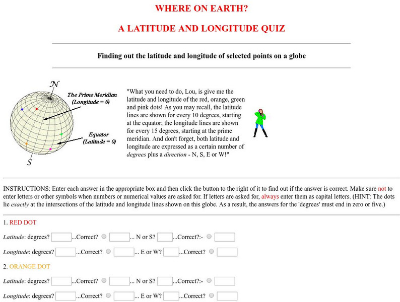
Virtual Geology: Where on Earth: A Latitude and Longitude Quiz
This quiz starts with select points on a globe. Students must determine the latitude, longitude, and direction for each point.
American Geosciences Institute
American Geosciences Institute: Earth Science Week: Places on the Planet: Latitude and Longitude
Students learn how citizen scientists involved in the Geological Society of America's EarthCaching project use GPS technology and latitude and longitude coordinates to find special places on the Earth.
Mocomi & Anibrain Digital Technologies
Mocomi: What Is Latitude and Longitude?
Provides interesting facts about latitudes and longitudes including how they are measured, why they are important, and the Halley meridian and Bradley meridian.
National Geographic
National Geographic: Introduction to Latitude and Longitude
In this lesson, students learn to determine the latitude and longitude of locations within the United States, while making observations about climate and the ways in which these measurements can be useful. Includes maps and discussion...
City University of New York
Brooklyn College, Cuny: Latitude and Longitude
Students can read about how lines of latitude and longitude form a grid that makes it easy to pinpoint one's location on Earth. Then they can take an online quiz to check their understanding.
ABCya
Ab Cya: Latitude and Longitude Treasure Hunt
Use the longitude and latitude clues to find the treasures on the map. The more treasures you find the more challenging it will be to find them.
NASA
Nasa: Latitude and Longitude
This site from NASA provides definitions of latitude and longitude with good graphics.
Teachers.net
Teachers.net: Explore Latitude and Longitude With Pumpkins: Lesson Plan
Students paint pumpkins to make their own globes in this fun way to learn longitude and latitude.
National Geographic
National Geographic: A Latitude/longitude Puzzle
Through examining maps students will be able to identify locations and characteristics of them based on latitude and longitude and infer what events might occur in the places.
Smithsonian Institution
Smithsonian Institution: Time and Navigation
Explore navigation methods by sea, air, and space, what latitude and longitude mean, how GPS works, about satellite navigation, and learn about professional navigators. Includes a timeline of developments in navigation from 1280 to the...
Curated OER
Clip Art by Phillip Martin: Latitude and Longitude
A clipart illustration by Phillip Martin titled "Latitude and Longitude."
Diffen
Diffen: Latitude vs. Longitude
Find out about the basics of latitude and longitude with this comparison chart. Then read the article and watch the video to dig a little deeper into the topic.
CK-12 Foundation
Ck 12: Earth Science: Location and Direction
[Free Registration/Login may be required to access all resource tools.] Using latitude and longitude to find a location.
CK-12 Foundation
Ck 12: Earth Science: Location and Direction Study Guide
This comprehensive study guide covers the main terms and concepts needed for an earth science unit on latitude and longitude. Review questions are included at the bottom of the study guide.
Quia
Quia: Noise Pollution?
This quiz will determine whether you can use latitude and longitude properly to find absolute locations on the earth.
CK-12 Foundation
Ck 12: Earth Science: Location on the Earth
[Free Registration/Login may be required to access all resource tools.] Using latitude and longitude to find a location.
University of Hawai'i
The Hawai`i Space Grant Consortium: Lunar Images
Part of the Exploring Planets in the Classroom series, this site provides images of the Moon, with Latitude and Longitude reference lines.
The Franklin Institute
Franklin Institute: In Quiry: Minutes From Me: Latitude, Longitude and Vacations
An explanation of latitude and longitude along with a classroom activity that uses the location of students' vacation destinations for charting latitudes and longitudes.
New York Times
New York Times: Crossword Puzzle: Latitude & Longitude
Here is an interactive & printable crossword puzzle developed by the New York Times Learning Network. The theme of this puzzle is Latitude & Longitude.
Other
Boat Safe Kids: Longitude and Latitude
This website starts at the very beginning and explains how round globes are transferred to flat maps. Then they explain the use of longitude and latitude.
Other popular searches
- Longitude and Latitude
- Latitude and Longitude Games
- Latitude and Longitude Maps
- Longitude and Latitude Game
- Longitude and Latitude Math
- Longitude and Latitude Lines
- Longitude and Latitude Grid
- Gps Longitude and Latitude
- Map Longitude and Latitude
- Maps, Longitude and Latitude
- Gaps Longitude and Latitude
- Finding Latitude and Longitude


