Curated OER
Space Science: A Scoop of Moon Dirt
Students discover soil characteristics and how it is formed on Earth and the Moon by examining local samples to a lunar simulant. They replicate the effects of wind erosion by scraping dry bread with sandpaper. Students use rocks and...
Curated OER
Asteroids
Students examine a potential asteroid impact site. They describe evidence and theories for extinction events.
Curated OER
The Difference Between Comets, Meteors And Asteroids
Students use Venn diagrams to highlight the similarities and differences between comets, meteors, and asteroids.
Curated OER
A Model of the Sun's interior
Students create a three-dimensional model of the sun. In this solar system lesson, students design a scale model of the sun using plasticine.
Curated OER
The Nature of Science and Technology
Students study the environmental concerns of orbital debris. In this orbital debris lesson students complete several activities.
Curated OER
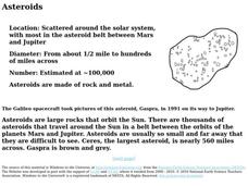
Asteroids
In this worksheet on asteroids, students look at a picture asteroids and read accompanying facts, along with a brief paragraph.
Curated OER
TE Activity: Testing the Caverns
Pupils make model caverns out of paper mache or clay. They bury them in a tray of sand, and test the models by dropping balls into them simulating as asteroid hitting the earth. They discuss the results of the activity in a whole class...
Curated OER
Possible Locations
Students create maps with cutout pieces of paper that represent caverns. They develop a scale for their map and decide where the best location is to live. They discover the importance of map reading skills.
Curated OER
Scaling the Map
Students practice determining map distances using the map scales. They discover how much an area represents on the map in relation to the actual area. They decide on the best place to build their cavern.


