Curated OER
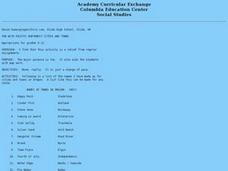
Fun With Pacific Northwest Cities and Towns
Intended for fun only, learners play with the names of cities common to their region or state. This activity includes a list of cities in Oregon and not much else. What you and your class choose to do with your list of cities is up to you.
Curated OER
Mapping It Out
This PowerPoint provides information about maps. Students discover the functions of legends, compasses, indexes, and scales on maps. Two resources links are provided, however one of them is broken.
Curated OER
Map Studies
Students study maps and use web based activities to develop their mapping skills. In this mapping skills lesson, students use the internet to define cartography they make a list of information regarding a typical road map and explain the...
Curated OER
Mapping the Family
Students research the locations where their fathers have lived. In this map skills lesson plan, students identify the locations their fathers have lived in the world as they create charts and maps that note the information.
Curated OER
Planting Time
Pupils research crops grown in the United States. In this agriculture lesson, students identify various crops cultivated across the United States as they create charts and maps that note the information.
Curated OER
The United States in 1790
In this geography skills worksheet, students study the provided map of the United States in 1790 and then complete the provided quiz over the 17 states and territories.
Curated OER
Orienteering: Map Skills
Students discover orienteering. For this orienteering lesson, students search for six specific landmarks. Students brainstorm how maps and landmarks are helpful.
Curated OER
Sub-Saharan Maps
In this geography skills worksheet, students draw real or imaginary maps that feature escarpment, rift valleys, gorges, diamond mines, plateaus, mountains, lakes, rivers, and gold mines.
Curated OER
Mapping the Civil War
Students identify the locations of pivotal American Civil War battles. In this map skills activity, students label Fort Sumter, Antietam, Vicksburg, Gettysburg, and the Battle for Atlanta on an outline map. The map is not included.
Curated OER
Tooling Around Arizona: Reading Arizona Maps
Students research Arizona maps. In this map lesson, students discuss map titles, scales, directions, elevation, and symbols. The class will examine topography, landforms, and rivers found on an Arizona map.
Curated OER
Europe Before and after WWI
Eighth graders compare and contrast maps of Europe before and after World War I. In this World War I instructional activity, 8th graders color and label maps of Europe prior to the war and after it. The historical maps can be accessed...
Curated OER
Take a Hike
In this geography skills worksheet, students respond to 9 questions that require them to read topographic maps and interpret them. The topographic maps are not included.
Curated OER
Mapping World War II: During and After
In this World War II worksheet, students follow the provided instructions to mark 2 maps according to events and outcomes of the war.
Curated OER
The Treaty of Versailles: An Outside Perspective
In this World War I instructional activity, high schoolers read an article about the Treaty of Versailles and examine 2 maps. Students then respond to 8 short answer questions based on the information.
Curated OER
The Extent of Alexander's Empire
In this ancient empires worksheet, students read an article about Alexander the Great and then respond to 7 short answer questions.
Curated OER
Topographic Maps Worksheet
In this geography skills worksheet, students respond to 37 multi-part questions that require them to read and interpret topographic maps.
Curated OER
Globe Skills Lesson 5
In this map skills worksheet, learners read a text selection about locations during the American Revolution and then respond to 8 fill in the blank questions.
Curated OER
Geography Tutor: Maps and Map Projections Questions
For this geography skills lesson, students watch a video titled "The Geography Tutor," and then respond to 14 short answer questions about maps and map projections.
Curated OER
Middle East Geography Worksheet
In this geography skills worksheet, students examine the provided map of the Middle East, identify the noted countries, and write facts about each of the countries.
Curated OER
Japan's Geography Worksheet
In this geography skills worksheet, students label a map of Japan and then respond to 8 short answer questions about the country.
Curated OER
Exploring the Past: Mayan, Aztec, and Incan Civilizations
Fifth graders research the Mayan, Aztec, and Incan Civilizations and identify contributions they made to modern society. In this ancient civilizations lesson plan, 5th graders look at maps of where they were located.
Curated OER
Discovering Prehistoric Trails
Eighth graders examine prehistoric terrain. In this geography lesson, 8th graders discover necessary resources for settlers. Students work in small groups to create a trail crossing the state of Kansas.
Curated OER
Worksheet for Analysis of a Map
In this primary source analysis activity, students respond to 6 short answer questions that require them to analyze the maps of their choice.
Curated OER
Mathematics of Cartography
Students practice their math skills as they explore maps. In this cartography instructional activity, students calculate distance, scale, coordinate systems, and projection as they work independently reading online maps.


