Curated OER
Post Roads
Students locate the major cities in the colonies during the Revolutionary War. For this map skills lesson, students use a globe to locate cities such as Charleston and Boston using latitude and longitude coordinates.
Curated OER
Civil War Naval Strategy
Students apply critical thinking skills to war strategy. In this Civil War map lesson plan, students use their knowledge of latitude and longitude as well as scale to respond to questions regarding Civil War battle strategies.
Curated OER
The Global Grid System-World Map Activity
Students demonstrate how to use the global grid system. In this map skills instructional activity, students use a world map to locate various locations. Students identify locations based on the global grid system. Students complete a...
Curated OER
Globe Lesson 5 - Latitude - Grade 6+
In this latitude worksheet, learners read a 3-paragraph review of latitude and respond to 12 short answer questions.
Curated OER
Latitude Longitude Skills
In this latitude and longitude worksheet, students determine the number of degrees between the equator and specific latitude points. Students to the same for the longitude points from the Prime Meridian. This worksheet has 3 problems to...
Curated OER
Latitude Longitude
In this latitude and longitude instructional activity, students place a dot on a graph that represents each latitude and longitude location given. The instructional activity has 46 locations to graph.
Curated OER
Latitude Longitude
For this latitude and longitude worksheet, students plot 39 latitude/longitude locations on a graph, connecting the dots as they go along.
Curated OER
Latitude Longitude
In this latitude and longitude worksheet, students plot 34 latitude/longitude locations onto a graph, connecting the dots as they go along.
Curated OER
Plotting Earthquakes
In this earthquakes worksheet, students access a website to gather information about the magnitude and location of earthquakes for 5 days. Then students complete 7 short answer questions.
Curated OER
Google Earth
In this Google Earth worksheet, students access the Google Earth website and find the latitude, longitude, and elevation for their house and school. Then they do the same for a variety of world locations. This worksheet has 10 fill in...
Curated OER
Earth's Features
In this geography worksheet, learners label a map of the world with the Arctic Circle, Tropic of Capricorn, Tropic of Cancer, Equator, North Pole, South Pole, and the Antarctic Circle.
Curated OER
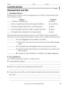
Viewing Earth and Sky
In this earth and sky worksheet, students review terms associated with map reading. Students also review topographic maps and how contour lines represent elevation. This worksheet has 5 matching, 5 true or false, 5 fill in the blank, and...
Curated OER
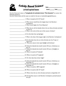
Latitude, Longitude, Seasons
In this latitude and longitude worksheet, students use their classroom notes on both longitude and latitude lines as well as seasons to complete 20 fill in the blank questions.
Curated OER
U.S. History: What Happened Here?
Young scholars apply the global positioning system to create maps of local historical sites. By collaborating with local historical groups, they research events and relate them to broader, national history. In addition to writing...
Curated OER
WORLD GEOGRAPHY
Pupils identify and analyze map symbols and map grids by completing various worksheets and creating their own map using these skills. Students identify and analyze what latitude and longitude are on a map to play a game of Bingo. Pupils...
Curated OER
Let the North Star Tell You Where You Are
Students participate in activities in which they find the Big Dipper and locate the North Star in the night sky, examine the relationship between the angle to Polaris and latitude, and determine latitude by using an astrolabe.
Curated OER
Celebrating the Solstice and Equinox
Fourth graders graph the number of daylight hors throughout the year and examine why day length varies. They discover that seasonal changes and latitude on Earth affect the number of hours of daylight in each day. Students listen to...
Curated OER
Anza and Font in Search of Latitude
This is an integrated lesson that incorporates Social Studies, Science, and Mathematics. In Social Studies, 7th graders complete an online interview and complete an online worksheet about latitude of sites on the Anza trail. In Science...
Curated OER
Follow That Ship!
Learners in this exercise are introduced to the distinct ways of measuring distance (nautical miles) and speed (knots) at sea, as well as the concepts of latitude and longitude for establishing location.
Curated OER
Creating Station Models
Students work in groups to interpret weather maps. They use latitude and longitude readings to complete a worksheet together and turn in the worksheet along with the maps and a rubric.
Curated OER
Maps, Charts, and Graphs
Students define key geographic terms and track a hurricane on a map. They examine various types of maps and find locations on them,including rivers, cities and mountains.
Curated OER
Where Am I?
Students apply map reading skills by locating places through the use of latitude and longitude.
Curated OER
What in the World?
Eighth graders plot points of longitude and latitude on a world map. In groups, they create a model of the earth's interior and label the parts,
Curated OER
Longitude & Latitude
Seventh graders role play as ship's captains to study longitude and latitude.


