Hi, what do you want to do?
Curated OER
Solving the Puzzle
Students create a map showing the United States borders at a specific period in history and produce three questions to be answered by examining the map. They also write a productive paragraph explaining who, what, when, where, how/why a...
Curated OER
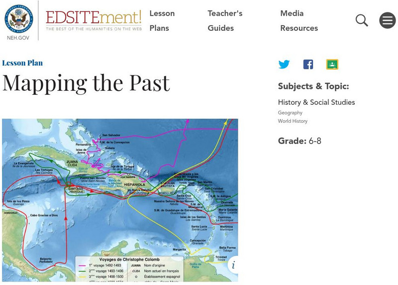
Mapping the Past
Students study historical maps to view how the world evolved from medieval times through the Renaissance. They work in groups to examine the maps and present a report on one of the listed maps.
Curated OER
Waldseemüller’s Map: World 1507
Young scholars take a closer look at historical maps. In this primary source analysis lesson plan, students examine the first world map produced by Martin Waldseemuller. Young scholars complete the included map analysis worksheet and...
Curated OER
Using Old Maps as Tools to Explore Our World
Students explore historical maps. In this primary source analysis lesson plan, students uncover the meanings in selected historical maps as they use them to enhance lessons on historical events. Samples for classroom use are provided in...
Curated OER
Mapmaker, Mapmaker, Make Me a Map!
Students evaluate the different types of historical and geographical information that one can gather through close study of historical maps from the 16th through the 19th centuries. They create their own maps.
Curated OER
Lewis & Clark Map
In this Lewis and Clark expedition map worksheet, students examine the route of the expedition and the separate return routes of both Lewis and Clark.
Curated OER
Trails West Map
In this United States historical map worksheet, students examine the trails that settlers of the Western United States took during the period of Western Expansion.
Curated OER
Colonial America 1776 Map
In this United States historical map worksheet, students examine the colonial boundaries in 1776 as well as the Proclamation Line of 1763.
Curated OER
The 13 British Colonies Map
In this United States historical map instructional activity, students examine the 13 colonial boundaries and noted major cities.
Curated OER
The 13 British Colonies
In this British colonies historical map worksheet, students examine the political boundaries of the 13 original colonies.
Curated OER
United States of America: 1860
In this United States historical map worksheet, learners examine the boundaries of the labeled states and territories of the nation in 1860.
Curated OER
Trails West: Westward Expansion Maps
In this United States historical map learning exercise, students examine the trails that settlers of the Western United States took during the period of Western Expansion. Major cities on the routes are labeled.
Curated OER
United States of America: 1860
In this United States historical map worksheet, students examine the boundaries of the states and territories of the nation in 1860. This map is unlabeled.
Curated OER
United States 1860
In this United States historical map worksheet, students examine the state and territorial boundaries as well as the large cities of the nation in 1860.
Curated OER
The Louisiana Purchase
In this historical map instructional activity, students analyze a map of the Louisiana Purchase. Students answer 4 multiple choice questions about the map.
Curated OER
Where in the World War? Mapping the Geography of D-Day
Students examine how to read maps for historical information. They listen to a lecture on the history of D-Day, analyze a historical map of the invasion of Normandy, and answer discussion questions.
Curated OER
Historical Map - United States: The Changing Frontier
In these United States frontier worksheets, students study the map of the United States frontier for various sections of time in the history of the United States. Students then finish a crossword puzzle using the various parts of the...
Curated OER
Relationships to Others
Pupils investigate aspects of a historical map drawn about 1721 by a Native American for presentation to the British governor of South Carolina, and draw maps of the classroom.
Library of Congress
Loc: America the Beautiful
A resource page of online map resources, lesson plans, students activities and the transcript of a live chat on the geography of the United States.
National Endowment for the Humanities
Neh: Edsit Ement: Mapping the Past
Students will examine European world maps from the Middle Ages, the Age of Discovery, and the period of New World exploration. They will then look at maps that record the early exploration of the American West and collect present-day...
University of Georgia
University of Georgia: Hargrett Library: Rare Map Collection
The Hargrett Library at the University of Georgia offers visitors the opportunity to view images of over 800 maps that go back almost 500 years. Researchers get a first-hand look at the lives of early Americans with these original maps...
Other
Toronto Public Library: Frozen Ocean: Hudson Bay and the Hudson's Bay Company
Presents historical images and maps of the area that the Hudson's Bay Company controlled.
University of Texas at Austin
The Perry Castaneda Library Map Collection
This collection contains more than 250,000 maps covering all areas of the world, and ranging from political and shaded relief maps to the detailed and the historical. Select from a region of the world or an area of highlighted interest.
University of Texas at Austin
Perry Castaneda Library Map Collection
Maps from all over the world can be printed from this site. Find historical maps of the world; thematic maps; and world, continent, country, state, and county maps for your use.


