Curated OER
Continents and Oceans
Students identify oceans and continents and their locations on a map. They color-code and label their own map of the world's continents and oceans. They play the game Continents and Oceans to identify specific areas.
Curated OER
Exploring an Atlas
Learners explore global geography by participating in an atlas activity. In this countries of the world instructional activity, students collaborate in small groups and analyze an atlas while researching continents, countries and...
Texas State Energy Conservation Office
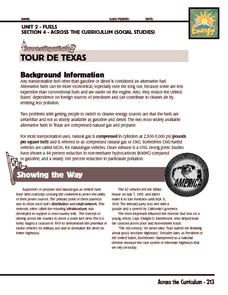
Investigation: Tour de Texas
Teams of Texas tourists gather into groups to analyze what they can do with $50 worth of an alternative fuel. They write checks, keep a balance sheet, and map out their sight-seeing route taking into consideration the location of...
Curated OER
Location, Location, Location!
Twelfth graders locate cities, states and countries on maps. They use the cardinal directions to locate places on maps. They describe where they were born by giving clues without naming the exact state. They trade papers and try to guess...
Curated OER
Around the World in 5 Days
Students explore continents, draw map, discuss cultures, use research to learn geography, and investigate cultures.
Curated OER
2nd Grade - Act. 22: The World Game
Second graders play World Game to become more familiar with continents, oceans, countries and states.
Curated OER
And a Star to Steer Her By: A Field Trip Guide for the Planetarium Show
In this field trip study guide for the planetarium show lesson plan, students construct a model of the Earth and describe the relative positions of the continents using latitude and longitude. Students construct a star chart to find...
Boston University
Scramble for Africa
In this fantastic simulation, your young historians take on the roles of imperialistic European countries in the nineteenth century and then "scramble" to carve up the continent of Africa! This is a very hands-on activity that will help...
Curated OER
Maps that Teach
Students study maps to locate the states and capital on the US map. Students locate continents, major world physical features and historical monuments. Students locate the provinces and territories of Canada.
Curated OER
Latitude & Longitude Bingo
Young scholars practice map reading skills through a reinforcement game of bingo. They select any 24 of 30 listed cities to write on blank bingo cards. Then using atlases, locate a city based on the latitude and longitudinal...
Curated OER
Canada, O Canada
Students study the similarities and differences between Canada and the United State in this unit. They examine geography, government and culture as they "travel" through Canada.
Curated OER
Primary Sources and Archaeology in the Study of Ancient Mediterranean Trade
Tenth graders begin the lesson by plotting trade routes, major empires and items traded. Using primary sources, they examine their own values regarding trading items for royality. They participate in a role-play exercise in which they...
Curated OER
The Legacy of the "Great War"
Learners study how the map of Europe changed as a result of the Treaty of Versailles at the end of World War I. They examine the results of the end of the Cold War.
Curated OER
Shackleton's Antarctic Adventure
Students research the exploration of Antarctica by the explorer Sir Ernest Shackelton. In this Antarctic exploration lesson, students watch a movie about Sir Ernest Shackelton and his ship the Endurance. Students study a map of...
Curated OER
On the Road Again": Moving People, Products, and Ideas
For this lesson learners learn how to identify modes of transportation and communication for moving people, products, and ideas from place to place. Students also study the advantages and disadvantages of different modes of...
Curated OER
World Geography: Who am I?
Students are able to provide a basic description of one country that has arsenic in its water supply. They are able to locate these countries on a map. Students explore the majors countries that have been affected by arsenic...
Curated OER
Where Do We Go From Here?
Pretending to be freed people, students explore the reasons why US citizens might emigrate from the USA to new lands. Within this lesson, they will prepare proposals discussing both the pros and cons for emigration. The lesson will...
Curated OER
Return South Migration Lesson Plan
Students study the reasons so many immigrants returned to the South following the Civil Rights Movement. They examine how the former slaves influenced the cultural life in the Northern cities.
Curated OER
Spice Up Your Life
Second graders identify major spices found in the world. They link spices with countries they are grown in and the uses for these valuable items.
Curated OER
Out On A Limb In The Pacific Rim?
Students act as cultural attachés to investigate and present briefings on the post-1945 histories and United States diplomatic relationships with East Asian countries. They articulate their foreign policy findings.
Curated OER
Water: The Flow of Women's Work
Students view photographs, read, and reflect on their own environments to gather information about gender roles in Lesotho and the United States. Students role-play gender role related scenarios and write about their reflections on the...
Curated OER
Diary of a Worm Secret Agents
Second graders explore the geography of Washington D.C. and President Bush's hometown of Crawford, Texas. They read the book, Diary of a Worm, determine the best route to go to Texas from Washington D.C., and throw a birthday party for...
Curated OER
On the Oregon Trail
Learners prepare cross-curricular lessons based on the experience of traveling the Oregon Trail.
Curated OER
Discover the Rain Forest
Students research tropical rain forests through the use of trade books, encyclopedias, rain forest videos, and computer searches to determine the effects that human use has on the rain forest.


